All posts by Jay Zagorsky

Professor in the School of Management

Day 12: Great Falls, to Lewistown Montana

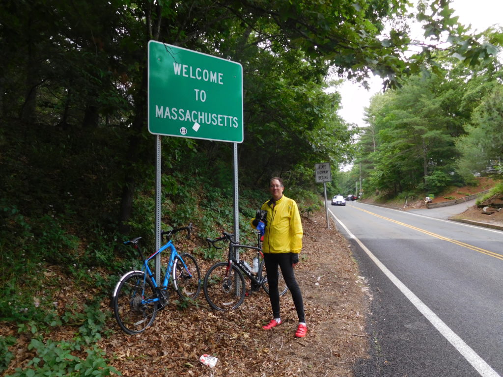
Sometimes life and the weather change suddenly.  First, the life change story and then the weather.

I have worked at Ohio State University as a researcher for the past 23 years.  My sudden life change is that I am retiring from OSU at the end of August.  I have enjoyed working at OSU very much.  I was featured in the Spring 2018 Alumni magazine.  They convinced me to write for TheConversation.com, where my total readership broke 2 million people a few months ago.  They have promoted my research with over a dozen press releases.  Unfortunately, my job was supported by government grants, which have been cut.  After the trip is over it will be time to think about my next career, since playing golf daily holds little appeal.

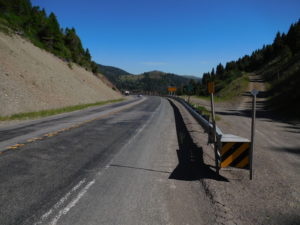
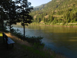
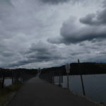
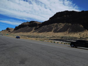
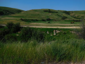
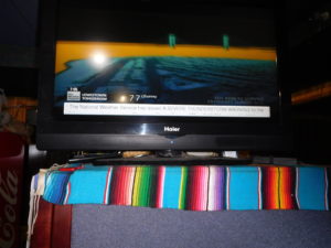
The weather, especially in Montana, also changes quickly.  Last night at dinner the forecast was for hot and dry conditions during this morning.  Then with a 20 to 40 percent chance the forecast predicted that sometime from 3 PM till 5 PM a new cooler weather front would arrive.  Where the two fronts collide, the forecast was predicting large hail, heavy rain and lightning.

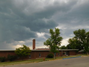
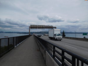
This forecast concerned me for two reasons.  First, pedaling a bike on the plains means that in a lightening storm I am the tall object on a metal bicycle.  While it is normally gratifying to attract attention, lightning is not something to entice.

Second, on the last cross-country bicycling trip, I was hit by hail and heavy rain in Kansas.  We made it to the edge of a city just as a storm hit.  One minute I could see.  The next moment everything beyond two feet away disappeared in the deluge.  I don’t mind getting wet.  But getting wet while being hit by sharp ice is quite painful.  In Kansas we were able to get onto the porch of a kind person’s home, so we had some protection.  I was unsure in Eastern Montana a similar kind of porch would be available again.

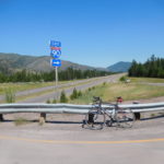
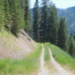
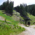
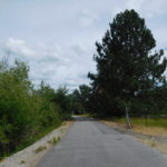
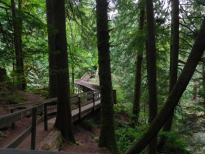
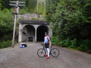
Since the forecast stated the chance of the storm was only 20 to 40 percent, I decided to try pedaling and not spend another night in Great Falls.  As a precaution I would start pedaling very early in an attempt to finish before the storm.  I also checked out all the places I could stop and seek shelter.

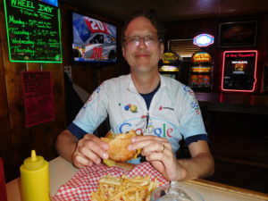
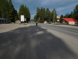
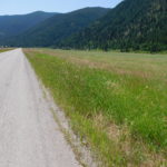
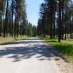
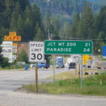
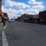
I was on the road at just after sunrise and did 25 miles before 9 AM.  I stopped for a bathroom break at a rest stop.  The bathroom had a loudspeaker system that was playing Montana’s weather.  The forecast had not changed.  By 11:30 I had done half the day’s mileage but was famished.  I stopped in the small town of Geyser for a hamburger, which was quite good!

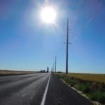
After Geyser my speed dropped.  Part of it was a strong headwind.  Part of it was pedaling on a full stomach.  Part of it was that by noon I had already been on the bike for about five hours without a long break, except for wolfing down a hamburger and pulling over to swap water bottles.

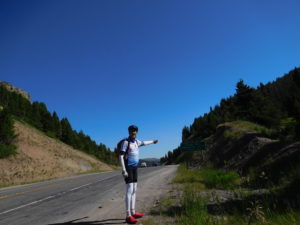
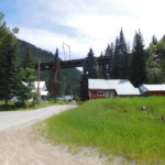
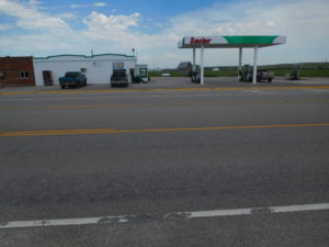
I made it to Stanford, MT around 2 pm.  One hour to go before the storm was supped to hit and I still had 45 miles left to pedal through rural areas.  In Stanford the wind started to change direction and the sky began to darken.  I stopped at the last gas station in town.  They said it was 28 miles to the next gas station/shelter.  I wasn’t sure what to do with the storm coming closer.  I decided to hitch another ride.  If the storm showed up before I got a ride, I could at least stand under the roof that protected the gas station’s pumps.  If the storm hit while I was in a pickup truck, I was protected.

A very nice man named Dale, stopped and offered to give me a ride to the next gas station.  Dale ran his own repair shop and did a lot of work on combines and tractors.  He was going to fix the air conditioning unit on a combine just beyond the next gas station.  We had a nice chat and I learned all about the economics of repairing farm equipment and contract harvesting.  Dale’s ride was great because the storm was coming from the west and he drove me due east, which increased the distance between me and the storm.

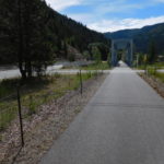
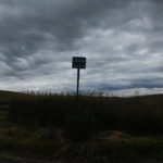
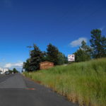
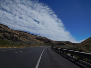
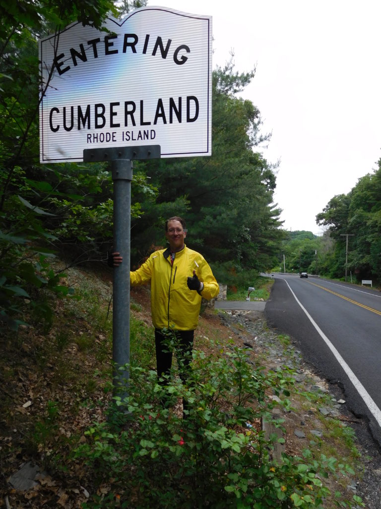
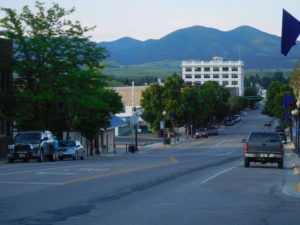
He let me off at Eddie’s Corner, which was 17 miles from my destination of Lewistown, Montana.  I looked at the sky.  I looked at Eddie’s Corner, which offered less protection than I hoped.  The storm seemed to have slowed a bit.  The wind was now a gusting 20 mph tailwind.  My conclusion was there was enough time to pedal to Lewistown safely.

Did you ever make up your mind and then have that sickening feeling that the choice was wrong?  About 4 miles down the road from Eddie’s, the whole left side of the sky looked dark and angry.  Then I heard thunder.  It was far off, but it was clear this storm was going to happen.  I started pedaling faster.  To make the story short, I sprinted for 1 hour.  Normally, with a loaded pack I pedal about 12 mph.  The program that monitors my speed and distance showed I did the sprint to Lewistown at about 18 mph, with the help of a tailwind.

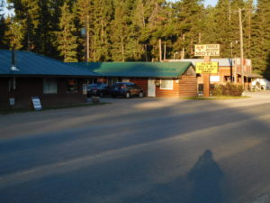
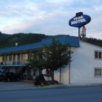
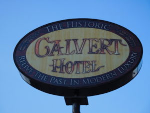
I made it to the “Welcome to Lewistown” sign just as the first rain drops fell.  I made it to a nice hotel, called the Calvert, as the sky overhead became dark and angry.  I don’t think hail hit Lewistown, so the forecast was off on that part.  But the forecast was right that the storm would pass quickly.  By the time I checked-in, took a shower and was ready to leave the hotel for dinner, the sky was clear again.

An afternoon of outrunning a storm was exciting, but also exhausting.  My original plan for tomorrow was to do 130 miles.  That plan is totally unrealistic.  Caleb, who checked me into the hotel suggested a shorter ride of 55 miles instead.  Caleb is a clearly a smart man.  I will sleep in tomorrow morning and take it relatively easy.

Day 11: Lincoln, Montana to Great Falls

Biking long distances is clearly more of a mental challenge than a physical challenge.  Last night, I stayed in the Three Bears Motel.  The bed was comfortable.  The room smelled fine.  The neighbors were not particularly noisy.  With all these advantages I didn't sleep a wink.  This morning I wanted to rename the motel the "Princess and the Pea," after the princess who could not sleep because a pea was placed under her mattress to test her.

What was the problem?  I lay in bed stressing about today's ride.  Today I needed to bike up Roger's Pass on Montana's Route 200.  Roger's Pass, as the picture shows, is where I cross the continental divide.  All water dropped on the ground to the west of the divide sooner or later ends up in the Pacific Ocean.  All water to the east of the divide ends up in the Atlantic.

Rogers Pass

For those of you interested in history, Roger's Pass is famous for having the lowest recorded temperature in the contiguous 48 states.  In 1954 at a mining camp on the pass the temperature hit minus 70 degrees.  You can read about it here.

The last time I biked across the country I did eleven different continental divide crossings.  I was young and a wee bit stupid.  Instead of crossing the Rockies once, I went up the backbone of the Rockies.  This time would be different.  Just one crossing, not multiple.

Most continental divide crossings are a physical challenge so I wanted to know what to expect.  Google Map and Earth tell you a lot, but local experience today still beats looking at computer images.  I asked four different people where I was staying in Lincoln what the pass was like.  Three out of four said they had never been up the pass and the fourth had done it a long time ago.

This was shocking to me because Roger's Pass is a bit over 18 miles from Lincoln and the town of Lincoln has only one main road, that goes directly to the pass.  If these people had not done the pass, there must be a reason.  My brain went into hyperactive mode all night thinking of all the reasons why locals wouldn't go there.

The reason, which I found out later, is that there is an alternative pass five miles closer than Roger's that is very steep and has lots of switchbacks.  If you can manage to get over the alternative pass then you end up on the Interstate highway (route I-15).  Going over Roger's Pass takes you away from the Interstate, which was something I was keen to do, but most people who live in Lincoln are not.

Roger's Pass ended up being something pretty straightforward to bike up.  When the pass started I had 4 gears left and thought "this is going to be a piece of cake."  Halfway up the pass I was in my easiest gear (smallest ring in the front, biggest ring in the back) and sweating hard.  I did make it up to the top without stopping or walking, but it was no piece of cake.

I took the obligatory pictures and spilled a little filtered Gatorade and water on both the west and east side of the continental divide sign.  Then it was time for the six mile downhill.  If you ever do something like this, make sure you have wrap-around glasses.

The wind and air pressure coming down was intense and my eyes were tearing up.  Having your eyes filled with tears when nothing separates you from going over the edge of a mountain except for a low guard rail is a hair raising experience.  I used my brakes a lot, which kept the speed down enough so that I could see.  Wrap-around glasses keep some of the wind and pressure off the eyes and let you go down the mountain faster.

The end result was that I made it up, over and then down Roger's Pass.  There was a bit to worry about, but nothing worth spending 8+ hours in bed imagining all kinds of terrible things.  The mental pain was much more than the physical pain of getting over the pass.

Day 10: Missoula to Lincoln, Montana

I was itching to start pedaling again after yesterday's rest day.  Sleeping is good, but  I could be sleeping at home in a bed that is far more comfortable than many of the motels where I am staying.

I woke up at 4 AM, but it was too dark to pedal.  I went back to bed and checked again at 5 AM.  It was still too dark.  I woke up at 6 AM.  The sun was up and the restaurant beside the Motel 6 was now open for breakfast.  I was the first customer of the day!  I had a cheese omelet and went back to my room to pack up.

I was on the road pedaling at 7 AM, which for me is shockingly early.  I tell people one of the reasons I like being a professor is that I can sleep in,  but not today.

Pedaling that early in the morning has some pluses.  There are few cars on the road.  It is peaceful.  It is cool.  The big minus is that the sun rises in the east and I am pedaling due east.  During the early morning hours it was hard for me to see.

I wasn't worried about the cars seeing me.  First, because there were so few on the road Sunday morning.  Second, the road and the shoulder were separated by  a large rumble strip.  Any car veering into the shoulder would make a horrible noise warning both myself and the driver.

The plan for the day was simple.  Pedal abut 80 miles uphill to Lincoln, Montana.  The Rockies are like the letter "M."   I went up the left side of the "M" from Idaho into Montana.  I then came down into the middle of the M going through towns like Alberton.  The middle part of the "M" was Missoula.  Today I am climbing the right half of the "M."  If all goes according to plan tomorrow morning I will cross a mountain pass, which is the top of the "M"'s right side.  Then it should be mainly downhill to Great Falls, which finishes the Rockies and the analogy.

I thought the road (Montana route 200) would have no services but was pleasantly surprised.  There were a couple of gas stations, with bathrooms and even one highway rest area.  The negative part of the route is that today there are many campers and recreational vehicles on the road.  These are large vehicles, often driven by inexperienced operators.  People with a regular car or truck license should not be able to drive an RV unless they pass a test showing they are qualified.

I arrived safe in Lincoln.  There are four motels in town.  One advertises that haunted rooms can be had for no extra charge.  I passed on that one.  One advertises it is the cheapest.  I passed on that one since it was a half-mile more to walk for dinner.  The third seemed very dumpy.  I decided on fourth called the "Three bears Motel."

So far I have been in the motel for a couple of hours and it seems "just right."  The only strange thing is that my room has four chairs.  I was expecting just 3; one for mamma bear,  one for papa bear and one for baby bear.  I guess the fourth is used by Goldilocks when she stays in my room, which is room #3.

Day 9: Rest day in Missoula

I am just beat, so very little happened today.  I spent a lot of time in bed trying to recover.  The Rockies and the Cascades were far tougher than I thought.

I had sushi in Missoula.  It was a nice change of pace from hamburgers.  I also spent a long time cleaning and reoiling the bike.

Day 8: Alberton to Missoula, Montana

Today was a relatively short day of pedaling, slightly more than 40 miles.  One problem that I have biking in Montana is that there are relatively few towns and motels.  The choice today was 40 miles to Missoula or 130 miles to Lincoln, Montana.

The last time I biked across the country I had the same problem in Montana; finding places to stop at reasonable distances.  Once on the last trip we just couldn’t make it to the next town because the distance was too far.  We saw a clearing just off the road.  It was besides some train tracks, but the tracks did not look very used.  We set up our tents, had some food and went to sleep.  In the middle of the night the ground started to shake.  It felt like an earthquake was happening.  Then a huge roaring noise filled the air as a giant train screamed by on the tracks.  I was too petrified to even open my tent flap.

The motel in Alberton was a bit like this story.  All the rooms looked at the Clark Fork River.  Just on the other bank of the river were train tracks.  These tracks were used more than the tracks I camped beside years earlier, but the result was the same.  I didn’t get a lot of sleep even though the surroundings were quite beautiful, and the motel’s restaurant served a great steak dinner.

My wife talked to me on the phone and tried to convince me of the need for a day off.  I wasn’t sure in the morning when I set off.  The ride towards Missoula was not much different than previous days of riding through Western Montana.  Today, luckily there were no missing or closed roads!  However, there were places were the road surface switched to loose gravel and hard packed dirt.   I was also chased by a dog, but it was early enough in the day that I could pedal faster than that dog could run.

I then hit a section of road construction.  The crew was spraying the dirt with water, so I got to pedal through sticky mud.  The bike and I were a total mess.  After making it through the mud the bike was not working well.  I was in a small town and found a man mowing his lawn.  I asked if he had a hose.  I was able to get the heaviest parts of the mud off the wheels, chain and brakes.  The bike worked much better after its bath, but I was still covered with dirt.

On the way into Missoula I picked up a bike path just ahead of a slightly overweight teenage girl wearing sandals.  I beat her on the downhill since I had the better bike.  On the flat she blew me away.  At that point I realized I needed a rest day, soon.

I made it by 2 PM to the local REI store.  I wanted a spare tire.  I had brought spare tubes and patches but the experience outside of Spokane convinced me that I needed a spare tire too.  They were out of my size (700 X 32 cm) but they did have lubricant so that I could reoil the bike after the mud bath.  The cashier chatted with me about my ride and felt that the next 200 miles would not be a problem.  He said the first 100 miles were a slow but steady uphill.  The next 100 miles were rolling hills that he didn’t think would give me a problem.  That was good news.

There was another bike store near my motel.  They had the same tire which REI was out of stock.  It was $10 more but I wasn’t going to take a chance of slicing a tire in Eastern Montana and not having a spare.  The salesman told me the same information about the next 200 miles.  I asked him if I should stop in Missoula or take a rest day in Great Falls, which is the town 200 miles from here.  He was unequivocal, “don’t go to Great Falls, stay here.”

It looks like I am spending two nights in Missoula.  I took a rest day here decades ago on my last bike trip.  None of the town looks familiar but I am doing familiar things.  Last time in Missoula I cleaned my clothes in a laundromat.  Tonight, I went to a laundromat to get the mud out of my bike clothes.  Last time we had a small party in the laundromat.  I bought wine, cheese and crackers.  This time was more subdued.  I talked on my cell phone and read email.  The result in both cases was the same; clean clothes.

Day 7: St. Regis, Montana to Alberton, Montana

This morning I hit the wall.  Maybe I was over-optimistic that I could do hundred-mile days through the Rockies.  Maybe I am just getting older.  Maybe many of you told me I was being unrealistic to not schedule any rest days.

Whatever the reason, I woke up around 5:30 AM and felt terrible.  I went back to sleep.  At 7 AM I woke up and still felt bad.  I decided to try the Super 8 Motel’s free breakfast.  It didn’t help.  On my way back to the room I looked at the sign and thought it said check-out was noon.  Maybe sleeping till noon would help?  I went back to bed.  At 11 am housekeeping knocked on the door and told me check-out was now.  Noon was actually check-in.

The front desk said I could stay the extra hour.  My original plan, months ago, was a 90-mile trip to Missoula, one of Montana’s big cities.  There was no way starting at noon that I could do 90 miles even if I felt in great shape and I didn’t.

Google Maps showed there was another motel 16 miles down the road in Superior Montana and also one 47 miles down the road in Alberton.  The maps also showed that some of the route would be on abandoned railroad right of ways.  My body was saying it needed a rest day, so I figured I would try the 16 miles and if that felt good I would keep going to Alberton.  Missoula would have to wait.

My wife called the motel in Alberton and they said there was plenty of rooms so there was no need to book ahead.  The first 16 miles to Superior were relatively easy for the Rockies.  There was one gravel section during a huge up and downhill, but the gravel was small and not very loose.

The scenery for the first 16 miles was amazing.  I went through one meadow that was particularly memorable.  A rancher had just pulled his truck and horse trailer into the meadow and opened the back down.  Four majestic horses sniffed the air and then bolted for freedom.  I felt I was watching a tourist commercial for “welcome to western Montana, were everything is free.”

Lunch, around 1:30 was a sandwich on the lawn in front of the courthouse in Superior.  After eating I checked in to see if I could go another 32 miles.  Legs, brain and backside all said 32 more miles were possible, but not a lot more.

The next 16 miles were just as scenic as the first 16 miles.  The river, mountains and trees were beautiful.  I was not setting any speed records by pedaling a bit less than 10 miles per hour, but the bike was moving forward.

A few miles later I ran into some problems.  Before setting out I had spent time with Google Maps ensuring I could make it the whole way from St. Regis to Alberton.  I looked at roads and even did satellite mode when the roads turned to dirt or gravel, since the Google mapping cars only stay on paved roads.  It looked like a good route on the computer.

Around mile 33 or 34 I was feeling good, thinking I had less than 15 miles to go.  Then the road switched from asphalt to gravel.  No worries, the gravel was packed.  Then the road split.  I was bit unsure which way to go since the mapping software said go straight but the sign clearly said, “no outlet.”  I went right and ended up at the river’s edge at a boat put-in and take-out.  I walked back up the hill, since pedaling on loose gravel with weak legs was not an option.  Just at the split a raft guide in his van passed me by.  I flagged him down and asked.  He said there was no road and I had to peddle on I-90 the last 15 miles to Alberton.

This did not sound good.  I-90 in Montana has an 80-mph speed limit.  I was not interested in being road kill.  Since not all the advice you get, even from river guides, is right I went up the “no outlet” road that Google Maps said was the way to go.

The gravel road soon stopped and became two ruts separated by grass.  Then the ruts stopped at a gate and the road completely disappeared.  There were two options.  First, bushwhack without a compass or map through someone’s private property.  This was not my first option since landowners in Montana don’t like trespassers.  The second was to go back to the highway.  Just before the highway I heard a truck coming up behind me.  I stuck out my thumb and a giant pickup truck pulled over.

It was driven by Jared, who was taking a couple from California, for a fishing trip on the river.  I told him my problem. He threw the bike in the truck and drove one exit down the highway, which was where he was going.  I was willing to pedal the whole way, but if the road no longer exists there did not seen much choice but to ask for a ride.

One exit down Google Maps showed I was still on the right road!  I pedaled for a few more miles and ran into another problem.  The road I was supposed to continue onward was closed with barbwire across it.  For added measure the owner put an interesting sign that you can see in the pictures.  For those who cannot see the pictures the sign suggested the surest way to a fast death was trespassing.  The only option was getting on I-90.

I stood next to the barbwire hoping someone like Jared would show up but traffic was nonexistent.  About 20 minutes later one car did drive down.  It turned out to be the co-owner of the fast death sign.  I told her my problem and she was clear that her family had bought the railroad right of way and did not want people on it.  However, she did understand my predicament and volunteered to drive me one exit down the highway, which was the town of Alberton, so I did make it to the next motel

Early this morning I didn’t think I could pedal even one mile.  I ended up having a relatively light day and covered about 40 miles of pedaling in about five hours.  I am not sure what lesson to take from today.  Maybe, just be flexible and things work out.

Day 6: Kellogg Idaho to St. Regis Montana

Today I hoped would be an easy day. It is the 4th of July. Traffic should be light and the maps said today would be under 70 miles. After doing two centuries, which are 100 mile days, that sounded like a nice change of pace. The goal was to get from Kellogg, Idaho to St. Regis, Montana.

It didn’t turn out easy. Instead, it took so much effort to get to St. Regis that I have fallen asleep numerous times typing this entry.

The first hour or so of pedaling was lovely. I was again on the Trail of the Coeur d'Alenes, which is a paved bike path. I even ran into the man who cleaned the path. He was driving an oversized golf cart. Attached as a trailer to the back of the cart was a large leaf blower on wheels. It was noisy, but certainly effective.

Unfortunately the trail ended, but the mapping program said to get on the Northern Pacific Trail, which was also an abandoned rail line. How different could the new trail be? For the first few miles, not different at all. Then the trail started to climb and not at a gentle 1 or 2% grade. Then the road switched from being paved to being hard packed dirt. Finally, it switched to rock and gravel. At a particularly steep part, I braked, got off the bike and switched from bike shoes with cleats to sneakers and started walking the bike up the hill.

I then spent the rest of the day alternating between riding and walking the bike. The map showed a large zig zag, which typically means a very steep part. As I was getting closer to the zig zag my legs started turning to jelly. I was a little concerned, but roughly every ten minutes an ATV (all-terrain vehicle) passed by me so I knew there would be help if I had to flag something down.

I soon discovered why my legs turned to jelly. I rounded a corner and saw that I was near the top of a large mountain and ¾ of a mile up in the air. It turned out I had pedaled and walked to “Lookout Pass” on the Idaho-Montana border. The legs turning to jelly was my feeling altitude queasiness.

Interstate I-90 was far below where I stood at the top of the pass. The signs stated the part of I-90 far below me is the highest elevation the highway ever reaches on its run from Boston to Seattle.

At the pass there even was a ski lodge and lifts (not running) which gave me an idea how high I had climbed. I figured having done the hard part, the easy part was next, the downhill. If the trail was paved or even hard packed it would have been a great ride. However, most of it was loose gravel. In some place the gravel was so loose I had trouble walking with the bike. The rough trail conditions made the ride down as punishing as getting up to Lookout Pass. One nice thing was after 15 minutes of riding downhill, my legs started recovering, which suggests altitude was a big part.

While the ride down was hard, I saw quite a few white-tailed deer. One even raced in front of my bike down the trail for a long way. Another stood in the middle of the trail and we had a staring contest. I lost.

While it wasn’t the easy day I was expecting, I made it to St. Regis without any serious problems to myself or the bike. There are a lot of fireworks going off right now since it is the 4th and the town has a big stand selling them. I don't think the explosions will hamper my sleep in any way, shape or form.

Day 5: Spokane to Kellogg, Idaho

If you read day 4's post you might ask, “What is the point of cycling across the USA?”  Today answered this question emphatically.

While yesterday had some low moments, today had one long and continuous high moment.  I had this experience during my last 50 miles of the day, while pedaling the Trail of the Coeur d' Alenes.

What is this trail?  Imagine a 10 foot wide flat sidewalk that winds its way for 72 miles through some of the most scenic areas in the Northwest.  While pedaling down this trail as added bonuses, you get bathrooms every dozen miles, benches or picnic tables every 2 or 3 miles, almost no road crossing, very few people and amazing wildlife and scenery.

I had no idea what the trail was like.  Nor did I expect to be on it for so long.  Unexpected experiences like this are the reason for traveling and in my case bicycling across the USA.

The trail starts almost at the Washington State border and ends just before the Montana border. It is a joint project of the Coeur d' Alene Indian tribe and the government of Idaho.  The trail runs along an old railroad bed which is why it is almost flat.

Are there downsides of the trail?  It is tough to find something negative to say.  The trail caused my camera to run out of power, because the views were so photogenic.  That is really not a negative.

The single small downside is that the trail has water at the beginning and end, but not in the middle.  In the trail’s defense after riding it I looked at some websites that discuss the trail and they say “bring water” and a camera.

I got on the trail at mile marker 6 and had no idea what to expect.  I was using Google Maps.  It said, “turn left here.”  I turned left and saw a sign “no motorized vehicles.”  I started pedaling and then after a mile pulled over to see what the next set of instructions were going to be.  I scrolled through a couple of screens of going straight when suddenly the screen showed I was supposed to be cycling in the middle of a lake.  I felt a bit confused but Google Maps had done well so far that day so I decided to take a chance.

A few miles later a giant bridge appeared that was open only for walkers and bicyclists.  The bridge crossed a large lake right where Google indicated I should be pedaling.  By the end of the bridge I knew I was on something special, since even the bridge was built to make cycling up it easy, with short flat spots interspersed with up-hills, so you were not continuously climbing.

On the other side of the bridge the trail didn’t just hug the shore.  Instead there were times it bisected inlets and small ponds.  The vegetation kept changing along the side of the trail and the distant scenery kept changing from farms, to alpine meadows, to mountains.

The skies were busy with birds flying about trying to catch insects.  I joined the birds by occasionally swallowing a few bugs too.  The difference was that they were trying to catch bugs and I just opened my mouth at the wrong time.

There were a few other special moments.  I was about 20 miles in on the trail when I saw what I thought was a horse on the trail in front of me.  Another bicyclist coming towards me saw me brake while staring ahead.  He turned to look back and whispered, “Moose.”  We stood there about 20 feet from a teenage moose who was sniffing trees on both sides of the trail before jumping in the water to swim off.

The trail has many interpretive signs.  My goal was to read the heading of every sign as I pedaled past.  I saw one that said, “bald eagle nesting ground.”  A few minutes later I could hear a pair of eagles screeching to each other, but I could not see the actual birds.

Another memorable  experience was about an hour later.  A moose started to crash out of the woods beside me.  Just as his head broke through the thicket I whizzed by.  We looked at each other from about 6 feet away.  The moose sniffed, turned and darted back into the forest.  While I don’t smell particularly fresh, I sill felt a bit insulted the moose darted off that quickly once it caught wind of me.

To top it all off, I booked a motel three blocks off a trail entrances in Kellogg Idaho.  The room is clean, comfortable and quite cheap ($45).  What more can you ask for in one day?

Day 4: Moses Lake to Spokane, WA

When doing long trips like hiking or biking the third or fourth day is typically a problem.  The initial adrenaline has worn off.  The novelty of being out of the office, school or work has worn off.  Most importantly, your body is tired.  This is the time when you want to say; “I quit.”

I was concerned about the “I quit” issue since today I needed to do over 110 miles to reach Spokane.  I didn’t really want to hit the century (100 mile) mark this early in the trip.  The problem was that after leaving Moses Lake, I didn’t see on the maps any motels or hotels until Spokane.  So, it was Spokane or bust.

I spent hours mapping out the optimal route using Strava.  Strava is a bicycle app that also shows you what other cyclists have done.  This gives it the ability to suggest the most “popular” bike routes.  I mapped out four choices.  My first choice was 111 miles.  The problem with this route is that it went through one town around mile marker 45 and then no other towns until Spokane.  Strava’s most popular choice was 160 miles, which was a no go this early in the trip.

I looked at another route that hit three towns.  It was ten miles longer for a total of 120 miles.  The clincher was that the last 35 miles into Spokane were labeled “most popular” by Strava.  I chatted with my wife and we agreed that an extra ten miles was probably worth it since it went through more towns.  I also liked it because the last 35 miles were on an east-west road and the weather report said that would give me a tailwind.

That choice of a route turned out to be a disaster, but more on that later.

The first part of the ride from Moses Lake to a town called Ritzville was lonely.  The road started off with two lanes in each direction and a wide shoulder.  As I pedaled out of town the road started shrinking.  First, the road dropped down to one lane in each direction with a shoulder.  Then the shoulder started shrinking.  At least the large telephone poles with their nice mile markers were still there.  Then the telephone poles shrunk in size before disappearing.

I was soon on a two lane road with nothing else.  No homes, no farms, no telephone poles, no cars, no trucks….nothing but wheat.  A vehicle passed in either direction about once every ten minutes.  I have not felt this isolated in my life.  It was like being in a zombie movie where almost everyone in the world has died.  For those of you worried about my safety, there was no fear for the first 45 miles.  The only thing that would have killed me was boredom.

After pedaling for three and a half, isolated hours in zombie land, I reached Ritzville.  Ah, I thought civilization, however, brief.  I was wrong.  Ritzville looked like it was once ritzy but that was a long time ago.  My guess is that Ritzville and many other towns around here thrived when farms were small, relatively close together and primarily used physical labor.  Today, with giant farms, heavy equipment and relatively few farmers there is less need for many rural towns.

I searched Ritzville for an open restaurant.  All I wanted was a sandwich, but I couldn’t find anyplace to eat.  On my way out of town, I passed a bowling alley that had a bar sign.  Under the bar sign it said, “we serve breakfast.”  If they serve breakfast in the bowling alley, maybe they serve lunch?

I carried the bike inside the bowling alley and the place was dark but there were four people inside.  It was not a good sign but what did I have to lose?  I asked if they were serving lunch?  One of the four people said, “sure, we can do that.”  Lunch (grilled cheese and a side salad) was excellent.  Plus, they had clean bathrooms. Then the bill came for just $5.80.  That was a real bargain given I am writing this from a restaurant in Spokane that just charged me $30 for a bowl of tomato soup, a bowl of mac-n-cheese and one glass of apple cider.

With a full belly it was back on the bike for 30 miles to Harrington.  The first part of the ride was great.  The road was smooth, sealed and I had a tail wind.  Then I switched onto “North Hills Road.”  The wind now tried to push me over as it gusted.  The road was not sealed and bounced me up and down.  Not surprisingly, given its name, I pedaled up and down a lot of large hills.  I arrived in Harrington, another semi-deserted town with a dying main street.  They did have a nice park with a bathroom and a working water fountain so all was good.

The final town before Spokane was Davenport.  This was where I would pick up the “popular” route.  I hit Davenport 85 miles after leaving Moses Lake.  It was a nice place and had a main street that was alive with shops, banks and a nice new park.  I was excited.  It was 4:15 pm and I had only 35 miles left.  I was thinking, this is great.  It is day 4, I don’t want to quit ,and the easiest part of the ride is about to happen.

At that point the entire day went very wrong.  The “popular” route from Davenport to Spokane was route 2, which was a graded highway.  Graded highways are where the construction crews blast out parts of hillsides and fill in valleys so that cars go straight.  It was also a busy highway. At this point I was trapped and had one choice; just to pedal onward to Spokane.  The first 13 miles were not bad.  The highway department had built a shoulder that was wider than a car.  I hugged the far right side and had plenty of distance between cars and myself.  There were relatively few trucks since long distance truckers use the interstate and the local truckers were all done for the day.

Then I hit Reardan, the last town before Spokane.  I stopped and had a milkshake to give me some energy for the last 20+ miles.  The highway changed leaving Reardan.  The shoulder was narrower, and it was no longer clean of garbage.  The ride after breaking the 100 mile mark was becoming less than fun.

At the edge of Spokane, at Fairchild Airforce base, the shoulder became filled with rocks, glass and other debris.  My rear tire punctured.  I was on a highway with cars whizzing by and the shoulder was not wide enough to fix the bike.  I had done almost 108 miles and made it to Spokane, but not downtown Spokane.  I thought to myself, “I quit!  This entire ride is dumb.”

Then I pulled the bike and myself off the road, mentally rebooted and stuck out my thumb to hitchhike.  About 20 cars and trucks passed me before someone stopped.  The man who stopped was named Roger.  Sometimes saints come in baseball caps.

He was part of the local Spokane Indian tribe and worked for the tribe as a tree scaler.  The tribe owns trees that they cut down.  To prevent lumber mills from ripping the tribe off tree scalers estimate how many usable board feet are available from each tree before the saw mill begins to cut.  If the mills output and the tribe agree (within 2%) there is no problem.  If they don’t agree then someone has to figure out why.  Who knew there was so much economics in cutting down trees?

Roger said he was just going down the road to the gas station.  I offered to buy gas for his truck if he was willing to take me the 12 miles I needed to go to get to my hotel.  He drove me into downtown using many of the same roads I would have had to pedal.  Getting a ride all the way was a smart thing.  The last 12 miles into Spokane were not designed for cyclists since it was strip malls and fast food restaurants, plus a shoulder filled with more debris.

I got the bike and myself into my hotel room and flipped the bike over to start changing the tire.  The rear wheel was badly out of alignment and the rear tire had two deep gashes.  It was almost 8 pm and the internet showed every bike store around was closed except one.  REI was open until 9 pm.  I called and the repair man said he had time for an emergency repair.

The store was only a few blocks from my hotel.  Randy the bike tech was amazing.  He spent a long time truing the wheel.  He replaced the tire and tube with heavier, but more puncture resistant stock.  He oiled and cleaned the chain and drive!  By 9 pm my bike was like new again, ready for another day of adventure.  After a shower and an expensive dinner (see above) my faith in humanity was restored.  I am looking forward to pedaling into Idaho tomorrow!

Day 3: Ellensburg to Moses Lake, WA

Before this trip started there were a number of days I had either nightmares or tossed and turned in my bed thinking for hours about part of this ride.  Today is the first of these days.

I have an easy morning, just 28 miles to Vantage Washington on a flat road that ends in a steep downhill.  Then comes the part over which I have lost sleep.  Getting across the Columbia River.  There is basically one bridge on this stretch of the river.  That bridge has Interstate 90 running over it.  The bridge is about one mile long, four lanes wide, no shoulder, no sidewalk and lots of trucks doing 70 miles per hour.

The Internet is filled with totally unhelpful suggestions for getting across.  For example; wait for a break in traffic (doesn’t usually happen), pedal as if your life depends on it (it does) or call the State Police and ask for an escort.  Another suggestion is that there is a dam nearby and if you call ahead by a month you can get security clearance to cross over the top of the dam.  This is impractical since I didn’t know the date and time I wanted to be escorted over the top of a dam.

My current idea is to pull into a gas station that is located just before the bridge and see if I can get a ride in someone’s pickup truck over the bridge.  Cross your fingers that this works.  If it does the pedal to Moses Lake, Washington where I am planning on spending the night should be fine.

What happened?

I left Ellensburg, Washington on a sleepy Sunday morning.  It was 28 miles to the bridge.  The first 18 miles were a slog.  I wasn’t going very fast and the scenery was mainly scrub and sagebrush.  I did have a nice tail wind, so it wasn’t miserable.  After pedaling for 18 miles I stopped at the top of a large hill beside a giant windmill farm to take off my windbreaker.  I was not looking forward to the next ten miles.  I was surprised at what happened next.

From the windmill farm to the Vantage Bridge was a 10-mile-long steep downhill.  The downhill was so long my fingers began to cramp holding them in anticipation of using the brakes.  The experience was a scream (both literally and figuratively).  I rolled into the gas station without pedaling once in the entire 10 miles.

I went inside the gas station to buy an ice cream and the clerk asked me if I was trying to get over the bridge.  She said there was a woman in town who drove cyclists over the bridge for a nominal fee.  She called, but the lady didn’t pick up.  Clearly, other riders had hitched rides across the bridge if the gas station clerk knew what I needed before saying anything.

Since the unofficial lift was not there, I looked around myself.  There was a boy and his mother selling cherries in the gas station parking lot.  They had a pickup truck and no customers, so I paid them to give me a lift over the bridge.  I worried for weeks about crossing the bridge, but it was relatively simple to get across safely.

The climb out of the Columbia River Basin once I made it to the other side was only a six or seven mile uphill.  Maybe it was the sugar from the ice-cream or relief that I made it across the river easily, but the climb was not too bad.  The last 50 miles of the day were okay.  I spent about half of it on the I-90 service road.  The scenery was mainly cars and trucks whizzing by, but I got to Moses Lake, which is where I want to be tonight.


Day 2: North Bend to Ellensburg Washington

Day two's goal was to get through the Cascade Mountain range.  My plan was to use the John Wayne bike trail, which was once the train tracks that cut through the Cascades.  This bike trail has a two mile long tunnel through the mountains, which I thought would be "easier" than pedaling over.

To steal from Dickens' "A tale of two cities," the ride was the best of times and the worst of times.  The motel I stayed in was a half-hour pedal outside of North Bend, Washington.  My mapping software suggested a "short cut."  Instead of pedaling all the way back into town and getting on the rail-trail, I could go do another "short walk in the woods" to avoid back tracking.

The short walk turned out to be a multi-mile wilderness experience where I carried my bike up the side of a mountain.  It took an hour and half going up a trail that I couldn't have done even on a mountain bike (biking was prohibited on the trail and it had a number of fallen trees covering the path plus stairs).

When I made it to the top I was in for a surprise.  They were running a marathon down the trail I was going up.  Fast runners would even qualify for the Boston Marathon!  The rail-trail went over a number of beautiful trestle bridges before getting to a 2 mile long tunnel.

The tunnel felt like a nightmare.  It was totally dark except for my headlight.  I kept pedaling and since the scenery didn't change it was like running in place.  Plus, I passed two guys in the tunnel and they were huffing and puffing behind me.  It all added up to a nightmare scenario.  People chasing me in a dark tunnel that never seemed to end.

After the tunnel the rail-trail alternated between amazing and awful.  Parts had miles of fresh, thick gravel which was like biking through quicksand that was trying to flip me over. I almost wiped out at least a dozen times.   Parts had great scenery and a hard packed surface where I could make good time, except for the constantly jarring  from the uneven surface.  You don't have to worry about cars and trucks on a rail trail, but the bike and I took a pounding.

The last part of the ride from Cle Elum to Ellensburg was amazing.  I took state highway 10 most of the way.  There was a strong tailwind the entire way.  The road was in good shape and the drivers all gave me a wide berth.  I hit 40 mph on one of the downhills coming out of the Cascades.

Day 1: Seattle to North Bend

The first day was very long.  I got up at 5:30 am to catch a 7:15 am flight to Seattle.  It took an hour to put the bike together in the Seattle airport, partly because I only had one small multi-tool, which was designed primarily for use in emergencies.

The first day of riding I thought was going to be relatively quick, just 40+ miles.  It took a very long time.  Part of the ride was on the I-90 bike trail.  While there is a fence pedaling along side speeding trucks was an experience.  Google Maps not only used the I-90 bike trail but for parts of the route had me go through the woods.  Maybe if I had a mountain bike the route would have made sense but on a road bike the woods were a huge slog.  Part of it was slow because I kept getting lost.  The entrance to the bike path at times was quite obscure.

I also took care of my first flat of the trip.  Luckily, it wasn't mine.  I passed by a stranded cyclists named Emily and helped fixed her bike.  She rewarded me with a Clif bar of energy shots, which came in handy over the next 24 hours.

I made it to the hotel in North Bend, Washington just as the sun was setting.  My speed was pretty low, but I got where I needed to be.

Only a few days left

There are three days till the adventure begins on Friday morning. I have upped the training miles and am now doing 50 mile rides (not in one piece....I have to work). Thanks to my children for high powered night lights so I can bike in the dark!

Ready for another training ride