
The reader of a travel blog and the blog’s writer have very different desires. The reader is interested in posts that are exciting and have interesting adventures. The writer, especially this one, would like a day or two of boredom. I thought today would be a simple, boring day where I could write a short post that said something like “nothing really happened.” Unfortunately, for me, but not for you, today was not boring.
I spent the night in the Calvert Hotel in Lewistown, Montana. The bed was large and comfy. The bathroom was stocked with soaps made with goat milk. The internet was fast and I was finally able to upload pictures. The hotel was quiet. It was heaven.
Check-out time was noon and they provided a cooked breakfast buffet that was worth eating. I woke up early, had breakfast and went back to bed to sleep. It was wonderful. I packed up just before noon and ate a lovely lunch in the hotel lobby that I procured at the local grocery store.
The ride for today was expected to be just 54 miles to Winnett, Montana. Google maps said there were two ways to go. One was to continue on Route 200. The second was just two miles longer and went via Route 238 through the town of Grass Range. I was skeptical of the second route since Google Street View was not available. This meant part of the second route was on an unpaved road.
I then used the satellite image to check out the road. Modern technology gives us such amazing tools. The road had a painted yellow line on it! The Street View map was done a decade earlier. The satellite image was only a few months old. That sealed the deal. I would take the second route, which looked like it went through more scenic land.
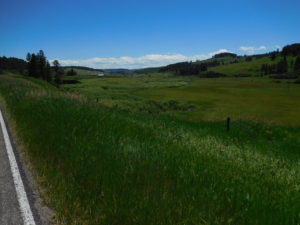
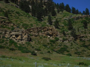
I started pedaling and made terrible time because the scenery was so amazing I kept stopping to take pictures. The weather was perfect. The road surface was new and hard. I was following a large stream and life was glorious for the first hour of pedaling. Suddenly the beautiful road stopped and became hard packed gravel and then the road split. At the split a road sign stated that route 238 was veering off in a southward direction. This was not right. Grass Range was due east.
No, I did not have any cell phone reception to check a map. No, I forgot to download and create an offline map, like I had done on other days. What to do? I did something old fashioned. I asked a man sitting in his front yard for directions.
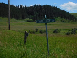
It took a while for us to connect since I kept telling him that I was trying to go to “Grass Land” and he had never heard of the place. Once we figured out I was using the wrong name of the town he told me that I missed the turn-off a couple of miles back. He said that I could get to “Grass Range” by continuing up the same gravel road and turning left at the next fork onto Tyler Creek Road. I then asked his advice. Should I go back to the turn-off or take Tyler Creek Road? He smiled and said something like “you are pedaling and looking for an adventure, so go up Tyler Creek Road.”
On the positive side Tyler Creek Road has some amazing scenery. On the negative side the road was in terrible shape. Parts were washed out a year ago and the temporary patches were just that, temporary. I bounced, smashed and slid for an hour and half over rough terrain.
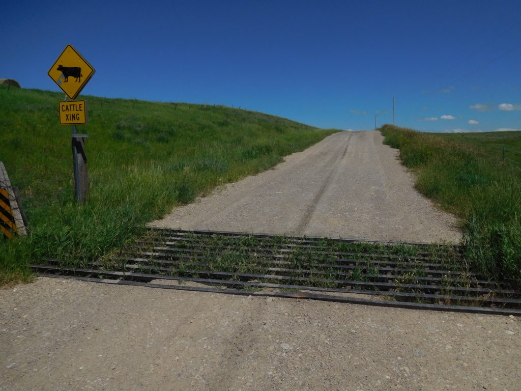
To make matters more exciting the road contained cattle guards or cattle grids. A picture of a cattle grid is above. The idea is simple a rancher fences off all their land but cannot fence off the roads. To prevent cattle from wandering off they drop a steel grid in the ground. When a cow tries to walk off the property using the road they get stuck in the grid and learn not to go through the opening in the fence.
While the grids are great for ranchers, they are horrible for bicyclists since they are very slippery and the bar spacing captures your wheels. The simplest way to handle a grid is to get off the bike and do a slip-slide walk over them. Grids are not placed for the convenience of cyclists either. There were places where I would come bouncing down a hill going too fast and realize there was a grid coming up very soon. There was also one grid on Tyler Creek Road which was near the top of a large hill. I almost pedaled to the hilltop when the grid appeared.
After bouncing for a long time, I came to the end of the road. Behind me was a pickup truck with a local rancher. He laughed at my going the back way to Grass Range and thought it was funny that I took Tyler Creek Road instead of the standard gravel road. He marveled that I was able to do Tyler Creek on “them skinny little tires.” He was also helpful and told me how to get on the regular road to Grass Range, which was called Forest Grove Road.
Forest Grove Road was also gravel, but most of it was hard-packed and none of it was washed out. The Tyler Creek detour added an extra 10 miles to the day’s pedaling.
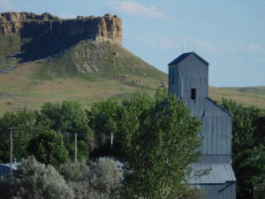
I made it to Grass Range finally. I never did find the gas station that attracted me to the town. It didn’t matter. The weather was cool so I still had enough water and Gatorade to make it the 20+ miles to the motel I booked in Winnett. Getting back on Route 200 was a pleasure after bouncing the back way. On Route 200 a motorcyclist slowed down to my speed and asked if I needed a refill on water. This meant I didn’t need to go to Grass Range at all, since I could have gotten a water refill on the road!
That peaceful uneventful day I wished for didn’t happen, but there are still many more miles to pedal. Maybe the peaceful day will be tomorrow?