Category Archives: Live from the Rock

Kashaveroff: A Month in Review

Rachel Gill checking in for one final time, this time from the comfort of home. This post sums up the end of the dig and my reflections.

Profiles:

The last time we chatted, pits in Block B were on the mind. We finally reached the bottom of those pits in some areas, mostly along the north wall of Block B. It was getting down to the wire, the last few days of our excavation season, and we needed to see the profile.

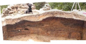
Quick digression: a profile is the view of the wall and all the layers that we have dug out. Typically, we measure and draw these on the last day in order to get a picture of how all the layers in the stratigraphy come together and how they looked before we took it all out of the ground.

BlockB2

Profile example: the north wall of Block B – The Pit! Note the thick orange ash (Level 2) on the left, which dates to 3800 years ago. The black charcoal is the fill of the pit.

This profile allowed us to see the pit as it would have been if we hadn’t dug everything out. A thick black layer curved in the shape of a ‘U’ dominated the right of the north wall, and the orange ash of L2 was virtually absent in that portion of the wall, as if the previous residents had dug out the ash and tossed it somewhere else to make their smoke pit.

OLYMPUS DIGITAL CAMERA
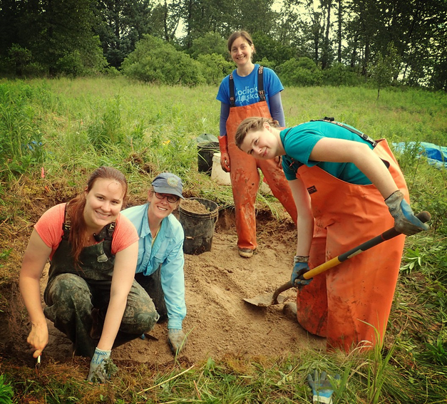
Students Ryan, Kate, Alexandria, Rachel, and Professor
Catherine 
West, mapping and drawing the features and profile in Block B

While we uncovered the majority of the charcoal and rock pit fill, we did not have time to dig out the walls of the pit. The plan for next year is to remove the walls and the base of the pit to see what lies beneath.

What else was happening at the Kashevaroff Site?

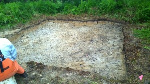
To determine the extent of the site, the last week was not only filled with frantic digging in the two main excavations, but a few test pits scattered around the site. A test pit is just what it sounds like: a 1 meter by 1 meter hole in the ground used to see if 1) there was any kind of human activity and 2) how the stratigraphy compares to the rest of the site. We ultimately decided on three test pits, one far to the north past the main grid, another far to the south on a small knoll past Block B and the smoke pits, and one right in the middle of the two. For the sake of simplicity, we will call these 201, 301, and 401 respectively.

OLYMPUS DIGITAL CAMERA
Students Sami Kassel and Hannah Wellman
after completing test pit 301

201 and 301 suggested the site stretches a long way. 201 looked similar to the 2X2 grid completed much earlier in the season next to Block A: very shallow with defined layers but nothing much underneath L3. 301 was much deeper, but the layers were less well defined. In fact, everything below the orange ash of L2 was muddled and confused, a heterogeneous mixture of sediments that weren’t identifiable as any specific layer. We expected to find glacial till at the bottom, but we found glacial outwash instead. This is basically slate sand that was deposited by glacial runoff.

401 looks like a HOUSE! This test pit is right between the two main grids, and was by far the most interesting. Below the L2 orange ash, we found what appeared to be the partial floor of a house. This indicates that not only were people smoking their food, but perhaps they were living nearby. Next season, we hope to open up the house entirely to see its features and perhaps date is specifically.

Sod quarrying might explain the discrepancies in the stratigraphy and depths to glacial material among the pits — in order to built their houses, smoke pits, other structures, and what have you, the residents were digging up sod from one part of the site and moving it to other parts. This would account for the very shallow dirt and complete absence of some layers in areas and the incredible depth in others. Hopefully we can test this hypothesis with further excavation.

Reflections

Over all, we did find some incredible artifacts and incredible potential for this site to hold answers to questions not yet discovered.

OLYMPUS DIGITAL CAMERA
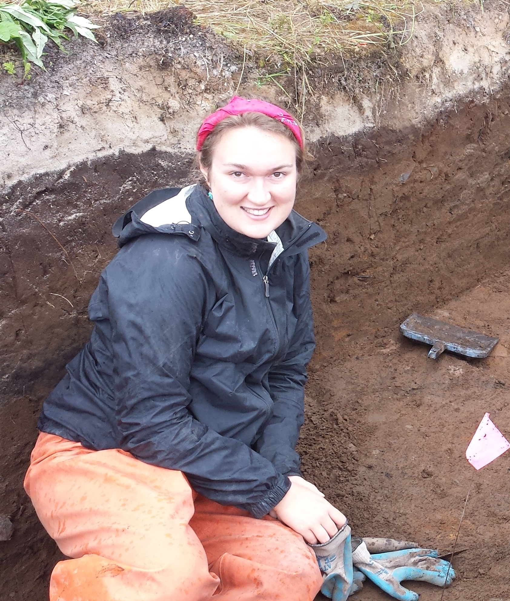
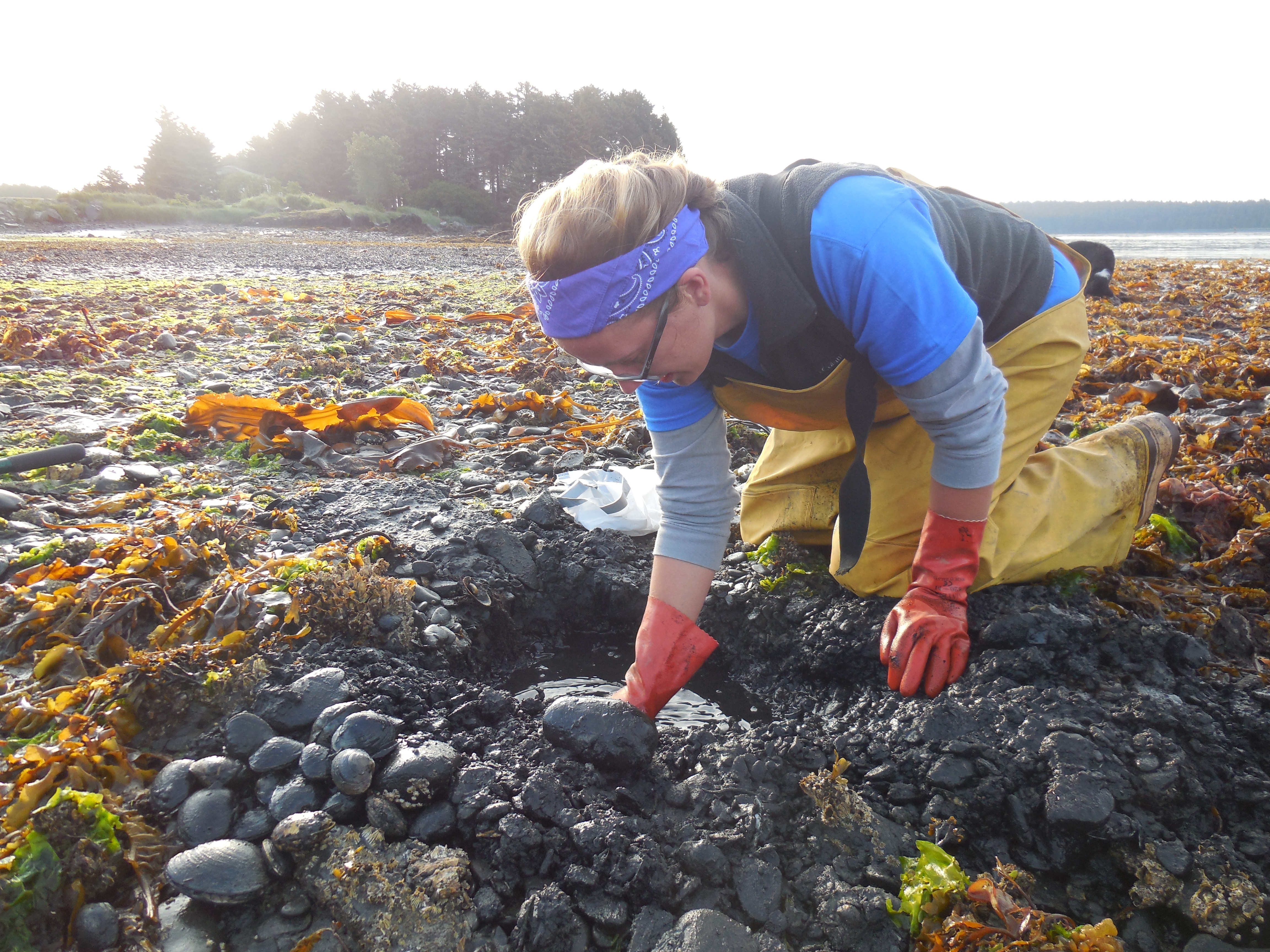
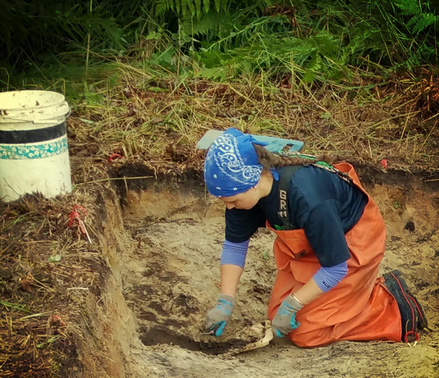
Student Rachel Gill mid-excavation

On a personal level, I just want to thank all of the amazing people that made this possible. I learned more than I thought possible about the Alutiiq people, their past and present, and myself as a student, a person, and a future archaeologist.

Island Otters and Ancient People

Hello there! My name is Hannah, and I am a graduate student at the University of Oregon, and your guest blogger for the week!

Hannah
Hannah excavating at the Kashevaroff Site, summer 2015

My study focus is on zooarchaeology, which is the study of animal remains, like bones and teeth. I'm especially interested in how humans and mammals interacted in coastal environments over time and how archaeology might intersect with understanding wildlife conservation. My recent research has been about sea otter populations in the past in the state of Oregon. I'm interested in understanding how Oregon sea otter populations have differed from those in California and Washington over thousands of years so we can understand how to best manage them today.

http://news.nationalgeographic.com/news/2014/09/pictures/140920-sea-otter-awareness-pictures-animals-ocean-science/

Even though I study sea otter bones, I have never seen a wild sea otter before this Saturday, when we had a bonfire on a beach at Chiniak here on Kodiak. This is because sea otters were nearly extirpated (or basically rendered extinct) along the Northwest Coast by the 1900s, except for a few groups in Alaska and California. Attempts to reintroduce the species to Oregon failed, so it wasn't until I left the state I could see one in the wild! Thankfully the sea otter is doing better in some areas, and has been reintroduced in British Columbia and Washington.

HannahBone
Measuring an archaeological sea otter humerus!

However, it is interesting for me to think about sea otters in Alaska specifically, because sea otters were extirpated largely due to Russian hunting - the incoming Russian traders pressured and forced the Alutiiq and other Native peoples along the Pacific coast to obtain sea otters for the 18th and 19th century fur trade. So while sea otters had been hunted before, it was hunted to an unprecedented degree for its furs in this era. Based on the artifact types recovered from the site of Karluk on Kodiak, dug and housed at the Alutiiq Museum, a recent publication suggests sea otters were not intensively hunted until Russian fur traders arrived  (Steffian et al. 2015).

The history of sea otters in Alaska from prehistory to the modern day is about conservation, discussions of colonialism, indigenous rights, and environmental and human exploitation. Being on this beautiful island has reminded me of the interdisciplinary nature of archaeology - it is complicated and messy beyond the mud and dust.

Check out the newest book from the Alutiiq Museum: Steffian, Amy, Marnie Leist, Sven Haakanson, and Patrick Saltonstall. 2015. Kal'unek: From Karluk. University of Alaska Press, Fairbanks.

Newsmakers

We have finally made it. Stars were born. Our celebrity is on the rise.

We are proud to announce that the Community Archaeology project - including the fabulous BU crew - was featured on Anchorage's KTVA Frontiers program this past weekend. We were interviewed about the archaeological site and the museum work we have been doing, and we got our University's participation a little press!

Click here to enjoy the show.

UAA grad student Alexandria made the cut!

It’s the Pits

Literally.

Rachel Gill back again to talk more about our site specifically and the journey into forming and testing a hypothesis. Science at work!

For the past two weeks, the Community Archaeology team has been agonizing over what the heck is going on in the vast 5x5 grid excavation affectionately named "Block B". Patrick and Catherine, our intrepid co-leaders, have toyed with a series of hypotheses, which culminated in the complicated excavation of a series of smoking pits.

But that conclusion was hard-won; let me take you through our two-week journey into the pits of Block B.

Initially, maybe a year or two ago when the study was in its infancy, a geologist used ground penetrating radar (GPR) to see if the main excavation extended past a series of trees. They found a depression beneath the sods, so naturally, the archaeologists thought house. And that's exactly the mindset we had when we stuck our shovels into the sod. The sheer amount of the first layer of ash, called Katmai, and how deep it was in some areas, was encouraging. It got deeper in the middle and was shallow on the outsides and all of that basically screamed house.

At least for the first three hours.

11222308_867149070020694_1765579128855250353_nBlock B just after the sod and Katmai ash was removed
and before the real excavation started

As we dug deeper into the ash, a series of mounds started to take form. So, people started to change their hypotheses; someone said it was a house with multiple rooms while others thought it may even be more than one house. One boy even joked that they were some kind of burial mounds, eliciting a cry of dissent from the crew. We left the first day all speculating.

In the days to come, a few things started to take shape. In two opposite corners of the excavation, our team found two rock features. (Another brief vocab lesson: a feature carries evidence of human activity like a hearth or a wall.) The one on the east end was larger than the other, with a series of rock piles in the middle of a pit of charcoal-stained soil. The west end had smaller rocks and less charcoal, so it seemed that the two-house theory might have support. We called this gravel layer Level 1A g (creatively, for gravel!).

OLYMPUS DIGITAL CAMERA
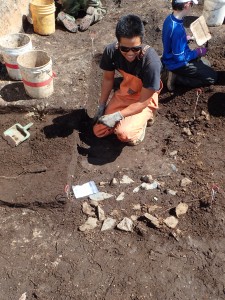
Alutiiq Museum intern Jesse kneeling next to
the smaller rock feature

It turned out that this thick, gravelly layer of charcoal-stained earth (L1Ag) actually seeped beneath other layers. Level 2A, the thick orange ash that dates to 3800 years ago, was actually on top of our L1Ag. This bizarre shift in stratigraphy forced us to reevaluate our "hearth" theory.

OLYMPUS DIGITAL CAMERA
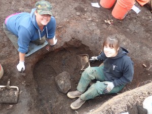
Students Alexandria and Jeannine excavate the
larger rock and charcoal feature

That was when Patrick thought about a smoke pit; according to him, they are some of the most common sites around Kodiak. The 3800 year-old ash that covers the L1Ag gravel-charcoal layer is mixed with darker brown soil, which made him think that perhaps there was one very large smoke pit covered with a roof made out of sod and ash. At one point or another the roof collapsed inward, possibly in a fire, covering the charcoal and rock underneath. For this to be true, we would eventually find a soil basically the color of bright orange Cheeto dust, which would indicate this severe burning.

The charcoal layer kept expanding, but no Cheeto dust.

Finally, the bizarre stratigraphy started to make sense when Patrick suggested that some of the ash layer may have been dug up and redeposited. Eventually, after a massive discussion, we came the conclusion that it's possible that one very large pit had been dug, used, covered when the ash fell, and then more smoke pits were dug after the ash fell. It's possible that these smoke pits were dug in contemporary periods or two entirely different sets of people used the same place for a smoking pit. (This is very much still up in the air and undecided amongst the crew.)

tumblr_ns8djaCak91roi5j1o1_540
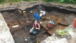
Student Rachel crouches in the extended smoke pit - note the charcoal-rich L1Ag at her feet, and the 3800-year old ash fall (L2) that covered the pit.

Still, we have one more week to excavate and perhaps our hypothesis will change or alter once more. Because that's the nature of this kind of investigation: as your evidence changes, your hypothesis is tested and may be challenged. And absolute certainty is a difficult thing to achieve, but the possibility is always there.

Sometimes archaeology is the pits. But it's the pits that always make it interesting.

A Satirical Ethnography of the Archaeols of Kodiak

Sami Kassel, who just graduated with a degree in Anthropology from Boston University and joins us at the Kashevaroff excavation, takes us deeper into the Ethnography of an Archaeologist.

--

After edging around a scurrying river, traipsing through a marshy field, and nimbly avoiding any bears that may be lurking in the bushes, one may stumble across the Archaeol tribe, a small yet vibrant community nestled on the side of Kashevaroff mountain in a remote region of Kodiak, Alaska.

The Archaeols can be easily identified by their traditional garb: sturdy, dark boots, which allow them to easily scale mountains of dirt or wade through streams; soft fabrics layered close to their bodies, which can be rearranged in response to changing weather; and thick overalls made from a slick material, brightly colored under layers of mud and ash. This discoloration marks the experience and status of the wearer; the more caked-on the dirt and wrinkled the fabric of one’s overalls, the more deference they are accorded. Clean garments are disdained, and newcomers to the community will quickly scramble to sully their clothes. This grime spreads to the Archaeols’ faces and hands—any exposed skin—and dirt settles in their hair and fills the creases around their eyes. They seem not to notice, or mind, when the soil finds its way to their food, or to the mouths of their water containers. In fact, so contrary to the expectations of any visitor who may be arriving from the neighboring town, where native households contain shrines dedicated to the ritual cleansing and purification of their bodies [see Miner, Body Rituals among the Nacirema], dirt seems to be the absolute and sole focus of the Archaeols’ lives.

Every man and woman above the age of fourteen spends nearly every waking hour immersed in the soil. With crude and often broken tools, they burrow into the earth, slowly and carefully creating massive pits. These trenches are called sayts, and are created so that the Archaeols may be truly surrounded by the earth. Centimeter by centimeter they scrape away the ground below their knees, taking care to interact with and honor each small layer. Even when the sayts are so deep that an Archaeol may sit on the bottom and no longer feel the breeze as it passes through the air, they continue to dig. It is clear that for the Archaeols, there is no greater joy than working with the dirt.

OLYMPUS DIGITAL CAMERAArchaeols working with dirt, the most prized pastime

When an Archaeol comes across a stone, they usually toss it aside, disgruntled that their connection to the dirt has been interrupted. They may even lick the stone before it is discarded, so that not a single grain of precious soil may be squandered. Occasionally, an Archaeol will encounter a particularly offensive rock, which they refer to as an artufakt. In a fit of rage, the Archaeol will shout and scream to call the attention of the rest of the group. Other Archaeols will inspect the intrusive stone, and shriek to express their disgust. With great care to avoid extensive contact with the artufakt, an Archaeol will place it in a sealed bag, which has been marked with symbols indicating the area of dirt which was contaminated by the stone. The artufakt is then taken far away from the sayt, to be kept in a sealed drawer or behind thick glass, so as to prevent any chance of future contamination between the offending rock and the Archaeols' cherished dirt.

Despite my many observations, the significance of the dirt still remains unclear. I hope to gain more insight on my next field project.

A Brief History of Time (and Stratigraphy): Kodiak Edition

Rachel Gill back with you again for just a glimpse into the vast Alutiiq history and how our small site fits into that enormous block of time...Okay, so maybe this won't be a history of all time, but archaeologists have literally dug into almost 8,000 years of obvious human occupation on Kodiak using both stratigraphy and artifact recovery.

A (brief) vocabulary lesson:

The recovery of certain types of artifacts can tell a seasoned investigator what time period they come from and can lead to certain conclusions about household behavior, hunting techniques, or even diet. The word stratigraphy may only be familiar to you if you are an archaeologist or a geologist. At its most basic, it refers to the order and position of the layers of dirt we dig through. These layers can indicate certain time periods of occupation, can offer a way to date artifacts above or below a certain date-able layer, or they can even indicate specific activities.

Picture1
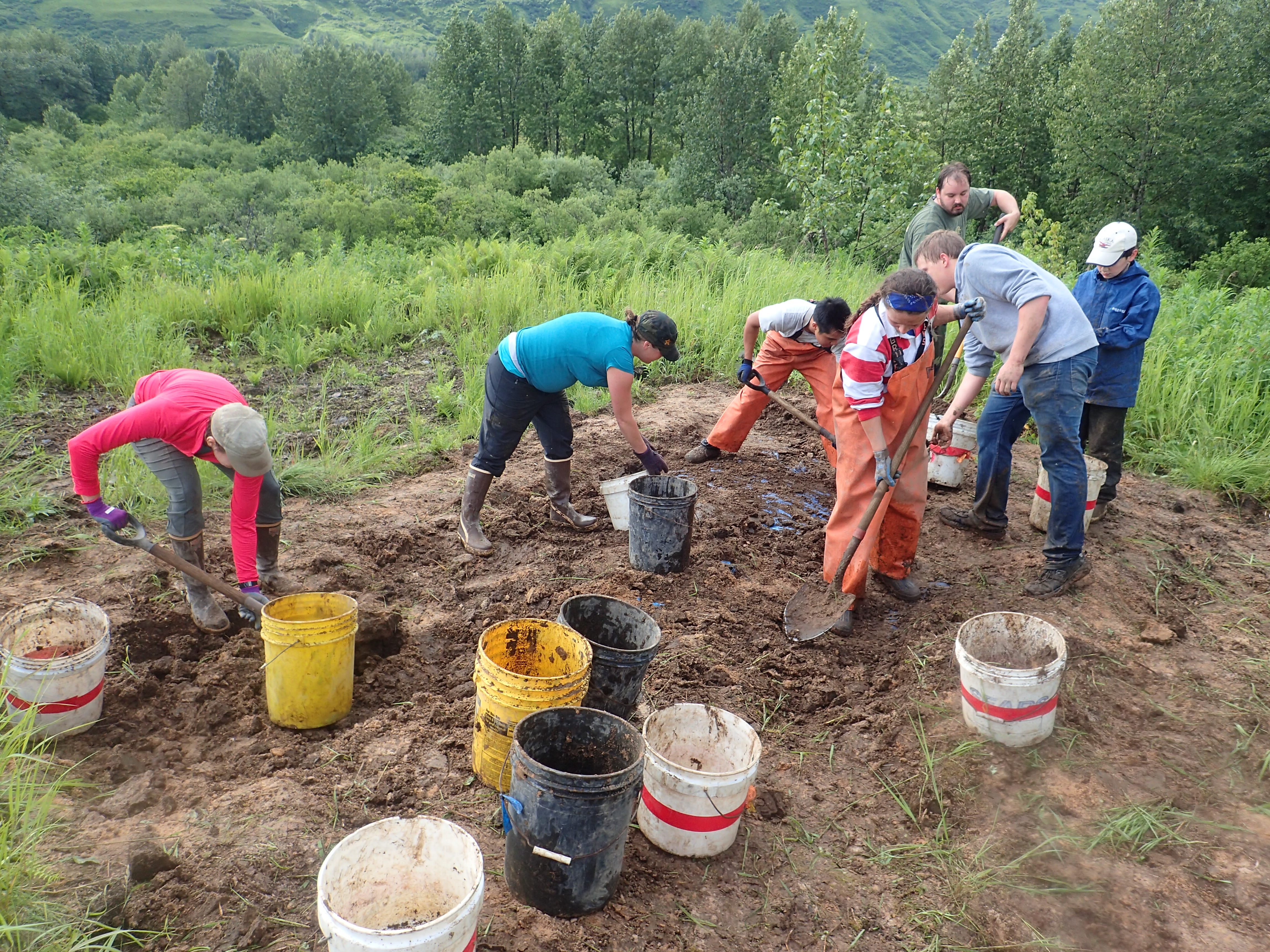
Example of the stratigraphy found at Salonie Creek, Kodiak Island - note the thick 1912 Katmai volcanic ash at the top, covering the archaeological layers below.

Some layers can be easily distinguished from one another, but sometimes it takes much more skill and practice to be able to tell the two thinly divided sediments apart. In Women's Bay on Kodiak, each layer has its own name and defining characteristics, and many of these layers are common across nearly all sites. For example, the Katmai ash that blanketed the region in 1912 after the eruption of Novarupta. Those layers that are unique to the site itself would be the floor of a house or a fire pit. During our excavation, each layers has received a designation - L1, L2, L3, etc. (The 'L' in this case stands for, you guessed it, "level". Please hold in your surprise!)

Alutiiq culture history:

The Kashevaroff site is just one of many around Women's Bay on Kodiak Island, and we hope it will shed light on what life was like around the Bay. At the Kashevaroff Site, we uncovered the sod and the Katmai ash, and found L1 below. The top of L1 is dark brown sediment, and seems to contain Koniag-era artifacts. The Koniag period is thought to be from around 200 to 650 years ago. Typically, houses are multi-roomed and are frequently found on salmon streams, and they yield salmon harpoons carved from bone and ground slate ulus, or fish knives. Very few of the artifacts we have found at our site have been from this period, so the occupation must have been brief.

OLYMPUS DIGITAL CAMERA
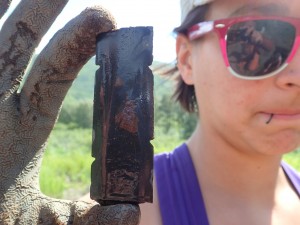
Bayonet shaft used for hunting sea mammals - this is made of ground slate, which is common in the area around the Kashevaroff site.

Deeper in the site, into the bottom of L1, we are finding evidence of the earlier Kachemak phase. This phase is much broader, from 650 to nearly 4000 years ago. Circular houses were built from sod (bricks of soil, grass, ash, and roots dug up from the ground’s surface), making their walls easy to spot and excavate. On the floor of the house, archaeologists will typically find a central hearth for cooking, ground slate for making sharp projectile points, and stone net-sinkers...and we have begun to find evidence of these artifacts.

OLYMPUS DIGITAL CAMERA
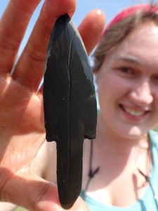
Ground slate point - the lines may be the hunter's identifying mark!

Though we have not found any, in sites with better organic preservation archaeologists might find carved bone tools for hunting sea mammals and wooden artifacts used for decoration. Unfortunately, these poorly preserved artifacts are only found where the acidity of the volcanic ash falls (like the dark brown, weathered ash we found in L2) is balanced with basic materials, like decomposing clam shells. So far in our excavation, the Kachemak period has yielded red chert (a kind of stone that comes from the west side of Kodiak Island and is good for making chipped stone tools) and ground slate for making points. We’ve also uncovered a few beautiful points and tools themselves.

OLYMPUS DIGITAL CAMERA
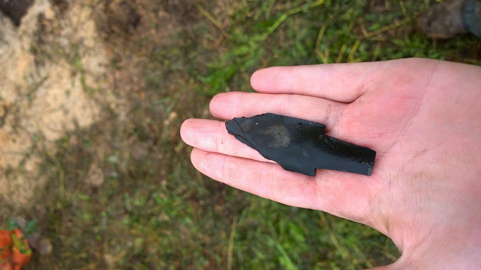
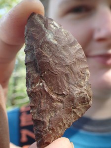
Red chert stone tool from the Kachemak period - this is probably a small knife that would have been hafted into a bone handle.

As we move further down in the stratigraphy, L2 is what we like to call a "dead zone" because it is incredibly rare to find artifacts in this reddish brown ash fall. This is because it is just that: an ash fall that has been dated to about 3800 years ago and must have smothered the site when it fell. We can use this ash to help date the occupation at our site.

The really old stuff is in L3. This level contains artifacts dating anywhere from 3800 years ago (before the ash fell) to 7,500 BP, when the Ocean Bay period started. Ocean Bay I and II are the earliest occupations of Kodiak, and are characterized by slate and chipped stone tools and evidence of more ephemeral housing: rock rings to hold down tent covers and small post holes. We may find stone oil lamps for light and the house floors are often marked by red ochre stains, a pigment ground from naturally occurring mineral. These earliest occupants hunted a vast array of marine life and most times, Ocean Bay sites are located very near to the coast line. The most distinctive tool type found in this time period is called a microblade, so once you find of these small hunting tools, you know exactly where you stand in the timeline. These microblades were inserted into a wooden lance and used for hunting. As of now, we haven’t uncovered any obvious Ocean Bay artifacts, but the dig is still young and we have our fingers crossed.

microblade
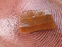
Example of a microblade from the Ocean Bay I period
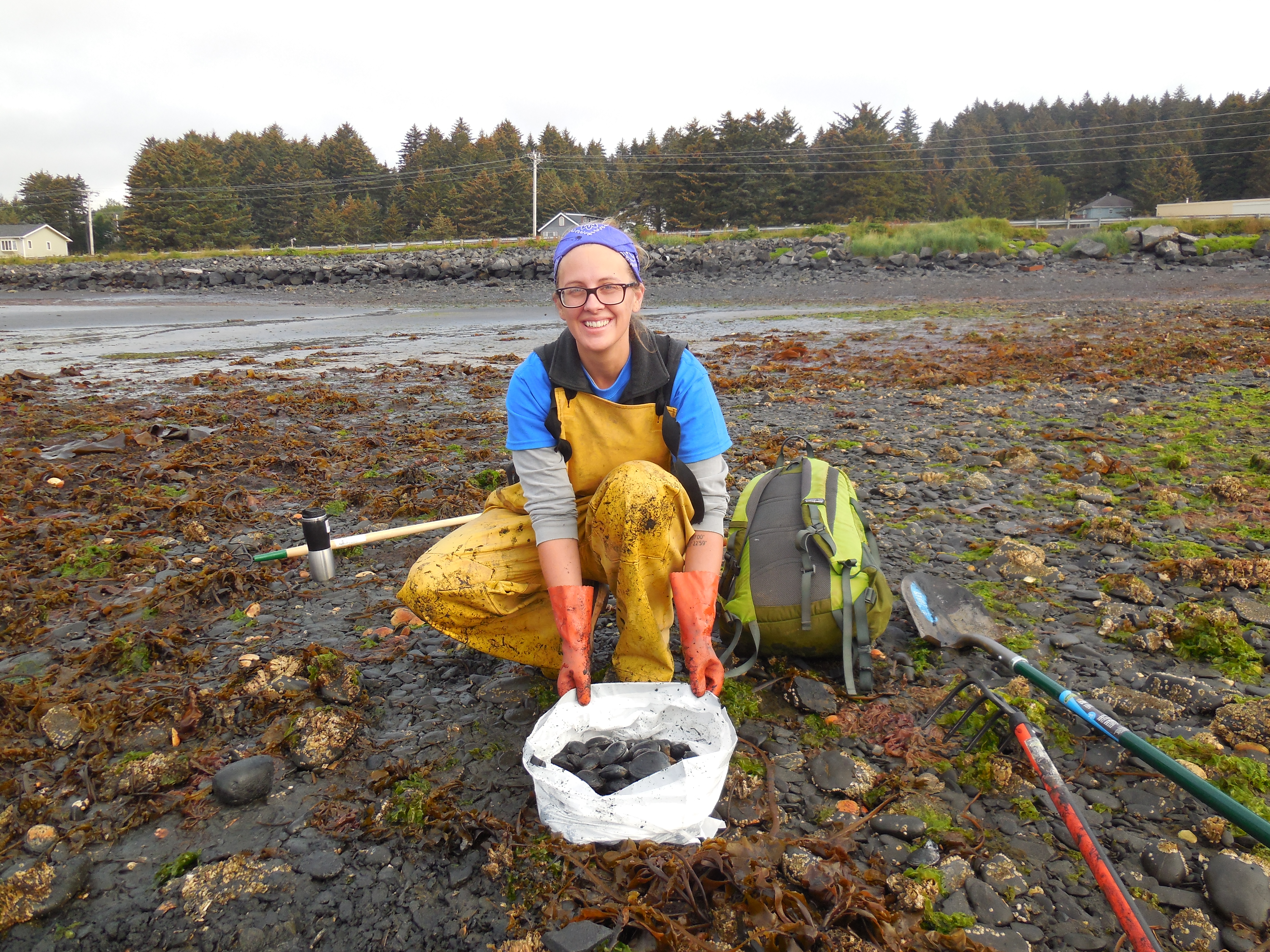
Hopefully our small site will shed a little more light on this complex and involved history by offering information about the earlier periods of the Alutiiq world.

Happy as a clam! Falling in love with Kodiak Island.

Christine Bassett joins us from the University of Alabama’s Department of Geological Sciences, where she is a graduate student. Check out the Aleutian Islands Working Group feature on her research here.

DSCN3486
Christine with her clam harvest

As a geologist, I am studying how butter clam (Saxidomus gigantea) shell chemistry and growth might help archaeologists to take a peek at past environmental conditions in the North Pacific Ocean. Clams are sensitive to changes in water conditions, and they record these changes in their shells – so the shells in archaeological sites around Kodiak may be the key to understanding ancient environments! I came to Kodiak, Alaska to collect live butter clams from several sites, and I will look for differences in how the shells are growing in each location.

21
Archaeological butter clam from the Uyak Site on Kodiak Island.

I grew up in central Georgia, so before coming to Kodiak I had never been clamming. I knew the types of environments where butter clams are most likely to grow and I knew how to identify butter clams, but finding them was a challenge. During my week on Kodiak, I learned by making connections and working with clamming veterans from the Alaska Department of Fish and Game and the University of Alaska. At low tide, they showed me how to dig and then rake back the sand and gravel to uncover groups of clams…and eventually I collected more than 120 clams in just three beach visits! I also took temperature and salinity measures at each site so I can connect the shell growth to the environmental conditions.

DSCN3468I will take these clams back to the University of Alabama, where I’ll analyze them over the next year. My fieldwork on Kodiak has been a huge success, and I can’t wait to come back to this spectacular place.

Community Archaeology: A Summary

Please welcome Rachel Gill, a senior archaeology major at Boston University, who will be blogging about our adventures on Kodiak!

On a small island just a 90 minute flight from Anchorage, Alaska, Kodiak has been home to the Alutiiq people for nearly 8,000 years.

10906233_867623609973240_7083963864078713177_n

Much of the landscape remains touched only by time and weather; mountains and trees tower above bays shrouded in mist and clouds almost constantly loom in the distance. And nearly all of Native American prehistory, from the ancient Ocean Bay period to the more recent Russian colonization, lies somewhere beneath the soil. With more than 1,300 known sites across the archipelago and many more left to be unearthed,  modern Alutiiqs now have ways to not only answer the questions they have about their own past due to aggressive and brutal western colonization, but connect with their ancient ancestors on a personal level thanks to Community Archaeology.

11698567_10153401486018077_9025132281772629407_n

Pioneered by Alutiiq Museum archaeologists in 1997, because of native curiosity and the escalating fear of site erosion and disturbance (accidental or intentional), Blisky was the very first site to be excavated by community volunteers. And with over 3,500 artifacts brought to the surface and studied, in the spring of 1998 the Community Archaeology project was born.

Nearly 17 years later, Community Archaeology has hosted at least one month-long excavation every summer. (High school and college age participants may also get course credit for the excavation as I am experiencing personally and the museum also employs a few interns every year to help with the project.)

Ultimately the goal is to understand how these ancient people used the land to work, live, exist. Through time, the settlement patterns of the Alutiiq, their tools, and priorities change. The daunting question is to figure out how, when, and why these patterns and tools shifted and altered.

Capture
Curator Patrick Saltonstall, Alutiiq Museum

Volunteers and students start by attending a small introductory session to explain the basics of excavation, where the site is located, and why they are interested in digging there at all. This year, just like last, we're excavating a few grids at the Kashevaroff site near Salonie Creek where they found a house in excavations past. (Don't worry, there won't be a quiz.) College students and directors of the project start the Friday before, surveying the site and setting up grid points for the volunteers to excavate in the coming weeks.

sod
Boston University student Rachel Gill, volunteers Leslie and Courtney, and BU professor Catherine West

Day 1 always brings two words every Alaskan archaeologist knows will only bring fatigue and muscle pain: sod busting. An unfortunately necessary evil because we have to remove the sod and a layer of volcanic ash before we can even think about reaching the goodies underneath.

sami
BU student Sami Kassell excavates

The rest of the dig brings the removal of layer after painstaking layer with a mucky dustpan and muddy trowel. Artifact recovery never moves at a steady pace; there are days where someone can't go five minutes without finding something new and interesting and exciting; and then there are days where it takes hours to find anything more than a rather disappointing pebble amidst all the mud.

11698532_867149480020653_8022931769508534042_n
Ground slate point!

But in the end, no matter the quantity of artifacts recovered or the sheer volume of dirt moved (which, believe me, can be immense), the community interest and the desire to preserve a Native history that was nearly wiped out by Westerners is what drives the museum and the project.

As perfectly stated by Patrick Saltonstall and Amy Steffian, two of the Alutiiq Museum's archaeologists: "Archaeology is much more than an academic discipline... archaeology is a practice with profound social consequences." Everything we find as archaeologists is just a piece of the vast history of the human race. It can change entire views of ancient cultures and people and cause a stir around the world. Community Archaeology seeks to let the local people be a part of this incredible unveiling of the past. 

Even they have to be covered in mud to do it.