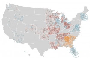
The New York Times Graphics has a process blog. And they use R and maptools. Good stuff.
Peter Frase @ The New Inquiry: “Phantom Tollbooths”
2012.04.09 at 12:57
Peter Frase in The New Inquiry:
There are those who want to defend an order based on intellectual property out of a desire to protect the livelihoods of working writers, artists, and other immaterial laborers. In a world where the likes of Google and Facebook are increasingly adept at extracting creative work for free, this defensive attitude is understandable. But if it comes at the cost of empowering a class of corporate rentiers and imposing pervasive surveillance on the internet, protecting a few meager royalty streams will hardly have been worth it.
Ambient Sounds + Map = This
2012.03.07 at 00:36
Dustin Baxter directed us to aporee.org/maps in class today. He recorded a busted speaker buzzing on a Green Line train, but there are also Estonian fountains, back yards, and casual conversations in French. Mesmerizing.
Long Nightmare at STRATFOR Continues
2012.02.27 at 11:41
The atmosphere at private intelligence firm STRATFOR, based in Austin, Texas and for whom I very briefly (and indirectly) worked years ago, must be tense since WikiLeaks began its release of thousands upon thousands of the company's internal email communications. For what it's worth, in response, they're temporarily offering all of their web content gratis.
As for the leaked emails, much like the HB Gary fiasco, they do little to bolster my esteem for the public-private security and intelligence apparatus.
Christian Parenti Thinks Climate Change Will Make Us Love Big Government
2012.01.27 at 11:41
From TomDispatch:
After all, there is only one institution that actually has the capacity to deal with multibillion-dollar natural disasters on an increasingly routine basis. Private security firms won’t help your flooded or tornado-struck town. Private insurance companies are systematically withdrawing coverage from vulnerable coastal areas. Voluntary community groups, churches, anarchist affinity groups -- each may prove helpful in limited ways, but for better or worse, only government has the capital and capacity to deal with the catastrophic implications of climate change.
Made By One Guy In Oregon
2012.01.04 at 15:45
"American mapmaking’s most prestigious honor is the “Best of Show” award at the annual competition of the Cartography and Geographic Information Society. The five most recent winners were all maps designed by large, well-known institutions: National Geographic (three times), the Central Intelligence Agency Cartography Center, and the U.S. Census Bureau. But earlier this year, the 38th annual Best of Show award went to a map created by Imus Geographics—which is basically one dude named David Imus working in a farmhouse outside Eugene, Ore."
Shake It, Baby, Shake It: West Texas Earthquakes
2011.12.20 at 01:20
I just read that West Texas experienced its third earthquake in less than a month. Intrigued, I grabbed USGS earthquake data for the continental U.S. and filtered out everything outside a bounding box around Snyder, Texas, where this most recent quake occurred. Now, I'm not sure if USGS changed the way it monitors quakes in the region or what, but there's clearly a marked change here:
Year,Month,Day,Time(hhmmss.mm)UTC,Latitude,Longitude,Magnitude,Depth,Catalog

1977,11,28,014050.50,32.954,-100.837,3.5,5,PDE

1979,07,05,010501,32.949,-100.895,2.7,4,PDE

1984,09,19,061542.35,32.027,-100.688,3.0,5,PDE

1986,01,25,225024.96,32.064,-100.733,2.9,5,PDE

1986,01,30,222637.07,32.066,-100.693,3.3,5,PDE

2006,08,12,104909.67,32.895,-100.894,2.8,5,PDE

2008,01,29,102453.24,32.898,-100.842,3.3,5,PDE

2008,07,18,173109.40,32.891,-100.842,2.7,5,PDE

2008,07,18,203841.78,32.849,-100.771,2.7,5,PDE

2010,01,27,045933.05,32.902,-100.833,3.1,5,PDE

2010,04,12,002005.97,32.935,-100.875,2.8,5,PDE-W

2010,08,08,011238.07,32.896,-100.851,3.4,5,PDE-W

2010,08,25,020514.32,32.951,-100.861,2.8,5,PDE-W

2010,08,29,124836.61,32.912,-100.916,2.6,5,PDE-W

2010,10,09,074227.63,32.929,-100.886,3.1,5,PDE-W

2010,10,26,065629.79,32.922,-100.850,3.1,5,PDE-W

2010,11,01,091058.42,32.996,-100.816,2.8,5,PDE-W

2011,03,01,033012.76,32.876,-100.839,3.1,5,PDE-W

2011,03,01,063159.89,32.839,-100.802,2.5,5,PDE-W

2011,03,12,152200.86,32.882,-100.896,3.0,5,PDE-W

2011,03,13,201620.62,32.995,-100.767,3.8,5,PDE-W

2011,03,14,001948.80,32.964,-100.809,3.0,5,PDE-W

2011,03,19,233401.21,32.978,-100.766,3.0,5,PDE-W

2011,03,28,091211.95,32.913,-100.816,3.0,5,PDE-W

2011,04,25,165631.88,32.822,-100.844,2.5,5,PDE-W

2011,07,14,102913.60,32.928,-100.806,2.5,5,PDE-W

2011,09,11,122744.32,32.848,-100.769,4.3,5,PDE-Q

2011,09,11,183634.68,32.887,-100.807,2.5,5,PDE-Q

2011,09,11,203158.11,32.892,-100.848,2.7,5,PDE-Q

2011,09,12,003149.11,32.804,-100.878,2.7,5,PDE-Q

2011,09,12,022931.34,32.730,-100.848,2.5,5,PDE-Q

2011,09,12,091946.92,32.833,-100.831,2.6,5,PDE-Q

2011,09,12,092612.83,32.773,-100.850,2.7,5,PDE-Q

2011,09,12,141834.05,32.822,-100.871,3.4,7,PDE-Q

2011,09,13,072135,32.818,-100.789,2.6,5,PDE-Q

2011,11,24,064959.99,32.954,-100.812,2.8,5,PDE-Q

2011,11,24,231548.91,32.956,-100.817,3.0,5,PDE-Q

2011,12,09,184733.18,32.939,-100.881,3.5,3,PDE-Q

2011,12,17,144658.75,32.802,-100.857,3.2,5,PDE-Q
Of the 39 quakes with their epicenter in this bounding box, 30 have happened in the last two years. Anybody know what's going on here?

