http://www.flickr.com/photos/animalmagazine/6329142875/in/photostream
Lovely Map of Occupy Wall Street
2011.11.29 at 00:43
Texas is Burning (Again)
2011.09.07 at 23:52
The Texas Forest Service has responded to 172 fires over 135,051 acres in the last seven days. Of the 254 counties in Texas, 251 are reporting burn bans. Parts of the state have seen less than two inches in the last eleven months, and we're heading into what's normally a dry part of the year. Things are pretty serious in the Lone Star State.
Monitor the situation at the Texas Forest Service site.

Maps for Cool Kidz
2011.09.04 at 09:42
Vicky J. writes weekly about maps for The Awl in a series called "Fun With Maps". Read it.
Time-Lapse Weather Imagery: 2010
2011.08.02 at 03:40
Ken Hardy's time-lapse video of satellite weather images for the lower 48 during 2010:
2010 US weather radar and satellite animation from egb13.net on Vimeo.
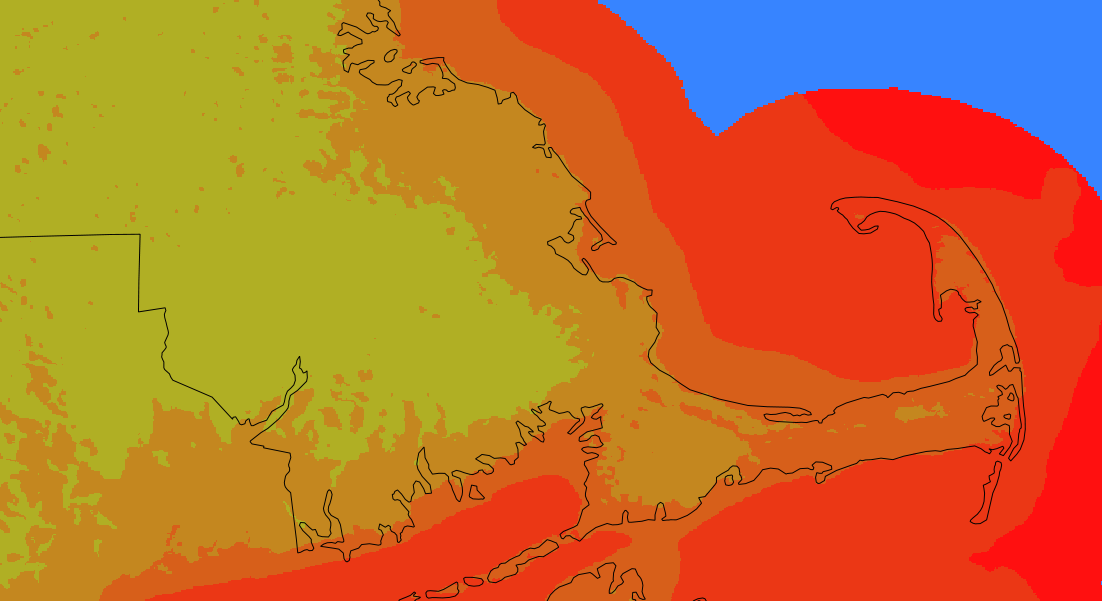
Drawing Water
2011.08.01 at 10:16
Artist David Wicks' "Drawing Water":
"Drawing Water is a constructed landscape shaped by the relationship between where water falls and where it’s consumed within the United States. It builds images to expose the reality that water is channeled, pumped, and siphoned to locations far from where it falls. Although the paths are imagined, Drawing Water is based on real data and it reveals a clear truth about water resources and use."

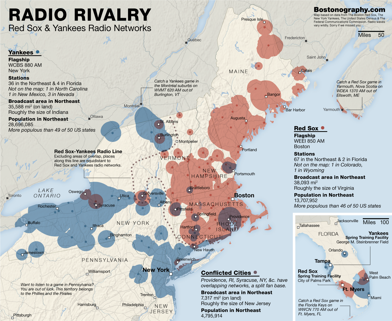
Baseball, Radio, and Pretty Maps
2011.08.01 at 09:32
A couple of weeks ago, Tim Wallace at Bostonography posted a discussion of the very nice maps he's made of the listening areas of Yankees and Red Sox radio stations.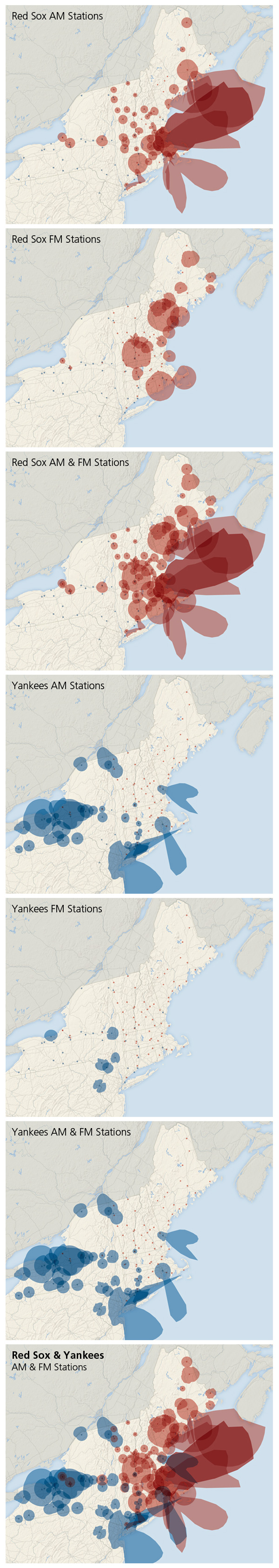
Post Office Closings in Texas
2011.07.28 at 23:37
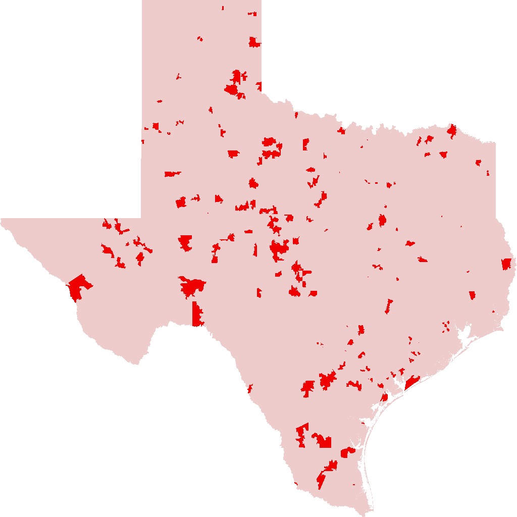
Zip Codes in Texas Which Stand to Lose a Post Office
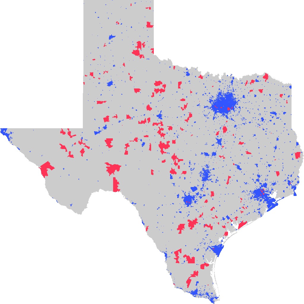
USPS Facility Closures vs. Census Named Places
The U.S. Postal Service has slated over 200 post offices for closure in Texas, part of a system-wide move that could shutter 3,700 offices across the country. The facility in my tiny hometown is one of them. The red bits in the first map represent zip codes in Texas with post offices at risk. Named places from the U.S. Census are represented in blue in the second.
These maps were made using GDAL and ImageMagick.
Digital Maps Are Giving Scholars the Historical Lay of the Land – NYT
2011.07.28 at 08:19
Patricia Cohen writes in the New York Times:
"Historians, literary theorists, archaeologists and others are using Geographic Information Systems — software that displays and analyzes information related to a physical location — to re-examine real and fictional places like the villages around Salem, Mass., at the time of the witch trials; the Dust Bowl region devastated during the Great Depression; and the Eastcheap taverns where Shakespeare’s Falstaff and Prince Hal caroused."