Upernavik: End of the Line
I was nervous about Upernavik. It’s extremely far north, though it’s amazing how much more of Greenland lies beyond it. Upernavik is also very small––it’s an island with a circumference of just a few miles––and planes fly in and out only sporadically. I landed on a Saturday, and there was no option to leave before Thursday. I hoped that I would like the place and I did, very much. It’s what I think of, now, when I think of Greenland.
Here are some things I did in Upernavik:
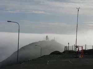
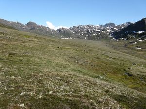
The cold, foggy hill where I pitched my tent
I walked around in a heavy fog, looking for the hotel-restaurant my guidebook promised. I learned that it had shuttered, and that there wasn’t anywhere to eat, sleep, or warm up any longer. I pitched my tent on a very high hill, near a giant satellite dish. I cooked elaborate meals on my camping stove and drank whiskey to keep warm. I wore all of my clothes to bed every night. It was always a relief to rediscover feeling in my fingers and toes in the morning.
I took to pestering the quiet man managing the museum in the director’s absence. After a lot of bothering, he finally let me into the old cooperage to shower and shave. The building had been recently renovated to function as a studio for artists. The last artists to live there were two women from North Carolina. They left their long hair in the shower drain and two inches of cold standing water in the stall. I cleaned the drain and took my shower. It was my first in over a week, and one of the best I’ve ever taken. I went to thank the man afterward, but he’d already closed up for the day. I think he was trying to avoid telling me that I couldn’t sleep there.
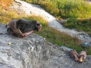
Spoils of the hunt
I descended the rickety staircase between my tent and the town about a thousand times, always pausing to admire the sawed-off head and hooves of a musk ox, drying on a rock.
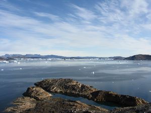
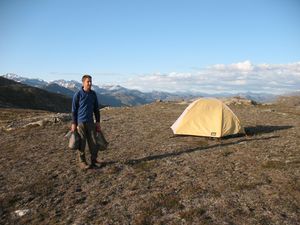
View from N72º48’18.2”
I walked the perimeter of the island twice, once clockwise and once counterclockwise. I saw the remains of an old turf hut, barely visible in the grass. On my first trip, I spent a while trying to find the northernmost spot on the island, thinking it was probably the northernmost place I’d ever get. The next day, I saw an aerial photograph of the island, and realized that I’d missed a small spit of rock that jutted out even farther. So, I repeated the trip a second time, in the rain, to reclaim my victory: N72º48’18.2”
I met a Danish doctor who was staying in Upernavik for a month-long residency. He worked mostly out of the hospital, but sometimes did overnights to the smaller settlements, scattered up and down Baffin Bay. At one settlement, of sixteen homes, they pushed two desks together at the school, and put paper down over top, as a place to see patients. Afterward they gave him two kinds of seal meat: one regular and one that confused him as to whether it was “seal lung” or “seal young.”
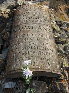
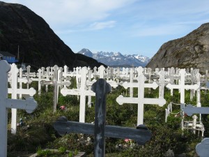
Navarana Freuchen’s grave
I found the grave of Peter Freuchen’s wife, Navarana, who died on the fifth Thule expedition. The ground in Upernavik is frozen most of the year, so the graves are raised and covered in rocks. The smell of death is faint but detectable.
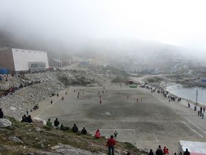
A view of the pitch
I watched many hours of an annual soccer tournament between Upernavik and the surrounding settlements. I ate aebleskiver and clapped for both sides. The crowds were enthusiastic––lots of shouting and airhorns––but the biggest cheers were reserved for the icebergs in the bay, which would calve loudly, every now and again. Sometimes the ball would fly errantly into the bay, and then all the kids would rush down and throw rocks at it in a vain attempt to coax it in. In general, the games were a lot of fun––I was impressed by the skill and physicality of the teams, particularly after learning that, in many of the settlements, there isn’t anywhere flat enough to practice, and they have to wait until the harbor freezes to get a real workout.
I spent hours hand-copying the wall labels at the museum, which detailed the complex dividing principles involved in traditional hunting.
I finished War and Peace.
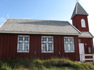
The old church (1839)
I found the most beautiful building in Greenland, a church built in 1839. Inside, there were chandeliers made from brass salvaged from a 1921 shipwreck. There were countless dead flies on the floor and windowsills. They looked oddly lovely against the gleaming white walls.
I met a lab tech from the hospital who was trying to get a kayak rental business off the ground. It took him months to get permission to build––he complained of rampant nepotism––but he got it, and now he’s struggling to get a structure up before winter. I tried to talk him into taking me out kayaking, but the timing and the weather never worked. He was understandably more intent on shoveling his basement out before the ground froze. I helped him move some rocks, and talked to him while digging. He had a terrifically dry sense of humor, and was at once very cynical about Greenland, but also committed to making a life there. I wrote down some of the things he told me in a little notebook. After getting back, someone showed me an article about Upernavik in Outside magazine, in which he says all of the same things, almost verbatim. I laughed at that. I hope he got his basement finished.
I saw the Kingigtorssuaq runestone. It’s much smaller than I expected. It was found atop a cairn on an island north of Upernavik. It’s been dated to 1250-1350 A.D. and represents the northernmost artifact left behind by the Vikings. How it got there is something of a mystery.
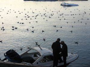
Chartering the boat
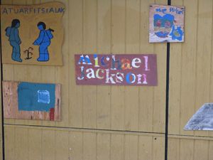
I found out that the Danish doctor and some nurses from the hospital had chartered a small motorboat to travel to the inland ice, and I talked them into letting me pay-in to come along. We sped through the fjords and I sat in the bow and looked up at the giant, intricately carved icebergs while the doctor and the nurses laughed and chattered in Danish. We stopped off at a settlement, where a small group of smiling kids showed us how they liked to hop between bags of gravel for fun. The town wasn’t much more than a few houses, a school with funny wooden cutouts of seal and narwhal on one of the walls. There was also a hand-painted sign memorializing Michael Jackson. I walked aimlessly around, thinking about how I was farther from home than I’ve ever been before––hours by motorboat to Upernavik, two days and three flights just to get to Nuuk, a few more days before the next available hop to Reykjavik, another night before crossing the Atlantic home…
Far from home. Mostly.
… But, in the end that’s what I did. It seemed like everyone in Upernavik knew someone who was either arriving or departing on my flight; they streamed up the hill from town to say teary hellos and teary goodbyes. I was the only one who didn’t know anybody. And then the Danish doctor arrived to see a friend of his off, so I got to wish someone well after all.
That’s a wrap, I guess. Thanks so much for reading.
—
Uummannaq
October 24, 2009
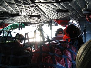
In the helicopter to Uummannaq
North of Disko Bay is where you really break free of the travelers––not to mention amenities like restaurants and places to sleep (to be fair, there is one of each in Uummannaq, though I’d soon be doing without either). The town is still a ferry terminal, however, so for the few hours that the boat is in harbor, people mill about taking pictures. No sooner does it pull out than the locals stare at you like maybe you missed it. The only other way to get there is by helicopter, which is how I made the trip. Too small for a runway, the island survives on these 10-minute helio-hops from nearby Qaarsuut. It’s a gorgeous ride if you don’t mind tucking your legs behind the bags of mail and other cargo.
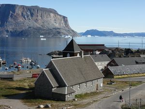
Uummannaq’s historical center
I had two days in the town and I spent the first exploring the sweetly picturesque old center. The most appealing historical district I encountered all trip, the various buildings––a beautiful granite church, a squat yellow-washed blubber house, a well-preserved vicarage, and three traditional turf houses––are artfully arranged around the harbor, and because the only market and restaurant are nearby, it remains the focal point of foot traffic. The museum is one of Greenland’s finest and the turf huts are manned by an octogenarian volunteer who wouldn’t let me leave until he’d dutifully pantomimed the complicated creation of a pair of traditional kamiks (sealskin boots). He clapped me on the back many times, laughing at how tall I was and how low the turf hut ceilings are.
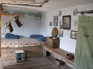
Inside a traditional turf house
A quick note about the turf houses: nearly everyone in Greenland lived in them until the forced consolidation/public housing boom of the 1950s. They look pretty rough from the outside, but every one I’ve been in––almost a dozen––has been unfailingly clean, bright, and sweet-smelling, like the citrusy moss that grows everywhere here. Every time I go inside one I expect it to be dank and dark, and every time I’m pleasantly surprised. They’re really quite cozy.
I probably shouldn’t have gotten this far without mentioning Uummannaq’s most distinctive feature. The sheer 1200m. mountain at the island’s far end ends up being the backdrop for every view of (and from) town. Made of colorfully banded gneiss, the peak is pretty unusual compared to others I saw in Greenland––it looks better suited to the Andes. Nevertheless it’s really beautiful, and the light constantly toys with its colors. I met a climber from Zurich intent on summiting it––he’d already been partway up to test the rock and drop off some gear. Personally, I was more than happy to circle the base and gaze up at the thing, which I did on my second day. The sun was impossibly bright, and my shadow eerily stark against the rocks while I walked. I kept feeling like there was someone next to me.
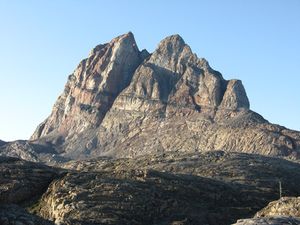
Uummannaq’s distinctive peak
I left town on a Saturday, and whether it was because of some unknown holiday or simply post-payday festivities, everyone in town seemed to be out drinking. Bottles were clinking in Pilersuisuoq bags, and the same people who greeted me a day before with blank stares were now waving me over to chat. To a person, everyone seemed smitten with their town, promising me that it never rained and that they would never consider moving anywhere else. By the time it was necessary to head to the helioport, I had a pretty warm feeling about Uummannaq––I was headed much farther north, where it was rumored to be much colder, and I had some regrets about abandoning that glorious sun.
—
Qeqertarsuaq
October 5, 2009
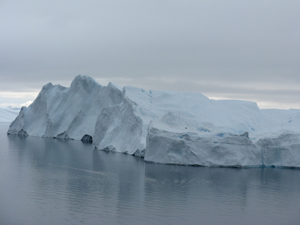
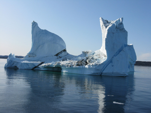
Qeqertarsuaq framed by ice
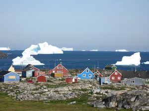
It can’t be more than thirty miles from Ilulissat, but tiny Qeqertarsuaq––the only active settlement on Disko Island––is worlds apart in every way. For one thing, the island is relatively new (in geological terms), so the bizarre basalt cliffs and thick, verdant vegetation are markedly different from anything to the west. But the town itself has a completely different feel, too: sleepy, relaxed, relatively indifferent to the visitors who trickle in off the ferry. Large, bright blue icebergs dot the bay, rumbling and calving all through the night. It ended up being more than a nice respite from the bustle of Ilulissat and actually one of my favorite spots in all of Greenland.
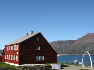
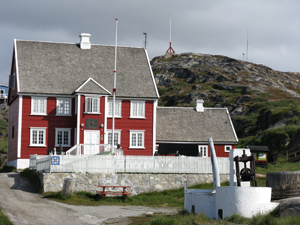
Qeqertarsuaq’s museum
The colonial old town is pretty much limited to the former inspector’s home, which now functions as the town museum. It seems that the bulk of the funding for the museum was made possible by the descendents of Philip Rosendahl, who served as the bailiff for the entire northwestern region of Greenland during the early part of the last century. As a result, much of the first floor is dedicated to him––the walls are covered with photos, and his bailiff’s uniform, complete with gold-braided epaulettes. is proudly displayed in a large glass case. It’s all very comical because you can tell from the photos that Rosendahl was someone who did not like a big fuss to be made about him. It’s possible to pick him out in group shots just by his posture––standing always a bit awkwardly off to the side, slinking down a little, always the man apart. I feel confident he would have been embarrassed by the idea of the exhibit, so the whole thing is sort of amusing. The woman running the museum was kind enough to leave it open while I lingered in the reading room upstairs. There were lots of yellowing community papers and pamphlets that made me sorry not to be able to to read Greenlandic, or even much Danish. Still, it was possible to glean some tidbits after lots of time spent digging.
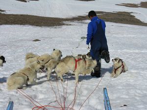
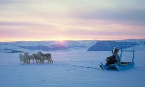
The driver harnesses the dogs
Disko Island is the only place in Greenland where it’s possible to dogsled during the summer months––high up on the Lyngsmarksbraen, whose ice cap stays frozen year-round. Getting up to the base hut is a steep but really pleasant climb; with few switchbacks, it’s pretty much straight up into the clouds, but once you clear them the sun is bright and glorious.
Once up top, I drank coffee and ice melt on the porch of the hut and waited for the ride to begin. In true Greenlandic fashion, there’s no indication of where or when or what to do. When I heard dogs yipping, I walked over and stood and watched them get harnessed. When the driver was finished, he walked straight past me and yelled up to the hut. Coming back, he seemed confused why I wasn’t already on the sled. I sat down, he fussed with the lines, and all of the sudden we were flying.
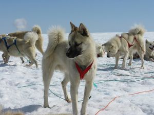
A member of the sled team
It was great, of course––how could it not be? He clucked and hissed and whistled constantly at the fifteen dogs, nicking their paws with the end of a whip for infractions I couldn’t discern. The dogs kicked through the snow, tails up, constantly changing position. The driver spoke no Danish, let along English, so I couldn’t even begin to ask the million questions I wanted to. After about 45 minutes, we stopped abruptly. The dogs immediately started gulping greedily at the snow, the driver stood up to piss, then sat down again and lit a cigarette. I walked around for a while, snapping pictures of the dogs, many of whom were already napping. After 10 minutes, he tossed his cigarette, I quickly hopped on the sled, and we sped off back to the hut. The way back was almost all downhill, the clouds clearing to reveal the icy bay all spread out below. When we got back, he tied the dogs up and hopped on a snowmobile to travel maybe fifty feet to the hut. It was funny––very Greenlandic, really.
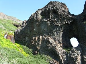
Disko Island’s basalt
The opportunity to dogsled made Qeqertarsuaq unforgettable, but I also really loved the sea cliffs east of town. About an hour’s walk from the center, tracing the coast line, the rolling hills change dramatically, to strange pillars of basalt. Assuming all manner of otherworldly shapes, the cliffs and caves are further enhanced by glacial melt pouring through their porous sides, and wet moss growing around beds of brightly colored wildflowers. The whole maze of rock formations just goes and goes, every turn offering new, incredible views. The whole thing is really beyond description––like the perfect spot for the world’s best game of hide-and-seek.
—
Ilullissat
October 1, 2009
Ilulissat ice
“This is it,” raves the Lonely Planet. “This is why you came to Greenland and spent all that money. Ilulissat is one of those places so spectacular that it just makes everything else pale in comparison.” Well, call me contrarian, but there are a half-dozen towns and settlements I’ll look back on more fondly. Home to a UNESCO world heritage site––the truly awesome Ilulissat Kangerlua (icefjord), choked with towering, glistening, impossibly sized bergs from the most prolific glacier outside of Antarctica–and a smothering tourist industry to match it, Ilulissat is a town where you can drop $100 for two nights of camping and a hiking map; where the Air Greenland-owned “World of Greenland” tourist office sells obscenely expensive excursions and boasts display cases full of artisanal crafts carved from polar bear claws and endangered whale species––with disingenuous signs reminding that these things are illegal to export (as if native Greenlanders are their intended customers).
Trying to capture the ice
The ice is gorgeous; the town stinks a little. I’m sincerely glad that there are benches and wooden walkways––not everything should be wild and mosquito-bitten and miles from any town or road. But there is nowhere in Ilulissat to even get impartial information. Every “tourism office” is furiously peddling something, and people seem dizzy if they’re not buying just the right thing. The Lonely Planet is right-–Ilulissat is unmistakably suffused with a sense that “this is it,” but it’s that very quality that makes it frantic, fraught, and a little depressing. I wandered around for days, snapping photos of the ice, using other people’s enormous cameras to snap photos of them in front of the ice, and after a while I realized that part of the problem is that the photos never do it. Every one is so frustrating because it’s impossible to capture the scale or the colors, and every botched attempt makes it necessary to snap two more, to shell out for a helicopter or a boat that will take you even closer to something so massive and indifferent and impossible to comprehend. Finally, I fought the urge and put my camera away.
Rasmussen’s birthplace
Here are some things that redeemed Ilulissat for me. Knud Rasmussen was born here (speaking of larger than life) and the old vicarage where he was born now houses a museum. There’s a little curtained-off corner where you can linger and watch his 1933 film Palo’s Wedding, and on the creaky top floor are the original drawings he collected from Polar Inuit during his 5th Thule Expedition––the “Danish Ethnographic Expedition to Arctic America.” These drawings are so marvelous–so modest and small and compositionally elegant. They’re like little pencil-scratched depictions of dogsleds and seal hunters atop an Agnes Martin canvas. I loved them, and how they’re displayed in a creaky old attic. They were a wonderful little escape from town.
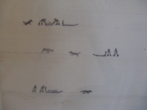
One of the Polar Inuit drawings
On my way out to the airport––a long trudge with a heavy pack––an old man pulled over his pick-up even before I could stick out my thumb. He was headed to the airport to pick up his sister, visiting from Sisimiut. He was bursting with excitement to see her. He had few teeth and spoke almost no English, but we muddled through together. It couldn’t have been more than 3 or 4 km. of driving, but he slowed way down to get his story out. He was a proud Sisimiut booster, raising his fist triumphantly every time he said the word. I asked him why he’d moved away and couldn’t really make straight his answer––his dogs are here and he can’t leave them. Can you take them back? Yes, but no. Do you hunt with them? Used to, but the ice in the bay isn’t what it used to be. Works at the fish processing plant now, but that’s not what it used to be either. Has lived in Ilulissat for twenty years, but it’s not Sisimiut. “Sisimiut!” he said again with a raised fist and a far-off smile. I could tell that he was slowing down to impart this elegaic message––that nothing is any longer what it used to be. But there he was, on the way to the airport to see his sister, bursting with happiness. The two sentiments kept fighting each other to a draw. It was a really nice ride.
—
Aasiaat
September 22, 2009

Aasiaat’s coat of arms
Aasiaat, an island on the southern edge of Disko Bay, means “the spiders” in Greenlandic. The town was taken enough with its name that it developed a coat-of-arms featuring a very graphically appealing spider’s web. Recognizing its appeal, all of the rest of the municipalities in Western Greenland quickly followed suit with their own, equally amazing versions. All that’s left is for someone with silkscreening skills to put them on t-shirts and make them available to buy online. Somebody–please!
vg-qe.gif)
vg_up.gif)
After five days in Kangerlussuaq, I’d almost forgotten what real Greenlandic towns look like. In that sense, Aasiaat was a breath of (foggy, brisk) fresh air. Spread out over a rocky, precipitous island, the community is comprised of boxy, brightly painted houses, and boasts the by-now familiar 1-2 olfactory punch of drying seal ribs and ripe sled dog shit.
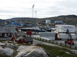
The 18th century Old Town and 21st century harbor
Aasiaat’s colonial old town is small but very beautiful––two cleverly constructed buildings (the first from 1778, the second from 1826) that served as the whaling station commander’s residence and the trading manager’s home, respectively. The museum is equally small but informative––they had some beautiful photographs from Qaanaaq, plus useful information on how the styles of traditional Inuit clothing change as you move farther north. There’s a lot of overlap in the small town museums, but I manage to learn something new and useful at each.
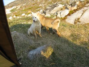
Sled dog pups visit my tent
Aasiaat is small and very cold, and it didn’t take me long to exhaust its offerings. After games of checkers down by the docks and many cups of coffee at the Seaman’s home, I was itching to head north. Falling asleep early in preparation for a dawn ferry ride, I awoke to a loud scratching at my tent. By failing to tuck away the pastry I’d bought for the morning, I managed to arouse the curiosity of a couple of sled dog pups who proved tough to shake. Eventually everything settled down, however, and after a cold night it was onwards up Disko Bay.
—
Kangerlussuaq
September 14, 2009
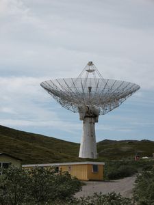
Decaying U.S. Radar Equipment in Kangerlussuaq
After nine days on the trail, Emily and I wasted no time seeking out what the former US airforce base Kangerlussuaq had to offer in terms of R&R. It turns out not much: the artificial “town” exists solely for its runway––because of the facilities the military left behind after the Cold War, it’s now the central transportation hub for all of Western Greenland. There’s practically nothing else to say for it, however; aside for the airport complex (home to a hotel and cafeteria), the town is basically comprised of some blocky barracks, a small market, and a tiny pizza operation. That’s it.
Of course, our first order of business was getting a room and washing more than a week’s worth of dirt off to see the sun damage underneath. After that, sleeping. And after that, hitting the cafeteria breakfast buffet hard. For the rest of the day we napped, snacked, and watched the unpredictable smorgasbord that is Greenlandic TV (I can’t believe I actually saw Dr. T. and the Women).
Not knowing just how long the hike might take, I allowed for 12 days on the trail, plus two on the other end as a cushion before the plane northwards. Because we had hiked relatively quickly, that meant we had five days to burn in Kangerlussuaq––a town with less than nothing to do. Almost as psychologically trying as the hike itself, the subsequent days were spent reading, writing, people-watching, and exchanging war stories with the trekkers who trickled in after us.
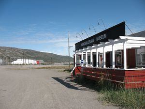
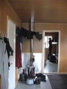
One of the few sites in town
We also sampled everything on offer at the airport cafeteria at least twice, and paid a long visit to Kangerlussuaq’s niche-oriented museum. It’s a treasure trove for anyone interested in Greenlandic plane crashes, the history of SAS airline routes, and Cold War-era radio equipment. Not really my bag, but the curator was charming. He seemed especially impressed that we were younger than 60, and insisted opening a series of “special” exhibits for us. Housed in the old Sondrestrom U.S. Air Force Command, he showed us the general’s old office, which still looked exactly the way it did when he locked up and left for good in the early 1990s. I sensed that the curator had been itching to sit in the executive chair––beneath the mounted musk ox head––for twenty years, but couldn’t quite work up the nerve to do it.
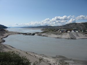
The town viewed from across the river
By the third day, we decided to do the unthinkable––hike again. Greenland’s largest herds of musk oxen call the grassy valleys around Kangerlussuaq home, and we were told that instead of shelling out for a pricey excursion to see them, we might have luck hiking past an ex-US radar facility, where the animals are said to be partial to licking the moss on the far bank of a small salt lake. Well, no dice. The walk was sort of useful as a time killer and a way to get reacquainted with aching muscles, but the wildlife was sadly elusive. When, on the way back to the airport I began to experience phantom limb syndrome from where my pack had rested on my shoulders, I knew it was time to take a break from the walking for a while.
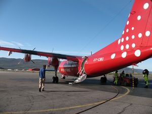
The only way out of town
On our last day in Kangerlussuaq, rumors started to fly about a potential Air Greenland strike––the second potentially disruptive transportation strike of the trip. We even saw a plane whose detailing had been defaced to read “Air Gree____d.” Fortunately, we made it out in the end, aboard an otherwise empty twin otter flight to Aasiaat. While taxiing, the flight attendant told me that the cloud cover was so heavy that the pilot had nearly been forced to turn around and head back to Kangerlussuaq. I’m really glad she waited until our arrival to let me know.
—
Arctic Circle Trail, Part II
September 8, 2009 at 1:47 pm
Day 4 to N67º03 x W52º38
Drying out at one of the huts
We got rained on only once, but it was a killer––ten hours of downpour, observed restlessly from the tent, before deciding we couldn’t bear to wait it out. We spent a while strategizing how to cook breakfast and break down our camp most dryly and efficiently, but of course we were soaked through upon departure. Fortunately, the hut we hoped to make by evening was upon us by mid-afternoon, but the last hundred yards involved a rushing river crossing that had me going face-first into the water. In the end, the hut made everything better––a Greenlandic family was already hunkered down, the kerosene stove roaring. They kindly cleared space on the clothesline and pretended not to be grossed out while I bandaged the foot I’d sliced up on the sharp rocks from the river. We learned later that the mother was a superstar athlete––an annual competitor in Greenland’s grueling Arctic Circle X-C ski race––and felt a bit sheepish about our drenched and sorry state. We ended up staying all afternoon and evening, reading Tolstoy, drinking whiskey, and eating chocolate.
Day 5 to N66º59 x W52º21
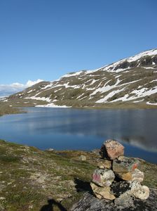
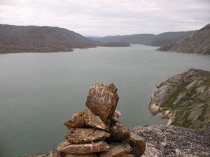
One of the last cairns we’d see on Day 5
On this afternoon we missed a cairn and climbed steeply up a hunting trail, surprising a mother duck who did an elaborate pantomime of wounded flight to distract us from her vulnerable ducklings. Realizing our wayfinding mistake, but refusing to go all the way down again only to climb the ridge elsewhere, we decided to plunge ahead with the map as our guide, following a river and then a shoreline with the intention of meeting up with the trail again by evening. It was sort of an unwise improvisation, but it paid off in one of my favorite moments of the hike. Bushwhacking through dwarf willow, swatting helplessly at bugs, I thought I spotted a cairn very high on a ridge. It was too soon to be the trail, but we climbed up to it anyway, discovering that it was much longer and lower than the other piles of rock. Gazing out at an incredible view––the lake spread out towards the horizon, birds diving from the edge of the rocky bluff––I realized that it was a grave. The National Museum in Nuuk had mentioned how, for centuries, the Inuit buried their dead under stones, and always at the mouths of rivers or overlooking large bays. This fit that description exactly, and although I would see a number of such graves in the weeks after, none was as haunting––or with a view as breathtaking––as this one.
Day 7 to N66º55 x W51º31
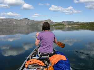
Paddling on Day 7
There is one leg of the hike where you can cheat magnificently. There are eight or so canoes on one of the long glacial lakes that the Arctic Circle Trail traces for a good 15 miles. Because everyone for some reason hikes the trail going the other way, the boats tend to pile up at the west end of the lake. We hit this point on Day 7––shoulders and calves screaming, sick of walking, desperate for any other possible mode of transport. Seeing the aluminum canoes shining from atop a ridge was great, but the paddling itself was even better. We stowed our bags between the gunwales an slipped into the glassy water. For part of the afternoon the surface was so still that the reflection of mountains and clouds was eerily exact––it was so impossible to tell up from down that it felt like we were paddling through the sky. We camped on an isolated spit on the far end of the lake and listened to the loons call back and forth all evening.
—
Arctic Circle Trail, Part I
September 4, 2009 at 9:26 pm
Four days from anywhere on the Arctic Circle Trail
The 100-mile trek between Sisimiut and Kangerlussuaq is variously described as a “backpacking classic” and “one of the great walks of the world.” I’m a sucker for just that sort of thing, and decided early that the hike would be central to my proposal. In the past, I’ve found that after three or four days of continuous walking my feet and mind slip into strange and productive new rhythms, difficult to otherwise replicate. And because my project is in some sense about an altered state––an epistemological crisis, an imagined obstruction of ice and rock that occurs only after many weeks at sea––it seemed somehow important to enact my protagonist’s voyage in miniature. Plus, in less lofty terms, a 100-mile walk across wild Greenland just seemed ridiculously romantic to me. I mean, right?
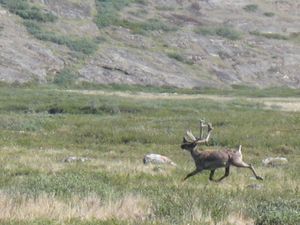
A reindeer blazes a false path
Well of course it’s one thing to like the sound of something and another to be doing it––day in and day out. Emily, my companion for the trek, and I have done multi-day hikes before, but by the end of just the first leg it was clear that this was something beyond what either of us was used to. In Greenlandic terms, the route is enormously popular (most days we’d encounter one or sometimes two parties, almost always going the other way). Even so, the trail itself is often just a rumor; cairns are clustered together in some places and altogether absent in others. Making this much harder is the fact that the route is crisscrossed with misleading reindeer paths. We often found ourselves moving briskly away from a cairn before noticing heaps of scat, and a path quickly narrowing into untrodden marshland.
The terrain at 66º North
The terrain this far north––just above the Arctic Circle––has some definite pros and cons. For one, there aren’t any trees, which makes contour map-reading terrifically easy. On the flip side, the walking isn’t quite a stroll through a rolling meadow; much of the low-elevation hiking is through boggy swamps with beautiful but challenging mounds of moss and grass. These hillocks are spaced about a stride apart, and covered over so that you can’t see the ankle-cracking crevasses between them. Even apart from these traps, the surface is spongy and absorbent to such a degree that it feels like walking through knee-high snow . I read somewhere that it’s like “walking on basketballs,” and that totally nails it.
A rare moment free of the headnet
I wasn’t accustomed to multiple river fordings per day, mosquitos so persistent that headnets were an absolute must, or having many days between latrines (there are huts, but they’re irregularly spaced, and only two in 100 miles have bag toilets). So, it was a little rough out there, but we made it out okay––9 days of walking, 100.2 miles on the GPS odometer, plugging away with 50 lbs. (minus our diminishing food) more or less on each of our backs. We’re pretty proud it’s behind us, and have decided that the only way we’ll ever do it again is via the 3-day winter dogsledding option.
Because no one wants to read a minute-by-minute (or even a day-by-day) account of a 9-day, 100-mile hike, I figured I would pick out three highlights––the best moments of an epic walk. I’ll post those next.
—
Climbing aboard the “Marie”
The Arctic Umiaq Line (AUL) is Greenland’s only long-distance passenger ferry, so I was expecting something a bit bigger––leaving the harbor of the capital city, mind––than theMarie Martek. Alas, the Mariewas what I got––smaller than a fishing boat, with seating for twelve, though the only other passenger between Nuuk and Maniitsoq was a homesick pre-teen with a tub of Haribo. The captain was gruff and heavyset, and seemed not to want the first mate to ever take the wheel. When he had to use the head, he would jog to the back and the controls would be unmanned for as long as he was gone. The first mate was scruffy and spindly, and smelled of wet cigars. He moved from the Faroe Islands to Sisimiut 35 years ago, and when I mentioned that his country was beautiful, he raised an eyebrow in surprise. “There are no trees,” he pointed out.
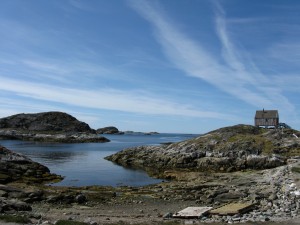
Fishing village between Nuuk and Maniitsoq
The ride really was gorgeous, though––miles and miles of snow-smothered mountains as we maneuvered through the maze of fjords. We stopped along the way at remote fishing villages, sometimes to pick up a passenger, sometimes to drop off a bag of mail. They were like something out of time––dirt paths winding between boxy, brightly painted homes, men sharing coffee on the decks of rusting fishing boats with harpoon guns mounted to the prow, markets selling frozen musk ox, digestive crackers, and long-range hunting rifles. At one of the villages, I climbed the rocks in back of town to get a view of the harbor and ate lunch while watching whales blow jets of water toward the distant horizon.
It took a full day to get to Maniitsoq, and by the time I arrived most everything was closed. A patch of grass between the sweet little town library and the rows of white crosses comprising the cemetery seemed the best place to pitch a tent. Very early the next morning I awoke to a whistling, chattering procession of voices: fishermen, or perhaps ghosts from the Maniitsoq cemetery? I never found out, but the timing was fortuitous because the sweetMarie was pulling out early for Sisimiut.
—
Nuuk
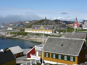
Nuuk’s historic old town
I began my journey in Nuuk, Greenland’s capital and––with 17,000 residents––by far its biggest city. My first impression was that it was warm––warmer, anyway, than I had feared––and after locating my bag (there were only about twenty of us on the twin-propeller plane from Reykjavik) I hiked down the hill from the airport to a rocky patch of grass along the Labrador Sea, where wild camping seemed possible. With a traditional turf hut built into the hillside on one side of my tent and a view of the craggy Sermitisiaq mountain across the water on the other, it all seemed pretty idyllic. But I learned the hard way that weather changes quickly in Greenland––so much so that long underwear, fleece, a wool hat and gloves aren’t always going to cut it inside a sleeping bag. The next morning I packed up quickly and found a warm bed inside the Godthåbshallen––a cavernous youth sports complex overlooking a graffiti-covered skate park. The “hostel” is really a bunk room that accommodates visiting sports teams. Thankfully, no matches were scheduled during my visit.
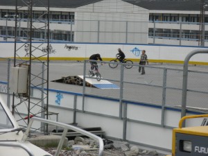
View from the Godthåbshallen
Nuuk was founded in 1728 by a Danish missionary whose effigy looms large over the picturesque old quarter of the town. It only really boomed in the 1950s, when Denmark made an effort to modernize the country by erecting enormous concrete housing blocks, which are now in a pretty sorry state. The contrast between the quaint historical center––where it’s still possible to see families walking on Sunday in traditional embroidered sweaters, white kamik boots, and sealskin pants––and the looming, paint-peeled housing projects is pretty stark. It’s a tension that’s apparent all over town, from the austere cemetery with naked white crosses that sits next to a fast food restaurant, to the apartment buildings where reindeer antlers hang beside TV antennas.
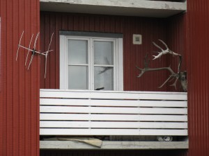
Old and new in Nuuk
For me, the twin highlights of Nuuk were the Katuaq Cultural Center and the National Museum. The former––a sleek, modern building that curves along the street like a wood and glass wave––accessibly blends modern Danish design with a more traditional Greenlandic aesthetic. The successful commingling transcends the architecture, too––the coffeeshop is a warm and welcoming place to readPolitiken or gather large families for lunch. In a town where national/colonial tensions are sometimes palpable, Katuaq felt–to an outsider, anyway––like a space that defused some of that.

Protest outside Katuaq Cultural Center
The other real highlight is the small but bountiful National Museum, which was full of artifacts and displays that are going to be useful for my project (I lingered for hours taking notes). The highlight, featured some time ago on a National Geographic cover, are the Qilakitsoq mummies, a group of eerily well preserved 15th-century Inuit, wrapped in furs. But there are many other fascinating relics, covering everything from Pre-Dorset cultures to 18th-century whaling to the post-1950s period of modernization.
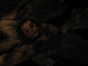
One of the Qllakitsoq mummies
Rumors of a strike down by the docks left me uncertain just where my ferry would leave from, and I spent my last morning racing between harbors. I successfully found the tiny boat, though, and headed north to Maniitsoq.
—

Nathan Hogan
I’m greatly looking forward to exploring the western coast of Greenland for seven weeks this summer. Since January, I’ve been at work on a historical novel about 19th century British Royal Navy Captain John Ross, and I’m hoping to get a fuller sense of what he experienced on his 1818 voyage in search of the Northwest Passage. I’m particularly excited to visit the National Museum in Nuuk, see the Kangerlua glacier at Ilulissat, go summer dogsledding on Disko Island, and complete the 112-mile backpacking route that connects Sisimiut and Kangerlussuaq.
—