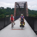
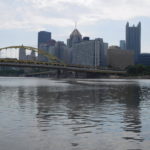
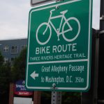
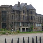
Final Thoughts on Pedaling Across the USA

I made it to Washington D.C. after 43 days, or about six weeks, on the road.  I pedaled approximately 3,000 miles in 38 days of biking and took 5 days off.  In the typical day of pedaling I covered about 80 miles.  I over-estimated my own abilities.  Before starting I expected the trip would take five weeks and when pedaling I would cover 100 miles a day on average.

During the six weeks I ate a lot of hamburgers.  My guess is that a burger was dinner about 20 times not counting the meals I had steak for variety. I drank gallons of Gatorade, but almost no beer or wine.  I stopped drinking alcohol a few days into the trip.  I found you cannot push your body to the limit each day and then toss down beers at night.  I did lose a bit of weight.  However, it was only six pounds.  At the end of an exhausting day the last thing I wanted to do was count calories.

What were the lessons I took away from the trip?  For those of you contemplating a long bike ride, pedal with someone.  Don’t pedal alone.  I had much more fun pedaling with my son from Ann Arbor, Michigan to Pittsburgh, Pennsylvania, pedaling with Beau in Wisconsin and pedaling with Greg from Pittsburgh to Washington D.C. than the days I spent by myself.  If you do decide to pedal alone, make sure you have amazing support.  My wife was phenomenal from cheering me up to getting me on a ferry boat that had already sold out all their tickets.

What other lessons did I learn?  I don’t want to sound trite but if you ask for help people across the USA in general will go out of their way for you.  After slashing and warping my rear wheel in Spokane, I was rescued by Roger and his pickup truck.  Then my bike was fixed only a few hours later by Randy.  When my son’s hydraulic bike brakes locked shut, bike shop Brad took care of us instantly and even told us where to get lunch.  When I was stranded and needed to travel down a few exits on the Interstate to get back on local roads there almost always was someone willing to give me a lift.

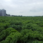
I also came away with a deep appreciation for the amazing productive capacity of the USA.  I spent weeks staring at giant fields of wheat, corn, soy beans and even kale.  I was passed by freight trains loaded with coal, oil, natural gas and other products that stretched almost forever.  While forever is an exaggeration, some of the trains were so long they needed four giant locomotive engines to pull all the cars.  I passed factories in the Midwest that were mind-boggling large.
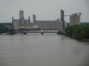
Grain silos in Toldeo

Not all was good.  I also came away with a realization that most of this country is empty of people.  In numerous places you could see that many people once lived there, but not anymore.  The eastern sides of the Cascades and the Rockies were both depressing to pedal through.  Towns are slowly dying as fewer people are needed in rural areas to run the farms and ranches.  The slow death spiral is disheartening as I pedaled through countless places that were once thriving, but today only have a post office that politicians are loath to shut down.

It was also clear that unemployment today is low, but income is definitely not high.  I pedaled past countless homes that were being lived in that needed repairs.  I was passed by numerous cars and trucks that were falling apart.  Low income and little choice in food seemed highly related.  I ate a lot of hamburgers, not because I love burgers but because many towns had little to no other choices for food.

I also noticed a huge concern over safety, security and personal property.  The most common sign I saw while pedaling was not “Stop” or even “Yield.”  Instead, it was “No Trespassing.”  Most of the signs were similar and looked like they were mass produced on only a couple of different assembly lines.  However, more than a few were unique, and every unique sign said roughly the same thing; “Trespassers will be shot.”
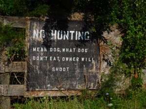
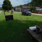
Stay off my land

More than half the people I talked to on the trip warned me there were lots of “crazy people out there” and I needed to be careful.  I did meet a few crazies, but everyone was harmless and more eccentric than dangerous.  For example, in Ohio it took a while to extricate myself from a man who wanted to tell me every detail about the electric trains that used to run on the path I was about to pedal.

While many of you accept that TSA will scan your body at the airport and check your luggage, I was amazed that a large TSA team showed up to paw through my and all the other passengers’ luggage before taking a 4-hour ferry ride across Lake Michigan.

In closing I want to thank everyone who helped me out.  Many of you did small things that helped a great deal.  For example, Caleb in Montana suggested a hotel about 60 miles down the road.  This suggestion probably didn’t seem like much, but it prevented me from attempting an exceptionally long bike ride in blistering heat that might have ended badly.  I also want to thank those of you who sent public and private encouragements.  The messages of support meant a lot and helped keep me going.

Where and when is the next trip?  I don’t know yet since I have only been off the bike for a few hours and it will take some time to heal my saddle sores.  Wherever and whenever it is, I am sure it will be interesting since there are so many fascinating places, people and pursuits to see and try in the world.
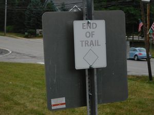
End of this trail but the beginning of the next adventure

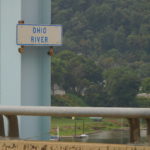
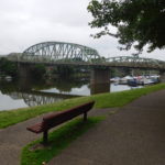
Day 43: Williamsport to Washington D.C.

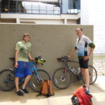
The final day.  All I need to do is pedal about 90 miles and I will have crossed the continental USA by bicycle for the second time.  Greg, who I met outside of Pittsburgh, is with me and also interested in making it to D.C. by Friday night.  We met for breakfast in the Waffle House, which was beside the motel and had some eggs, toast and juice.  We set off pedaling about 8:15 AM.

The first 10 miles were paved and went through scenic Western Maryland countryside.  Then at the top of a hill, Greg pulled over and said he had a problem.  He had broken a rear spoke.  Spokes are a tough item to fix on the side of the road.  It was even tougher than usual to fix since neither Greg nor I were carrying any spare spokes.  Searching the Internet showed no bike shops close to us, so we carried on and Greg rode on a broken rear wheel all the way to Washington.

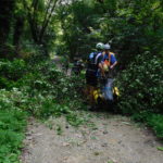
About 20 miles into the ride the instructions told us to get back on the C&O Canal bike path.  The bike path started out drier than yesterday but soon started having big problems.  We had to cross over a large tree that had fallen across the trail.  We had to cross three different places where the trail had been washed away by floods.  In two of the washed out places the park service had created temporary detours or bridges.

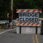
In the third place the park service had given up, closed the trail and expected cyclists to take a long detour that included sections of a highway and a very large climb.  In the west when I came to a road closed or detour sign I had to guess if it was possible to get through.  In the east it was much easier because there were at least a dozen cyclists coming from the other direction who offered advice.

The consensus view of the west-bound cyclists was that we didn’t need to take the highway detour.  It was possible to push our bikes up a short hill, jog or run along a set of railroad tracks for about 200 feet and then slide down a hill to rejoin the trail on the other side of the washed-out bridge.

Reading this previous paragraph now, which is hours after the day is over, suggests this should be no big deal.  However, it was a lot of effort to get up to the railroad tracks and down the other side, not to mention my concern about being hit by a train while on the tracks, even if it was for only a couple of minutes.  We managed it all safely and the only lasting problem was a profusion of mosquito bites from the swarms that attacked us during the mini-adventure.  The mosquitoes even got under my clothes and I have a large series of bites on my arms, neck and head.

For the next 50 miles the trail was at various points muddy, slippery, rocky, very narrow and for a few miles had branches which kept smacking me in the face.

It all didn’t matter because the mile markers were counting down to zero, which was Washington D.C.  I could feel the end.

Around 4 PM we made it to the Potomac River falls.  Just after the falls Google Maps told me that we needed to get off the C&O Canal and take the “Billy Goat Trail.”  The name seemed quite suspicious.

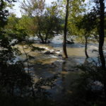
Luckily, near the falls a park service ranger walked by while Greg was in the restroom.  I asked her if the Billy Goat Trail was suitable for bikes.  She told me that the trail was something people did by scrambling and jumping from rock to rock and that our bikes would not make it.  She told us to stay on the canal path, but to make sure we took a small detour that allowed us to stop and see the falls.  It was great advice.  The falls were spectacular, and I would have missed the best part of the day if I had just kept pedaling.

I left Greg just after we crossed the Beltway into Greater Washington.  His brother met us in a parking lot just off MacArthur Avenue.  It was now 6 pm and I had one hour to get myself across town for an interview with a National Public Radio reporter at Union Station before boarding an Amtrak train for home.

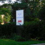
I texted the reporter that I had crossed the Beltway.  I pedaled more and stopped and took a picture of the “Welcome to Washington, D.C.” sign.  No one was there to see it but the smile on my face stretched from ear to ear.

Two blocks after taking the welcome sign’s picture, Google Maps told me to get off MacArthur and onto a bike trail.  The trail turned out to be a two-foot wide dirt path that led down a steep cliff.  I turned around and pedaled back to MacArthur and kept heading towards downtown.  This was a small mistake because Google was furiously updating my screen and trying to both explain where I was going wrong and how I could “fix” it.  I made it Georgetown at 6:30 PM.  Thirty minutes to go before the interview.

For weeks I had been picturing myself and the bike being photographed at the Lincoln Memorial at the end of the trip.  I had half an hour to get to the Memorial and then to Union Station.  I texted the reporter that I was in Georgetown.  The message went out and then the phone’s battery died.  I don’t know if the furious updating killed the battery, but it certainly did not help.

I now had two small dilemmas.  First, I didn’t know exactly how to get to the Lincoln Memorial.  I had a rough idea, but rough ideas don’t cut it when you are short on time.  Second, I now had no way to contact the reporter.  I didn’t know what he looked like or where he would be located at Union Station.

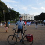
Solving the first problem was easy.  I didn’t go to the Memorial.  Instead, I pedaled down Pennsylvania Avenue and got a quick shot of me, the bike and the White House.  Then I asked several other cyclists pedaling down the street for directions to the train station.  I had been to Union Station a number of times in the past, but I had always taken the Metro and been below ground on the subway.

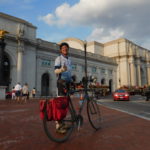
Around 7 PM I pedaled up to Union Station and asked a tourist to take a photo of me and the building.  The second problem, contacting the reporter, resolved itself.  The reporter was standing outside the building and was looking for me.  I guess there were not that many cyclists covered in mud who were out pedaling that evening.

We had a wonderful interview sitting in a quiet wing of the station.  We talked about economics, the trip and traveling in general.  I don’t know if what I said makes for a good radio show, but both the reporter and I were pleased by the conversation.

I had a quick bite to eat and then caught the 10 PM train to Boston.  The train is not fast since it took over 10 hours to get to Boston but Amtrak was happy to take my muddy bike unboxed all the way home for just $20.

Day 42: Cumberland to Williamsport, Maryland

I just wanted to give up this morning and go home.  This might sound strange given how close I am to the end.

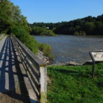
I was biking alongside the Potomac River.  The mileage markers started at 188 and were counting down to zero.  Zero is Washington D.C.'s Georgetown neighborhood.  I have pedaled a huge distance in the last 41 days and the only thought that went through my head over and over was stop, go back to where you started this morning in Cumberland, get on the train to D.C. and stop all this.

Why was the little voice saying give up?  Because the C&O Canal trail was very difficult.  This past weekend it rained heavily in this part of Maryland.  The Weather Channel on Saturday ran one story over and over about a town in Maryland, not far from here, where they were thinking of evacuating because so much rain had fallen the town's dam was in danger of bursting.  Since the weekend even more rain has fallen, including a few hours of heavy rain last night.

One hundred miles back I met a man called Jan, who was a real character.  You occasionally meet people on the road who pedal a little and talk a lot.  That was Jan.  He was coming back from attempting the Pittsburgh to Washington route.

He had done it five times in the past but said it was too tough this year.  He also said someone he met had turned back because the water was up to the bike's bottom bracket, which is where the pedals connect to the frame.  Jan was an old guy and clearly a story teller so I didn't believe it.  I do now.  I went through at least one puddle that was so deep my bottom bracket was in the water and quite a few other very deep puddles.

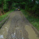
Why was the path in such bad shape?  Part was due to the rain.  But another part is that the C&O Canal Bike Path is maintained by the National Park Service.  The Park Service is a wonderful, but woefully underfunded organization.  One result of the under-funding is that my miles today were in conditions designed for mountain bikers, even though there wasn't a hill or mountain on the trail.   Unfortunately, I wasn't riding a mountain bike.

What was it like to ride?  It was muddy, slippery and tree roots crossed the road.  Around 10:30 AM I used a spoon to scrape the mud off my chain, frame and brakes.  The storms also had dropped trees across the trail.  We met up with a three man crew cleaning up downed trees and limbs, twice during the morning.

Plus, to add extra misery you could not stop.  The C&O Canal is a giant stagnant pool of water that breeds mosquitoes.  Stopping resulted in large numbers coming over to feast on my body.

The result was that I didn't pedal down the trail.  Instead, I lurched, slid, bounced and prayed that I wouldn't crash for 50 miles.  At the 50 mile mark the state of Maryland had pity on the bikers who pedal down the C&O Canal Trail.  The state has built a 23 miles long paved bike trail.  It is literally 100 feet away from the C&O trail but because the state built it, the trail is maintained and in very good shape.

After 23 wonderfully easy miles, Maryland's trail ended and we switched back to the C&O.  Luckily, for me and Greg who is still pedaling with me the last 18 miles on the C&O were much less muddy.  Part of this was due to the sun baking off the water all day.  Part seemed to be that this section of the trail was in slightly better shape.  Whatever the reason, after 89 miles I made it to the hotel I booked in Williamsport, Maryland.  My bike, gear and I were so muddy the hotel owner told me not to bring the bike or bags into the hotel's lobby.  Luckily, he let me come in so that I could check into the room and pay.

Tomorrow there is just 90 miles left to pedal in the whole trip.  Most of it is back on the C&O Canal path.  It does not look like an easy ride, but to give up on the last day is foolishness.  My guess is that adrenaline will ensure I make all the way to Washington D.C.

Day 41: Connellsville, PA to Cumberland, Maryland

I write this entry from the state of Maryland.  This might be my last state.  Tomorrow I pedal along the Maryland-West Virginia border and it is hard to see on the map if I need to cross over to the West Virginia side of the border.  If I don't cross the Potomac River, then the last border remaining is Washington D.C's!

The goal  right now is very simple.  Pedal 90 miles tomorrow, which is Thursday.  Pedal 90 miles on Friday and then get on an evening Amtrak train back to Boston.  The evening train is the only one on the schedule that will take my bike home, without the bike being in a box.

The small problem is that these last 180 miles are mainly along side the C&0 Canal.  The Canal area this past weekend was flooded by torrential rains.  I talked to some people who tried to pedal along the Canal two days ago and they gave up because the mud was too deep.  Hopefully, by tomorrow the ground will have dried out enough for me to make it through.  I really don't want another experience like the one I had outside of Fargo, North Dakota, where the mud made the road impassable for bikes.

The end of the today's ride showed me the problems caused by this past weekend's torrential rain.  The first 70 miles of today's ride was a gentle up-hill.  That is not a misprint.  I pedaled up a slight grade from 8 AM until about 5:30 PM.  At 5:30 PM I reached the Eastern Continental divide, which is where water either goes into the Atlantic or the Gulf of Mexico.

From the Continental Divide to the hotel in Cumberland, Maryland it was a gentle 20 mile downhill.  Unfortunately, part of the path was washed away by the rain and someone did temporary repairs by tossing loads of fine rock and gravel on the path without packing it down.  This led to lots of spots where I almost had the bike slide out from under me.  Luckily, I was able to stay upright each time and made it to the hotel without crashing.

The downhill ride was also interesting since it crossed the Mason-Dixon line, which demarcated free and slave states before the Civil War. The people who built the trail created a solid line in the ground so that you knew exactly where the line stood.

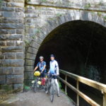
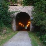
The trail also had a number of railroad tunnels for pedaling through.  Five years ago the tunnels had no lights.  This time the tunnels all were lit.  It was much safer today, but less of an adventure when it is possible to see where you are going.

On a different topic, while on the trip I have done a number of interviews about various topics. For example Bloomberg News did a story on “Successfully managing a financial windfall" and the Spanish language newspaper El Pais asked me questions about the economic problems associated with divorce.  Just before typing the blog I did an email interview about when consumers should or should not buy an extended warranty.

The most interesting request so far is an email from a reporter at "The Pulse", a health and science show from the public radio station WHYY in Philadelphia. He wants to interview me as I ride into Washington D.C. for an upcoming episode. The theme of the show is "in the name of science" and it is about the lengths that researchers go to for work or academic field. I don't know if it will happen, but it certainly sounds intriguing.

Day 40: Pittsburgh to Connellsville, PA

Today was one of the easiest days of bike trip.  I did 80 miles primarily on bike trails.  It was very easy for a couple of reasons.  First, I had pedaled much of today's route five years ago.  Knowing where you are going and what is coming up makes anything easier, including biking.  Second, I only pedaled 10 miles yesterday so even though I drove over 600 miles yesterday my legs felt fresh.

During much of the morning I thought about possessions.  In economics there is a unstated assumption that "more is better."  For example, all politicians around the world want to boost their countries GDP.  Boosting GDP means more stuff for all the people.

For the last five weeks I have  existed with very few possessions.  For example, I have three pairs of socks with me and I contemplated taking just two pairs to keep down the weight.  When I went home for the weekend I walked into a house full of possessions.

When I was home I spent a couple of minutes staring at the top of my dresser.  Before leaving on the trip I purchased a half-dozen pair of socks.  I had not even opened the packaging.  They were still sitting there on the dresser in a large pile, clean and unopened.  Just below the brand new socks was a large pile of a dozen clean but slightly used socks.  I wondered did I really need 18 pairs of socks?

By the end of pedaling this morning I began to realize how few possessions I really need to survive and have begun to question one of the key underlying assumptions in economics.  I don't know if this realization will change my buying habits or my lectures in the future, but it might.  In the short term I definitely will not be buying more socks.

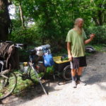
In the afternoon I met up with another long distance bicyclist named Greg from Colorado.  He had been pedaling since mid-June and is also going to Washington D.C.  on the bike trail.  We are splitting a hotel room tonight.  It is always interesting to have someone new to talk with about their life's experiences and makes the pedaling less lonely.

Tomorrow it is expected to rain.  It rained on the trail this afternoon before I got there.  The trail partly turned to mud and my clothes and bike are covered.  Oh, well.  In a few days I will be home and no longer have to worry about mud and rain.  Instead, I can spend my time contemplating what to do with my large pile of clean socks.

Days 37 to 39: The “Rest” Days

From Friday afternoon August 3rd to Monday afternoon August 6th I took a couple of "rest" days.   Rest is in quotes because I needed to be back in Boston on Sunday August 5th and the drive each way from Pittsburgh's Airport to Boston was almost 12 hours long.  Twenty four hours of driving covering 1,200 miles in three days is not really a rest.

On the way to Boston I had my son help do the driving.  He did about two-thirds.  On the way back to Pittsburgh I did the entire drive alone.  Going to Boston it rained very heavily while we were driving through the Pocono Mountains.  In the Poconos the rain came down so hard cars put on their four-way flashers and drove around 45 mph on the highway instead of the usual 65 to 70 mph.

The weather was fine going back to Pittsburgh, but there were quite a few road construction crews out.  Numerous parts of the highways were being fixed and this slowed traffic in parts to a crawl.

I arrived home Saturday morning at 2 AM, which meant I did not pedal for two days!  Not much happened during Saturday.  I spent most of the time sleeping, eating and doing laundry.  Laundry was the key activity since my clothes were so filthy they were starting to bother even me.  It is a shame the weather forecast for Tuesday is rain, which will just get my clothes filthy all over again.

I made it back to the Pittsburgh Airport about 7 pm on Monday afternoon.  I reassembled my bike in the rental car return lot and started pedaling again.  I didn't do a lot of miles late Monday.  I only managed about 10 miles.  However, it felt good to be back on the bike and getting a bit closer to Washington D.C.

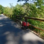
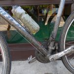
For those of you who are looking at the photos on this page, you will notice I swapped bikes while in Boston.  I left the new road bike at home and am riding an older bike that does better on gravel and dirt.  The older bike's tires are wider (37 cm) than the new bike's tires (just 32 cm).   Plus, the older bike is not as fragile, so it is easier to ship home from Washington.

Tomorrow is an exciting day!  I start the final push to the USA's capital.

Day 36: Pittsburgh, PA (Aug. 3, 2018)

A number of years ago I went with my family to Beijing. I had heard that traffic in that part of China was terrible and the best strategy was to use the subway system instead of taxis. I looked carefully at maps and picked a hotel a few blocks from a subway station.

When we left the hotel the first day to look for the subway station we could not find it. We walked for what seemed like miles in various directions but no subway was found. Finally, we found a policeman and one of my sons took the map over to him and asked in Mandarin where the station was located. The policeman laughed a lot and said that station was not yet built. It was just a proposal. The map showed where the station will be.

I thought a lot about that story today. Last night we stayed in a hotel in Beaver Falls which is on the outer edge of Greater Pittsburgh. Our goal was the Pittsburgh Airport, just 30 miles of pedaling away. Google Maps wanted to send us down route 51, which for many miles was a divided highway, two lanes in both directions, with no shoulder. Not the type of road I really wanted to pedal down.

Looking at the map closely showed a bike trail running parallel between the highway and the river. I was a bit surprised that the mapping program did not put us on the trail, but after all the errors and problems I have encountered with the mapping program I was not overly concerned.

We left the hotel and pedaled over a number of bridges until we reached the start of the bike trail. There was a large "no trespassing" sign. In Montana one of the signs suggested trespassers would be shot. In Pennsylvania the sign said trespassers would be prosecuted to the full extent of the law. I am not willing to be shot at but arguing in front of a judge doesn't concern me as much. We started pedaling down the road.

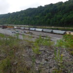
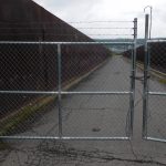
To make a long story and pedal short, the bike path was a proposed bike path. We pedaled a number of miles of rough gravel through rail yards, by coal dumps, beside junk yards and decrepit industrial sites. Then, near the county jail the way seemed blocked with real fences and more serious security. There was "luckily" a bridge that seemed to connect the rail yard we were in with the highway we didn't want to be on. My son pedaled on ahead to look at the bridge. He came back with a good news-bad news story. The good news was the bridge went where we wanted to go. We didn't have to retrace our steps. The bad news was the bridge had a locked gate at the end and part of the gate was topped with barbed wire.

For a brief time we stopped being bicyclists and switched to being climbers. Luckily, there were two of us. I don't know how I would have gotten the bike over the fence if there wasn't someone on the other side. Once we were safely over the fence we pedaled about two miles down the highway. At the end of the highway there was a small sign that stated the highway was part of Pennsylvania Bike Route A. If that was their "A" route, I really don't want to pedal the state's B or C routes.

We made it to the Pittsburgh Airport about 2 pm. There were other adventures, like pedaling through a road paving crew, sliding around on a brick road that had been laid down over 100 years ago and pedaling on the airport roads but these were relatively minor compared to the proposed bike path.

We went to the Pittsburgh Airport because this weekend my family is having a big affair and my son needs to go back to work.  We will drive from Pittsburgh in a rent-a-car back to Boston and spend two days at home.

Then I will drive back to Pittsburgh alone and start pedaling again either Monday afternoon or Tuesday morning. Yes, it is about 1,200 miles of driving to go with all my pedaling. The two days at home will be "rest days." I don't know how much rest I will get, but at least there will get a chance to do laundry before pedaling the last 400 miles.

Day 35: Cuyahoga Falls, Ohio to Beaver Falls, Pennsylvania

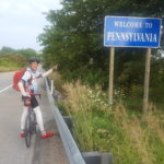
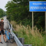
Wow, I made it to another state! Tonight I am in Pennsylvania.  This means there is only West Virginia and Maryland left.  Once I pedal about 400 more miles I am done going from coast-to-coast.

Today,  my son and I pedaled about 80 miles.  It was a hard but relatively uneventful day.  To give you a sense of where we are, today's ride took us through the north east corner of Ohio.  We went through Kent, Ohio, which is where Kent State is located.

The day was hard for three reasons.  First, we spent a lot of time on gravel or very rutted roads.  The roads were not in as poor a shape as Michigan's, but they were in bad shape  My left hand and wrist were bounced and jarred a lot.  During one part of the afternoon I could not use my left hand to brake or shift because it hurt so much.  Luckily, shifters and brakes are on both sides of the handlebars so I didn't have to stop riding.

The second reason the day was hard was due to the day ending with a very long and steep climb.  After biking all day the last thing I wanted to see was a giant hill.  Google Maps counts down how long to your destination.  The count down timer is not very good.  It just assumes you are pedaling at 12 mph.   I was stuck at 18 minutes to go before reaching the motel for what seemed like forever since I was not pedaling up the giant hill at anywhere near 12 mph.

Third, we got rained on.  After we ate lunch a large black cloud filled just part of the sky.  I was not very worried because I could see blue sky around all parts of the cloud.  The cloud soaked us and then moved on.  Unfortunately, the cloud was moving slowly and in the same direction we were pedaling.  We quickly caught up to the cloud and got soaked a second time.  We decided to outrun the cloud so that we didn't get soaked a third time but getting really wet twice was not a lot of fun.

The problems of pedaling all disappeared from my mind after a warm shower and a great meal at "Sal's" in Beaver Creek.  I look forward to tomorrow and its new adventures.

Day 34: Norwalk, Ohio to Cuyahoga Falls (Aug. 1, 2018)

A few days ago I checked into a hotel in Ann Arbor, Michigan.  The desk clerk smiled and asked how far I had traveled.  I said over 2,00 miles from Seattle, Washington.  His reply was  similar to one I had heard from several other people.  He said the trip sounded fascinating but if he tried doing it he would have stopped after about a dozen miles and given up.

To be honest the thought of giving up crossed my mind a couple of times this trip, especially around Missoula, Montana when my legs were like jello.  What prevented me from giving up was you.

I learned from behavioral economics that one simple method of accomplishing a major task is to make a public commitment with verification.  The major task doesn't have to be cycling across the country.  It can be as simple as losing ten or twenty pounds of weight.

How did you prevent me from giving up?  I made a public commitment by creating this blog.  Forcing myself each night to write about the trip ensures each day I remember that a lot of people were told I was going to complete the trip.  Dropping out in the Rocky Mountain would mean publicly admitting defeat to a large audience.  If I didn't have the blog then quitting would have been relatively easy since no one would have known.

Verification is important, too.  On the side of the blog is a widget or box that contains information from Strava.  Strava is an app on my phone that every 30 seconds tracks where I am.  Strava uses this to calculate my speed, distance and height climbed.  By keeping Strava on all the time I cannot cheat and call Uber, Lyft or a taxi without a reader noticing.

What is the takeaway?  If you want to do something relatively large then what you need to do is first make a public commitment.  It doesn't have to be a blog.  Any kind of public commitment works.  Getting up during a family dinner and telling everyone your plan is just as good as tweeting to the entire world.
Then you also need to follow through by ensuring there is some way for people to monitor or watch what you are doing.  For example there is a television show that tracks obese people trying to lose weight.  They periodically bring contestants in to be weighed.  That is an example of monitoring.
Looking at the above paragraphs it all seems so simple. In reality, doing any large project or task is not simple even with the help of behavioral economics plus supportive friends and relatives.

+++++++++

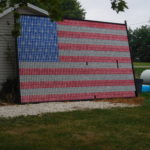
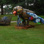
Today, my son and I pedaled from Norwalk, Ohio to Cuyahoga Falls, Ohio.  The morning was relatively easy.  We spent much of the time on the same bike trail as yesterday.  We saw amusing things like a giant US flag made out of empty beer cans and a giant bird statue.

We ended the morning in Oberlin, Ohio and had some excellent burrito bowls for lunch at a restaurant that looked at the town's park.  Before leaving Oberlin we stopped at the location where the process for creating aluminum was invented.  The inventor patented his process and went on to create Alcoa.

After lunch the beautiful roads and rail trails started to disappear.  Hills started reappearing as we got closer to Cleveland.  Traffic also became heavier as we went through the suburbs of Cleveland.

We ended the day by cycling through one of the newest national parks in the US; the Cuyahoga Valley National Park.  Getting into the park was quite easy.  The road went straight downhill in a series of hair pin turns.  I used my brakes more getting into the park than I did pedaling down the western mountains.  In the center of the park is part of canal that connected the Ohio river with Lake Erie.  We pedaled along a wonderful trail that traced the canal's tow path.

Then it was time to leave the park.    The road out of the park was straight up.  It wasn't exceptionally long but it was one of the most painful climbs I have done this trip.  There was no chance to pull over and walk since the road had no shoulder and there was very heavy traffic.  At the top of the climb I was exceptionally winded and my legs burned for quite a while.  On the positive side, I kept up with my son going up-hill so doing all those mountains earlier in the trip paid off.

Today we are just outside of Akron, Ohio.  Tomorrow we should be in Pennsylvania.  Once I cross the border there will only be three states left to go!

Day 33: Toledo to Norwalk, Ohio (July 31, 2018)

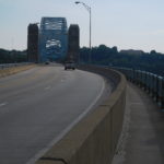
We got a late start leaving Toldeo this morning.  Leaving major urban areas is typically not a lot of fun and Toledo was no exception.  We pedaled over a huge bridge, which had guards preventing people from jumping or throwing things off the bridge.  The guards stopped just before the middle of the bridge, leaving the highest point open.  I guess the authorities are okay if people throw themselves off the bridge into the river but are not happy if anyone wants to throw themselves off the bridge and hit something on land.

We pedaled by a giant oil refinery, which my son said smelled like his bicycle tires. We also pedaled down a long urban highway lined with strip malls and chain restaurants.

Finally, about 15 miles from downtown we reached Genoa, a more rural town with less traffic.  We stopped for an early lunch on the main street.  The service was quite slow.  This turned out to be fortuitous since it rained heavily while we were waiting and then eating.  If we had gotten our food faster, we would have been caught in a major downpour.

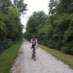
About five miles outside of Genoa we got on the start of Ohio’s North Coast Inland Trail.  It started off as gravel but quickly switched to pavement.  We were on the trail for much of the day and I only have good things to say about this trail.  It was well marked and well maintained.

In a few of the larger towns the trail stopped on the edge of town and started up again on the other side.  This happened in Fremont, Ohio and we used it as an excuse to stop for some Gatorade and some snacks.  I ate an entire container of Pringles potato chips plus I tried zero calorie Gatorade.

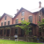
On the way out of town my son noticed a sign for the Rutherford B Hayes presidential library.  It turned out Hayes, who was the 19th president of the United States, lived in Fremont.  Hayes served just one four year turn as president a bit after the civil war ended.  His “claim to fame” is that he signed the bill that ended reconstruction of the south and gave back political control to southern states.  His library of papers and books was the first Presidential library in US history.  We didn’t stay long but it was interesting seeing a presidential library of a man who, roughly 150 years after being the most powerful elected official, is basically forgotten.

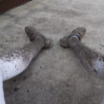
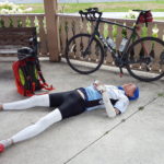
After pedaling about 10 more miles I began to get cramps and needed to stop.  We pulled over into a gazebo and I fell asleep on the concrete floor.  I woke up and did not feel well, but we were still about 26 miles from our hotel.  The next few miles of pedaling were agony.  Luckily, we were on a bike trail and I didn’t have to worry about cars.  I felt like throwing up.  For the next two hours of pedaling I felt terrible. Slowly, though I began to feel better.  By the time we hit the 15 miles to go mark I felt fine and the last hour plus of pedaling was easy.  For the rest of the trip I will not eat Pringles or drink diet Gatorade.