Final Thoughts on Pedaling Across the USA

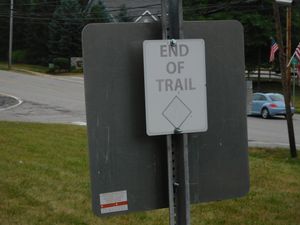
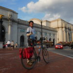
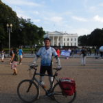
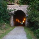
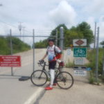
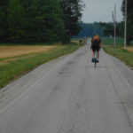
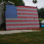
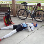
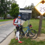
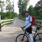
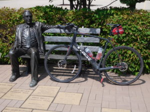
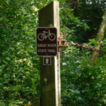
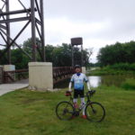
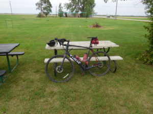
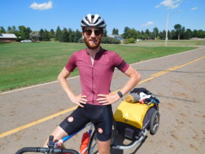
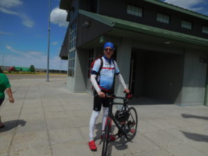
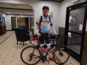
I made it to Washington D.C. after 43 days, or about six weeks, on the road.  I pedaled approximately 3,000 miles in 38 days of biking and took 5 days off.  In the typical day of pedaling I covered about 80 miles.  I over-estimated my own abilities.  Before starting I expected the trip would take five weeks and when pedaling I would cover 100 miles a day on average.

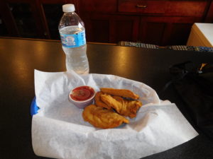
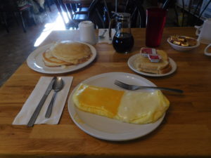
During the six weeks I ate a lot of hamburgers.  My guess is that a burger was dinner about 20 times not counting the meals I had steak for variety. I drank gallons of Gatorade, but almost no beer or wine.  I stopped drinking alcohol a few days into the trip.  I found you cannot push your body to the limit each day and then toss down beers at night.  I did lose a bit of weight.  However, it was only six pounds.  At the end of an exhausting day the last thing I wanted to do was count calories.

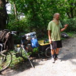
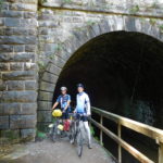
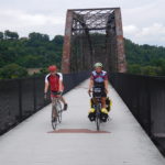
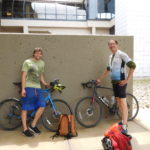
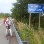
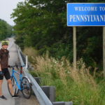
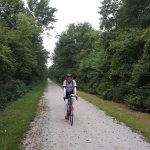
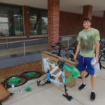
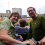
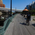
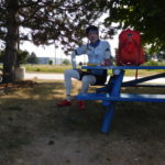
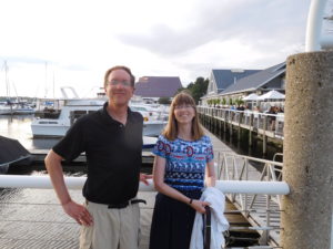
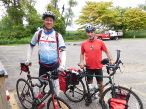
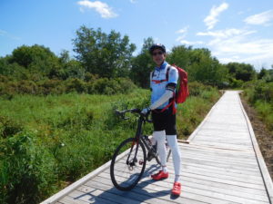
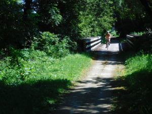
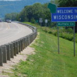
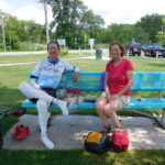
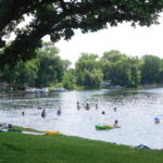
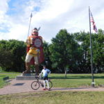
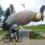
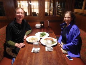
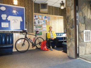
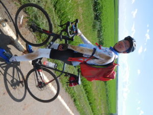
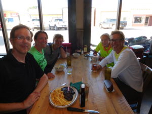
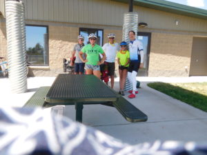
What were the lessons I took away from the trip?  For those of you contemplating a long bike ride, pedal with someone.  Don’t pedal alone.  I had much more fun pedaling with my son from Ann Arbor, Michigan to Pittsburgh, Pennsylvania, pedaling with Beau in Wisconsin and pedaling with Greg from Pittsburgh to Washington D.C. than the days I spent by myself.  If you do decide to pedal alone, make sure you have amazing support.  My wife was phenomenal from cheering me up to getting me on a ferry boat that had already sold out all their tickets.

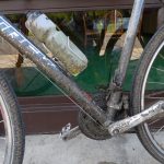
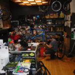
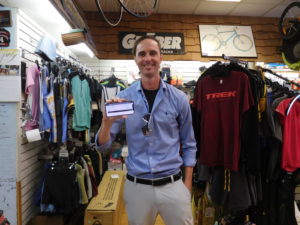
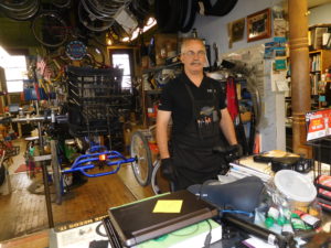
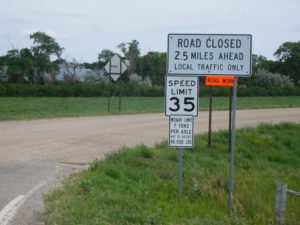
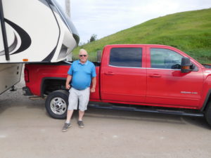
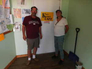
What other lessons did I learn?  I don’t want to sound trite but if you ask for help people across the USA in general will go out of their way for you.  After slashing and warping my rear wheel in Spokane, I was rescued by Roger and his pickup truck.  Then my bike was fixed only a few hours later by Randy.  When my son’s hydraulic bike brakes locked shut, bike shop Brad took care of us instantly and even told us where to get lunch.  When I was stranded and needed to travel down a few exits on the Interstate to get back on local roads there almost always was someone willing to give me a lift.

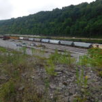
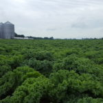
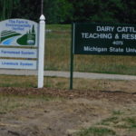
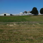
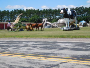
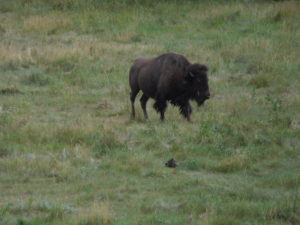
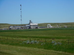
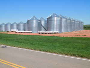
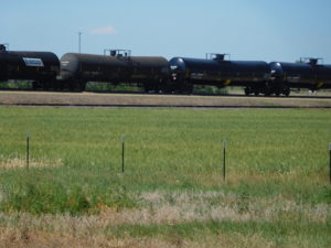
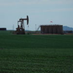
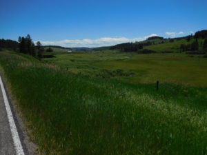
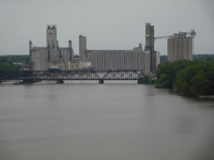
I also came away with a deep appreciation for the amazing productive capacity of the USA.  I spent weeks staring at giant fields of wheat, corn, soy beans and even kale.  I was passed by freight trains loaded with coal, oil, natural gas and other products that stretched almost forever.  While forever is an exaggeration, some of the trains were so long they needed four giant locomotive engines to pull all the cars.  I passed factories in the Midwest that were mind-boggling large.

Grain silos in Toldeo

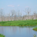
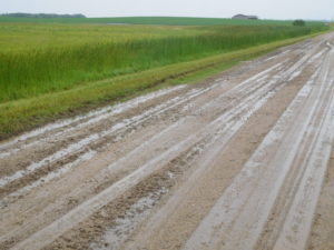
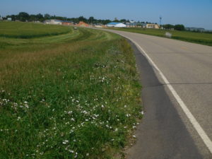
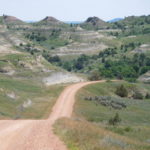
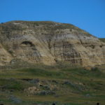
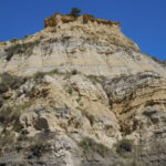
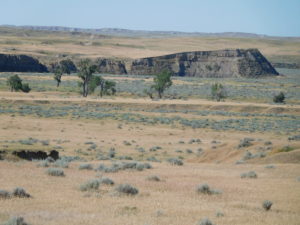
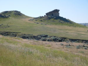
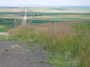
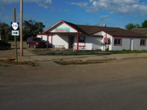
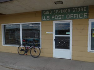
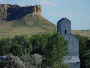
Not all was good.  I also came away with a realization that most of this country is empty of people.  In numerous places you could see that many people once lived there, but not anymore.  The eastern sides of the Cascades and the Rockies were both depressing to pedal through.  Towns are slowly dying as fewer people are needed in rural areas to run the farms and ranches.  The slow death spiral is disheartening as I pedaled through countless places that were once thriving, but today only have a post office that politicians are loath to shut down.

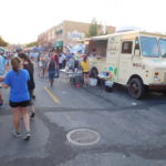
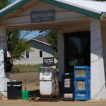
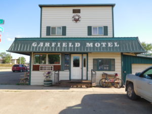
It was also clear that unemployment today is low, but income is definitely not high.  I pedaled past countless homes that were being lived in that needed repairs.  I was passed by numerous cars and trucks that were falling apart.  Low income and little choice in food seemed highly related.  I ate a lot of hamburgers, not because I love burgers but because many towns had little to no other choices for food.

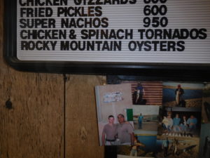
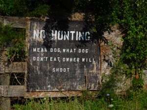
I also noticed a huge concern over safety, security and personal property.  The most common sign I saw while pedaling was not “Stop” or even “Yield.”  Instead, it was “No Trespassing.”  Most of the signs were similar and looked like they were mass produced on only a couple of different assembly lines.  However, more than a few were unique, and every unique sign said roughly the same thing; “Trespassers will be shot.”

Stay off my land

More than half the people I talked to on the trip warned me there were lots of “crazy people out there” and I needed to be careful.  I did meet a few crazies, but everyone was harmless and more eccentric than dangerous.  For example, in Ohio it took a while to extricate myself from a man who wanted to tell me every detail about the electric trains that used to run on the path I was about to pedal.

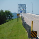
While many of you accept that TSA will scan your body at the airport and check your luggage, I was amazed that a large TSA team showed up to paw through my and all the other passengers’ luggage before taking a 4-hour ferry ride across Lake Michigan.

In closing I want to thank everyone who helped me out.  Many of you did small things that helped a great deal.  For example, Caleb in Montana suggested a hotel about 60 miles down the road.  This suggestion probably didn’t seem like much, but it prevented me from attempting an exceptionally long bike ride in blistering heat that might have ended badly.  I also want to thank those of you who sent public and private encouragements.  The messages of support meant a lot and helped keep me going.

Where and when is the next trip?  I don’t know yet since I have only been off the bike for a few hours and it will take some time to heal my saddle sores.  Wherever and whenever it is, I am sure it will be interesting since there are so many fascinating places, people and pursuits to see and try in the world.

End of this trail but the beginning of the next adventure

Day 43: Williamsport to Washington D.C.

The final day.  All I need to do is pedal about 90 miles and I will have crossed the continental USA by bicycle for the second time.  Greg, who I met outside of Pittsburgh, is with me and also interested in making it to D.C. by Friday night.  We met for breakfast in the Waffle House, which was beside the motel and had some eggs, toast and juice.  We set off pedaling about 8:15 AM.

The first 10 miles were paved and went through scenic Western Maryland countryside.  Then at the top of a hill, Greg pulled over and said he had a problem.  He had broken a rear spoke.  Spokes are a tough item to fix on the side of the road.  It was even tougher than usual to fix since neither Greg nor I were carrying any spare spokes.  Searching the Internet showed no bike shops close to us, so we carried on and Greg rode on a broken rear wheel all the way to Washington.

About 20 miles into the ride the instructions told us to get back on the C&O Canal bike path.  The bike path started out drier than yesterday but soon started having big problems.  We had to cross over a large tree that had fallen across the trail.  We had to cross three different places where the trail had been washed away by floods.  In two of the washed out places the park service had created temporary detours or bridges.

In the third place the park service had given up, closed the trail and expected cyclists to take a long detour that included sections of a highway and a very large climb.  In the west when I came to a road closed or detour sign I had to guess if it was possible to get through.  In the east it was much easier because there were at least a dozen cyclists coming from the other direction who offered advice.

The consensus view of the west-bound cyclists was that we didn’t need to take the highway detour.  It was possible to push our bikes up a short hill, jog or run along a set of railroad tracks for about 200 feet and then slide down a hill to rejoin the trail on the other side of the washed-out bridge.

Reading this previous paragraph now, which is hours after the day is over, suggests this should be no big deal.  However, it was a lot of effort to get up to the railroad tracks and down the other side, not to mention my concern about being hit by a train while on the tracks, even if it was for only a couple of minutes.  We managed it all safely and the only lasting problem was a profusion of mosquito bites from the swarms that attacked us during the mini-adventure.  The mosquitoes even got under my clothes and I have a large series of bites on my arms, neck and head.

For the next 50 miles the trail was at various points muddy, slippery, rocky, very narrow and for a few miles had branches which kept smacking me in the face.

It all didn’t matter because the mile markers were counting down to zero, which was Washington D.C.  I could feel the end.

Around 4 PM we made it to the Potomac River falls.  Just after the falls Google Maps told me that we needed to get off the C&O Canal and take the “Billy Goat Trail.”  The name seemed quite suspicious.

Luckily, near the falls a park service ranger walked by while Greg was in the restroom.  I asked her if the Billy Goat Trail was suitable for bikes.  She told me that the trail was something people did by scrambling and jumping from rock to rock and that our bikes would not make it.  She told us to stay on the canal path, but to make sure we took a small detour that allowed us to stop and see the falls.  It was great advice.  The falls were spectacular, and I would have missed the best part of the day if I had just kept pedaling.

I left Greg just after we crossed the Beltway into Greater Washington.  His brother met us in a parking lot just off MacArthur Avenue.  It was now 6 pm and I had one hour to get myself across town for an interview with a National Public Radio reporter at Union Station before boarding an Amtrak train for home.

I texted the reporter that I had crossed the Beltway.  I pedaled more and stopped and took a picture of the “Welcome to Washington, D.C.” sign.  No one was there to see it but the smile on my face stretched from ear to ear.

Two blocks after taking the welcome sign’s picture, Google Maps told me to get off MacArthur and onto a bike trail.  The trail turned out to be a two-foot wide dirt path that led down a steep cliff.  I turned around and pedaled back to MacArthur and kept heading towards downtown.  This was a small mistake because Google was furiously updating my screen and trying to both explain where I was going wrong and how I could “fix” it.  I made it Georgetown at 6:30 PM.  Thirty minutes to go before the interview.

For weeks I had been picturing myself and the bike being photographed at the Lincoln Memorial at the end of the trip.  I had half an hour to get to the Memorial and then to Union Station.  I texted the reporter that I was in Georgetown.  The message went out and then the phone’s battery died.  I don’t know if the furious updating killed the battery, but it certainly did not help.

I now had two small dilemmas.  First, I didn’t know exactly how to get to the Lincoln Memorial.  I had a rough idea, but rough ideas don’t cut it when you are short on time.  Second, I now had no way to contact the reporter.  I didn’t know what he looked like or where he would be located at Union Station.

Solving the first problem was easy.  I didn’t go to the Memorial.  Instead, I pedaled down Pennsylvania Avenue and got a quick shot of me, the bike and the White House.  Then I asked several other cyclists pedaling down the street for directions to the train station.  I had been to Union Station a number of times in the past, but I had always taken the Metro and been below ground on the subway.

Around 7 PM I pedaled up to Union Station and asked a tourist to take a photo of me and the building.  The second problem, contacting the reporter, resolved itself.  The reporter was standing outside the building and was looking for me.  I guess there were not that many cyclists covered in mud who were out pedaling that evening.

We had a wonderful interview sitting in a quiet wing of the station.  We talked about economics, the trip and traveling in general.  I don’t know if what I said makes for a good radio show, but both the reporter and I were pleased by the conversation.

I had a quick bite to eat and then caught the 10 PM train to Boston.  The train is not fast since it took over 10 hours to get to Boston but Amtrak was happy to take my muddy bike unboxed all the way home for just $20.

Day 42: Cumberland to Williamsport, Maryland

I just wanted to give up this morning and go home.  This might sound strange given how close I am to the end.

I was biking alongside the Potomac River.  The mileage markers started at 188 and were counting down to zero.  Zero is Washington D.C.'s Georgetown neighborhood.  I have pedaled a huge distance in the last 41 days and the only thought that went through my head over and over was stop, go back to where you started this morning in Cumberland, get on the train to D.C. and stop all this.

Why was the little voice saying give up?  Because the C&O Canal trail was very difficult.  This past weekend it rained heavily in this part of Maryland.  The Weather Channel on Saturday ran one story over and over about a town in Maryland, not far from here, where they were thinking of evacuating because so much rain had fallen the town's dam was in danger of bursting.  Since the weekend even more rain has fallen, including a few hours of heavy rain last night.

One hundred miles back I met a man called Jan, who was a real character.  You occasionally meet people on the road who pedal a little and talk a lot.  That was Jan.  He was coming back from attempting the Pittsburgh to Washington route.

He had done it five times in the past but said it was too tough this year.  He also said someone he met had turned back because the water was up to the bike's bottom bracket, which is where the pedals connect to the frame.  Jan was an old guy and clearly a story teller so I didn't believe it.  I do now.  I went through at least one puddle that was so deep my bottom bracket was in the water and quite a few other very deep puddles.

Why was the path in such bad shape?  Part was due to the rain.  But another part is that the C&O Canal Bike Path is maintained by the National Park Service.  The Park Service is a wonderful, but woefully underfunded organization.  One result of the under-funding is that my miles today were in conditions designed for mountain bikers, even though there wasn't a hill or mountain on the trail.   Unfortunately, I wasn't riding a mountain bike.

What was it like to ride?  It was muddy, slippery and tree roots crossed the road.  Around 10:30 AM I used a spoon to scrape the mud off my chain, frame and brakes.  The storms also had dropped trees across the trail.  We met up with a three man crew cleaning up downed trees and limbs, twice during the morning.

Plus, to add extra misery you could not stop.  The C&O Canal is a giant stagnant pool of water that breeds mosquitoes.  Stopping resulted in large numbers coming over to feast on my body.

The result was that I didn't pedal down the trail.  Instead, I lurched, slid, bounced and prayed that I wouldn't crash for 50 miles.  At the 50 mile mark the state of Maryland had pity on the bikers who pedal down the C&O Canal Trail.  The state has built a 23 miles long paved bike trail.  It is literally 100 feet away from the C&O trail but because the state built it, the trail is maintained and in very good shape.

After 23 wonderfully easy miles, Maryland's trail ended and we switched back to the C&O.  Luckily, for me and Greg who is still pedaling with me the last 18 miles on the C&O were much less muddy.  Part of this was due to the sun baking off the water all day.  Part seemed to be that this section of the trail was in slightly better shape.  Whatever the reason, after 89 miles I made it to the hotel I booked in Williamsport, Maryland.  My bike, gear and I were so muddy the hotel owner told me not to bring the bike or bags into the hotel's lobby.  Luckily, he let me come in so that I could check into the room and pay.

Tomorrow there is just 90 miles left to pedal in the whole trip.  Most of it is back on the C&O Canal path.  It does not look like an easy ride, but to give up on the last day is foolishness.  My guess is that adrenaline will ensure I make all the way to Washington D.C.

Day 41: Connellsville, PA to Cumberland, Maryland

I write this entry from the state of Maryland.  This might be my last state.  Tomorrow I pedal along the Maryland-West Virginia border and it is hard to see on the map if I need to cross over to the West Virginia side of the border.  If I don't cross the Potomac River, then the last border remaining is Washington D.C's!

The goal  right now is very simple.  Pedal 90 miles tomorrow, which is Thursday.  Pedal 90 miles on Friday and then get on an evening Amtrak train back to Boston.  The evening train is the only one on the schedule that will take my bike home, without the bike being in a box.

The small problem is that these last 180 miles are mainly along side the C&0 Canal.  The Canal area this past weekend was flooded by torrential rains.  I talked to some people who tried to pedal along the Canal two days ago and they gave up because the mud was too deep.  Hopefully, by tomorrow the ground will have dried out enough for me to make it through.  I really don't want another experience like the one I had outside of Fargo, North Dakota, where the mud made the road impassable for bikes.

The end of the today's ride showed me the problems caused by this past weekend's torrential rain.  The first 70 miles of today's ride was a gentle up-hill.  That is not a misprint.  I pedaled up a slight grade from 8 AM until about 5:30 PM.  At 5:30 PM I reached the Eastern Continental divide, which is where water either goes into the Atlantic or the Gulf of Mexico.

From the Continental Divide to the hotel in Cumberland, Maryland it was a gentle 20 mile downhill.  Unfortunately, part of the path was washed away by the rain and someone did temporary repairs by tossing loads of fine rock and gravel on the path without packing it down.  This led to lots of spots where I almost had the bike slide out from under me.  Luckily, I was able to stay upright each time and made it to the hotel without crashing.

The downhill ride was also interesting since it crossed the Mason-Dixon line, which demarcated free and slave states before the Civil War. The people who built the trail created a solid line in the ground so that you knew exactly where the line stood.

The trail also had a number of railroad tunnels for pedaling through.  Five years ago the tunnels had no lights.  This time the tunnels all were lit.  It was much safer today, but less of an adventure when it is possible to see where you are going.

On a different topic, while on the trip I have done a number of interviews about various topics. For example Bloomberg News did a story on “Successfully managing a financial windfall" and the Spanish language newspaper El Pais asked me questions about the economic problems associated with divorce.  Just before typing the blog I did an email interview about when consumers should or should not buy an extended warranty.

The most interesting request so far is an email from a reporter at "The Pulse", a health and science show from the public radio station WHYY in Philadelphia. He wants to interview me as I ride into Washington D.C. for an upcoming episode. The theme of the show is "in the name of science" and it is about the lengths that researchers go to for work or academic field. I don't know if it will happen, but it certainly sounds intriguing.

Day 40: Pittsburgh to Connellsville, PA

Today was one of the easiest days of bike trip.  I did 80 miles primarily on bike trails.  It was very easy for a couple of reasons.  First, I had pedaled much of today's route five years ago.  Knowing where you are going and what is coming up makes anything easier, including biking.  Second, I only pedaled 10 miles yesterday so even though I drove over 600 miles yesterday my legs felt fresh.

During much of the morning I thought about possessions.  In economics there is a unstated assumption that "more is better."  For example, all politicians around the world want to boost their countries GDP.  Boosting GDP means more stuff for all the people.

For the last five weeks I have  existed with very few possessions.  For example, I have three pairs of socks with me and I contemplated taking just two pairs to keep down the weight.  When I went home for the weekend I walked into a house full of possessions.

When I was home I spent a couple of minutes staring at the top of my dresser.  Before leaving on the trip I purchased a half-dozen pair of socks.  I had not even opened the packaging.  They were still sitting there on the dresser in a large pile, clean and unopened.  Just below the brand new socks was a large pile of a dozen clean but slightly used socks.  I wondered did I really need 18 pairs of socks?

By the end of pedaling this morning I began to realize how few possessions I really need to survive and have begun to question one of the key underlying assumptions in economics.  I don't know if this realization will change my buying habits or my lectures in the future, but it might.  In the short term I definitely will not be buying more socks.

In the afternoon I met up with another long distance bicyclist named Greg from Colorado.  He had been pedaling since mid-June and is also going to Washington D.C.  on the bike trail.  We are splitting a hotel room tonight.  It is always interesting to have someone new to talk with about their life's experiences and makes the pedaling less lonely.

Tomorrow it is expected to rain.  It rained on the trail this afternoon before I got there.  The trail partly turned to mud and my clothes and bike are covered.  Oh, well.  In a few days I will be home and no longer have to worry about mud and rain.  Instead, I can spend my time contemplating what to do with my large pile of clean socks.

Days 37 to 39: The “Rest” Days

From Friday afternoon August 3rd to Monday afternoon August 6th I took a couple of "rest" days.   Rest is in quotes because I needed to be back in Boston on Sunday August 5th and the drive each way from Pittsburgh's Airport to Boston was almost 12 hours long.  Twenty four hours of driving covering 1,200 miles in three days is not really a rest.

On the way to Boston I had my son help do the driving.  He did about two-thirds.  On the way back to Pittsburgh I did the entire drive alone.  Going to Boston it rained very heavily while we were driving through the Pocono Mountains.  In the Poconos the rain came down so hard cars put on their four-way flashers and drove around 45 mph on the highway instead of the usual 65 to 70 mph.

The weather was fine going back to Pittsburgh, but there were quite a few road construction crews out.  Numerous parts of the highways were being fixed and this slowed traffic in parts to a crawl.

I arrived home Saturday morning at 2 AM, which meant I did not pedal for two days!  Not much happened during Saturday.  I spent most of the time sleeping, eating and doing laundry.  Laundry was the key activity since my clothes were so filthy they were starting to bother even me.  It is a shame the weather forecast for Tuesday is rain, which will just get my clothes filthy all over again.

I made it back to the Pittsburgh Airport about 7 pm on Monday afternoon.  I reassembled my bike in the rental car return lot and started pedaling again.  I didn't do a lot of miles late Monday.  I only managed about 10 miles.  However, it felt good to be back on the bike and getting a bit closer to Washington D.C.

For those of you who are looking at the photos on this page, you will notice I swapped bikes while in Boston.  I left the new road bike at home and am riding an older bike that does better on gravel and dirt.  The older bike's tires are wider (37 cm) than the new bike's tires (just 32 cm).   Plus, the older bike is not as fragile, so it is easier to ship home from Washington.

Tomorrow is an exciting day!  I start the final push to the USA's capital.

Day 36: Pittsburgh, PA (Aug. 3, 2018)

A number of years ago I went with my family to Beijing. I had heard that traffic in that part of China was terrible and the best strategy was to use the subway system instead of taxis. I looked carefully at maps and picked a hotel a few blocks from a subway station.

When we left the hotel the first day to look for the subway station we could not find it. We walked for what seemed like miles in various directions but no subway was found. Finally, we found a policeman and one of my sons took the map over to him and asked in Mandarin where the station was located. The policeman laughed a lot and said that station was not yet built. It was just a proposal. The map showed where the station will be.

I thought a lot about that story today. Last night we stayed in a hotel in Beaver Falls which is on the outer edge of Greater Pittsburgh. Our goal was the Pittsburgh Airport, just 30 miles of pedaling away. Google Maps wanted to send us down route 51, which for many miles was a divided highway, two lanes in both directions, with no shoulder. Not the type of road I really wanted to pedal down.

Looking at the map closely showed a bike trail running parallel between the highway and the river. I was a bit surprised that the mapping program did not put us on the trail, but after all the errors and problems I have encountered with the mapping program I was not overly concerned.

We left the hotel and pedaled over a number of bridges until we reached the start of the bike trail. There was a large "no trespassing" sign. In Montana one of the signs suggested trespassers would be shot. In Pennsylvania the sign said trespassers would be prosecuted to the full extent of the law. I am not willing to be shot at but arguing in front of a judge doesn't concern me as much. We started pedaling down the road.

To make a long story and pedal short, the bike path was a proposed bike path. We pedaled a number of miles of rough gravel through rail yards, by coal dumps, beside junk yards and decrepit industrial sites. Then, near the county jail the way seemed blocked with real fences and more serious security. There was "luckily" a bridge that seemed to connect the rail yard we were in with the highway we didn't want to be on. My son pedaled on ahead to look at the bridge. He came back with a good news-bad news story. The good news was the bridge went where we wanted to go. We didn't have to retrace our steps. The bad news was the bridge had a locked gate at the end and part of the gate was topped with barbed wire.

For a brief time we stopped being bicyclists and switched to being climbers. Luckily, there were two of us. I don't know how I would have gotten the bike over the fence if there wasn't someone on the other side. Once we were safely over the fence we pedaled about two miles down the highway. At the end of the highway there was a small sign that stated the highway was part of Pennsylvania Bike Route A. If that was their "A" route, I really don't want to pedal the state's B or C routes.

We made it to the Pittsburgh Airport about 2 pm. There were other adventures, like pedaling through a road paving crew, sliding around on a brick road that had been laid down over 100 years ago and pedaling on the airport roads but these were relatively minor compared to the proposed bike path.

We went to the Pittsburgh Airport because this weekend my family is having a big affair and my son needs to go back to work.  We will drive from Pittsburgh in a rent-a-car back to Boston and spend two days at home.

Then I will drive back to Pittsburgh alone and start pedaling again either Monday afternoon or Tuesday morning. Yes, it is about 1,200 miles of driving to go with all my pedaling. The two days at home will be "rest days." I don't know how much rest I will get, but at least there will get a chance to do laundry before pedaling the last 400 miles.

Day 35: Cuyahoga Falls, Ohio to Beaver Falls, Pennsylvania

Wow, I made it to another state! Tonight I am in Pennsylvania.  This means there is only West Virginia and Maryland left.  Once I pedal about 400 more miles I am done going from coast-to-coast.

Today,  my son and I pedaled about 80 miles.  It was a hard but relatively uneventful day.  To give you a sense of where we are, today's ride took us through the north east corner of Ohio.  We went through Kent, Ohio, which is where Kent State is located.

The day was hard for three reasons.  First, we spent a lot of time on gravel or very rutted roads.  The roads were not in as poor a shape as Michigan's, but they were in bad shape  My left hand and wrist were bounced and jarred a lot.  During one part of the afternoon I could not use my left hand to brake or shift because it hurt so much.  Luckily, shifters and brakes are on both sides of the handlebars so I didn't have to stop riding.

The second reason the day was hard was due to the day ending with a very long and steep climb.  After biking all day the last thing I wanted to see was a giant hill.  Google Maps counts down how long to your destination.  The count down timer is not very good.  It just assumes you are pedaling at 12 mph.   I was stuck at 18 minutes to go before reaching the motel for what seemed like forever since I was not pedaling up the giant hill at anywhere near 12 mph.

Third, we got rained on.  After we ate lunch a large black cloud filled just part of the sky.  I was not very worried because I could see blue sky around all parts of the cloud.  The cloud soaked us and then moved on.  Unfortunately, the cloud was moving slowly and in the same direction we were pedaling.  We quickly caught up to the cloud and got soaked a second time.  We decided to outrun the cloud so that we didn't get soaked a third time but getting really wet twice was not a lot of fun.

The problems of pedaling all disappeared from my mind after a warm shower and a great meal at "Sal's" in Beaver Creek.  I look forward to tomorrow and its new adventures.

Day 34: Norwalk, Ohio to Cuyahoga Falls (Aug. 1, 2018)

A few days ago I checked into a hotel in Ann Arbor, Michigan.  The desk clerk smiled and asked how far I had traveled.  I said over 2,00 miles from Seattle, Washington.  His reply was  similar to one I had heard from several other people.  He said the trip sounded fascinating but if he tried doing it he would have stopped after about a dozen miles and given up.

To be honest the thought of giving up crossed my mind a couple of times this trip, especially around Missoula, Montana when my legs were like jello.  What prevented me from giving up was you.

I learned from behavioral economics that one simple method of accomplishing a major task is to make a public commitment with verification.  The major task doesn't have to be cycling across the country.  It can be as simple as losing ten or twenty pounds of weight.

How did you prevent me from giving up?  I made a public commitment by creating this blog.  Forcing myself each night to write about the trip ensures each day I remember that a lot of people were told I was going to complete the trip.  Dropping out in the Rocky Mountain would mean publicly admitting defeat to a large audience.  If I didn't have the blog then quitting would have been relatively easy since no one would have known.

Verification is important, too.  On the side of the blog is a widget or box that contains information from Strava.  Strava is an app on my phone that every 30 seconds tracks where I am.  Strava uses this to calculate my speed, distance and height climbed.  By keeping Strava on all the time I cannot cheat and call Uber, Lyft or a taxi without a reader noticing.

What is the takeaway?  If you want to do something relatively large then what you need to do is first make a public commitment.  It doesn't have to be a blog.  Any kind of public commitment works.  Getting up during a family dinner and telling everyone your plan is just as good as tweeting to the entire world.

Then you also need to follow through by ensuring there is some way for people to monitor or watch what you are doing.  For example there is a television show that tracks obese people trying to lose weight.  They periodically bring contestants in to be weighed.  That is an example of monitoring.

Looking at the above paragraphs it all seems so simple. In reality, doing any large project or task is not simple even with the help of behavioral economics plus supportive friends and relatives.

+++++++++

Today, my son and I pedaled from Norwalk, Ohio to Cuyahoga Falls, Ohio.  The morning was relatively easy.  We spent much of the time on the same bike trail as yesterday.  We saw amusing things like a giant US flag made out of empty beer cans and a giant bird statue.

We ended the morning in Oberlin, Ohio and had some excellent burrito bowls for lunch at a restaurant that looked at the town's park.  Before leaving Oberlin we stopped at the location where the process for creating aluminum was invented.  The inventor patented his process and went on to create Alcoa.

After lunch the beautiful roads and rail trails started to disappear.  Hills started reappearing as we got closer to Cleveland.  Traffic also became heavier as we went through the suburbs of Cleveland.

We ended the day by cycling through one of the newest national parks in the US; the Cuyahoga Valley National Park.  Getting into the park was quite easy.  The road went straight downhill in a series of hair pin turns.  I used my brakes more getting into the park than I did pedaling down the western mountains.  In the center of the park is part of canal that connected the Ohio river with Lake Erie.  We pedaled along a wonderful trail that traced the canal's tow path.

Then it was time to leave the park.    The road out of the park was straight up.  It wasn't exceptionally long but it was one of the most painful climbs I have done this trip.  There was no chance to pull over and walk since the road had no shoulder and there was very heavy traffic.  At the top of the climb I was exceptionally winded and my legs burned for quite a while.  On the positive side, I kept up with my son going up-hill so doing all those mountains earlier in the trip paid off.

Today we are just outside of Akron, Ohio.  Tomorrow we should be in Pennsylvania.  Once I cross the border there will only be three states left to go!

Day 33: Toledo to Norwalk, Ohio (July 31, 2018)

We got a late start leaving Toldeo this morning.  Leaving major urban areas is typically not a lot of fun and Toledo was no exception.  We pedaled over a huge bridge, which had guards preventing people from jumping or throwing things off the bridge.  The guards stopped just before the middle of the bridge, leaving the highest point open.  I guess the authorities are okay if people throw themselves off the bridge into the river but are not happy if anyone wants to throw themselves off the bridge and hit something on land.

We pedaled by a giant oil refinery, which my son said smelled like his bicycle tires. We also pedaled down a long urban highway lined with strip malls and chain restaurants.

Finally, about 15 miles from downtown we reached Genoa, a more rural town with less traffic.  We stopped for an early lunch on the main street.  The service was quite slow.  This turned out to be fortuitous since it rained heavily while we were waiting and then eating.  If we had gotten our food faster, we would have been caught in a major downpour.

About five miles outside of Genoa we got on the start of Ohio’s North Coast Inland Trail.  It started off as gravel but quickly switched to pavement.  We were on the trail for much of the day and I only have good things to say about this trail.  It was well marked and well maintained.

In a few of the larger towns the trail stopped on the edge of town and started up again on the other side.  This happened in Fremont, Ohio and we used it as an excuse to stop for some Gatorade and some snacks.  I ate an entire container of Pringles potato chips plus I tried zero calorie Gatorade.

On the way out of town my son noticed a sign for the Rutherford B Hayes presidential library.  It turned out Hayes, who was the 19th president of the United States, lived in Fremont.  Hayes served just one four year turn as president a bit after the civil war ended.  His “claim to fame” is that he signed the bill that ended reconstruction of the south and gave back political control to southern states.  His library of papers and books was the first Presidential library in US history.  We didn’t stay long but it was interesting seeing a presidential library of a man who, roughly 150 years after being the most powerful elected official, is basically forgotten.

After pedaling about 10 more miles I began to get cramps and needed to stop.  We pulled over into a gazebo and I fell asleep on the concrete floor.  I woke up and did not feel well, but we were still about 26 miles from our hotel.  The next few miles of pedaling were agony.  Luckily, we were on a bike trail and I didn’t have to worry about cars.  I felt like throwing up.  For the next two hours of pedaling I felt terrible. Slowly, though I began to feel better.  By the time we hit the 15 miles to go mark I felt fine and the last hour plus of pedaling was easy.  For the rest of the trip I will not eat Pringles or drink diet Gatorade.

Day 32: Ann Arbor, Michigan to Toledo, Ohio

Quite a lot happened today.  First, TheConversation.com published a piece I wrote about the safety of various activities like bicycling.  You can read the piece they published here or you can read a slightly different version in the post published between Day 31 and Day 32 (the post is here if you cannot find it).

Second, my oldest son, Josh flew out to Michigan to join me for a week of cycling.  This gave me a chance to sleep in and recover a bit from yesterday's total exhaustion.  I am not fully recharged, but at least I can keep my eyes open.

Josh and his bike made it safely to Michigan, but his hydraulic brakes were locked shut when the bike came out of the box.  Luckily, a great bike shop was open in downtown Ann Arbor and only two blocks away.  Brad, the shop's bike mechanic, was able to open the brakes and got the bike working like new in no time flat.  That saved the day!  Brad also recommended a great place for breakfast and we dined outside before setting off.

Our goal was Toledo, Ohio, which meant entering another state.  Now there is just Pennsylvania, West Virginia and Maryland to go.

Google Maps did its very best to show my son every type of road surface possible, from new roads to bike trails.  We even did quite a few miles of gravel and hard packed dirt.  At the end of the gravel section my son said "now I know why you are so exhausted."

We arrived in Toledo around 5:30.  Our hotel faced the local baseball stadium and we picked the perfect night.  The local team, the Toledo Mud Hens (the farm team for Detroit Tigers),  was playing at 7 pm.  Josh picked up two of the cheapest tickets available ($13 each).  They turned out to be right behind home base.  We sat about 10 feet from a half-dozen major league baseball scouts who were watching the game with their own video cameras, radar guns and laptops.

It was a great experience watching minor league baseball up close.  I was tired so we left before the game was over.  That wasn't a problem since our hotel room looked down on the stadium and we finished watching the game from high above.  Yes, the Mud Hens beat the Louisville Bats, but the Mud Hens led the whole game so it was not unexpected.

Overall, it was another great day on the road and we even managed to pedal about 57 miles.

How safe are summer activities like bicycling?

It is summer, a time when many people who were sedentary all winter get outside and start being active again.  While being active is great, many people become injured when they start playing new sports or ones they haven’t done in years.  So, how safe are the various activities done by the typical weekend warrior?

I am personally interested in this question because this summer I am bicycling across the U.S.  When people hear a middle aged man is pedaling alone 3,000 miles the first question they ask is, “Is it safe?”  Given the near misses and one crash on loose gravel I have had so far this trip my inclination is to say no.  Nevertheless, personal experience is no substitute for looking at actual data.

The U.S. Consumer Product Safety Commission is the government agency that gathers data and makes rules to help reduce the risk of injury or death when using equipment like a bike, golf club or even treadmill.  They estimate that total damage, death and injuries from using faulty consumer products costs the U.S. more than $1 trillion a year.

They track the specific types of injury from every kind of sport and make this available online via the National Electronic Injury Surveillance System (NEISS).  This database not only tracks sports injuries, but also injuries from contact with any kind of consumer product from ATVs to workshop tools.

The NEISS system has tracked injuries since 1979.  It counts only injuries that resulted in a person ending up in a hospital emergency room.  Injuries that people take care of at home or leave untreated are not counted.

The NEISS releases data in aggregate form and also as individual case records without people’s name or geographic location.  For example, one of the first injuries reported in 2017 is a 21 year old white man who was boxing with a friend while drunk and went to the ER because he was punched in the face.

The overall NEISS data show that bicycling is indeed dangerous.  About 455,000 cyclists ended up in the emergency room in 2017.  However, other sports and exercise activities have even more injuries.  There were half a million ER visits because of injuries received while playing basketball.  Going to the gym is the most dangerous with 526,000 people injured using exercise equipment.  Maybe all the bike riders, basketball players and gym rats should try something safer like horseback riding since that group only had 49,000 ER visits.

The problem with using aggregate NEISS data to compare the dangers of various sports and activities is that participation rates vary.  One reason few people are injured horseback riding is that relatively few people do this compared to the large number shooting hoops in their driveway or at the neighborhood playground.

This problem can be overcome by using the Bureau of Labor Statistics’ American Time Use Survey (ATUS), which provides information on how much of each day people spend exercising.  The data show only about one in five Americans got exercise in a typical day.  The ATUS list does not match perfectly with the injury data, but there is a large overlap.

ATUS shows the most common types of exercise are walking and using exercise equipment and weights, which I consider going to the gym.  Using the gym figures as a baseline it is possible to compute a participation adjustment figure for each sport.  For example, the data show 2.5 times more people go to the gym on a typical day than play basketball.  This means basketball injury figures need to be increased by 2.5 times to make a fair comparison of being hurt in the gym versus being hurt on the court.

What do the adjusted figures show?  The most dangerous activity is no longer going to the gym.  Instead, it is playing football.  The second most dangerous activity is playing hockey.  Unfortunately, for me bicycling stays in third place on the list.

Table: Dangerousness of Various Activities Based on ER Visits

Activity Original Rank Adjusted Rank
Football 4 1
Hockey 11 2
Cycling 3 3
Soccer 6 4
Basketball 2 5
Baseball, softball 7 6
Equestrian sports 10 7
Rollerblading 8 8
Volleyball 9 9
Gym 1 10
Swimming, surfing 5 11
Racquet sports 13 12
Running 12 13

The adjustment is not perfect because we should also adjust for the amount of time spent in the activity since the longer people spend doing an activity the more time they have to be injured.  Nevertheless, the message is clear for those of you thinking about taking your bike out for a spin on a lovely summer day.  Be careful out there.

Day 31: The journey to Ann Arbor

I am exhausted today.  I am not sure how I pedaled the 90 miles from Portland Michigan to Ann Arbor but somehow I got here.

I was exhausted like this once before in southern Michigan.  When I was younger a friend convinced me to come out and do the Wolverine 200 Belle Isle Bicycle Marathon in Detroit.  This marathon was simple.  For about 40 years an island in the middle of the river, next to downtown Detroit, was shut down to all car traffic for one day. 

Bicyclists then pedaled round and round the island in an attempt to do 200 miles in 24 hours.  The first time I tried, I was only able to do about 150 miles.  The second time I did the 200 miles with time to spare.  At the end of the 200 miles I was exhausted.  I got off my bike after hitting the double century goal and fell asleep in the grass by the side of the road.

I am feeling that kind of exhausted.  Two days ago I averaged 13 mph over the day.  Yesterday I averaged 12 mph.  Today, it is down to 11 mph.  That might not seem much but the two miles per hour difference means sitting on the saddle an extra hour.  That extra hour hurts my bottom, a lot, especially on Michigan's roads, which look like the state's highway department ran out of money years ago.  I have not seen roads in such poor condition since Montana.

I need a rest day.  The last one was almost two weeks ago in Bismark, North Dakota.   My son, however, is flying out and will be here tomorrow.  He is expecting to go riding with me.  He is also a very strong rider.  We did a 70 mile training trip together just before I started this adventure.  After the 70 mile ride, I laid on my couch and watched a movie.  That was all the energy I had left.  He wasn't tired.  Instead he went for a four mile run because he wanted a bit more exercise and then went out with friends.

I will try going to bed immediately.  Maybe 10 hours of sleep will help?  I will let you know tomorrow.

++++++++++++++

PS:  The big adventure/problem of today was exploding chocolate.  I bought some chocolate bars to eat during today's ride.  I ate part of them this morning and then stuck the rest back in my pack and forgot about them.  When I got to the hotel I stuck my hand in the backpack and it came out covered in melted chocolate.

When you are exhausted the last thing you want to do is wash chocolate out of your clothes and pick chocolate pieces out of power cords.  It took some time, but I think the biggest part of the mess is cleaned up.  The proof tomorrow is the bug test.  If I cleaned up enough, bugs will not be attracted to me.  If I didn't clean up enough, I will be a bug magnet.

Day 30: Muskegon to Portland, Michigan

Wow, I pedaled 90 miles and nothing happened today!  After weeks of daily adventures, problems and highlights today was very routine. I left the motel around 9:30 and pedaled about 25 miles on a paved bike trail that ended at the western edge of Grand Rapids, Michigan.

Then I pedaled through rich and poor neighborhoods in Grand Rapids.  One minute I was pedaling by homeless people sleeping on top of a low wall.  A few minutes later I was pedaling through a fancy restaurant district, where the patrons were sipping cocktails on outdoor patios.

The eastern edge of Grand Rapids is clearly not a safe place for autos.  While leaving the city I had to dodge three different areas filled with the broken glass, plastic and metal of previous car accidents.

In the late afternoon I stopped for more Gatorade.  Google decided to update my route during the pause and gave me three choices for the final push into Portland, Michigan.  One choice took an extra hour so that one was out.

Of the two remaining, one was very simple (go straight for six miles and then go east for fourteen miles).  The other was Google's recommended route.  It took many different roads in a step pattern, but supposedly was 7 minutes faster.  I started on the faster step route.  After two miles the pavement stopped and gravel roads began.  I turned around, pedaled back to town and took the simpler route to my hotel.

I am sorry to disappoint readers who expected more excitement today.  Almost any activity can become routine after doing it long enough.

Day 29: Muskegon, Michigan

Today was a great bicycling day.  What made it great?  Conversation.  I stayed in a charming bed and breakfast in Ludington, Michigan, called “The Inn at Ludington.”  Lars, the owner was very friendly.  Since they were fully booked, they had two breakfast seatings.  I took the early shift and while the food was good, the conversation was even better.  Two of the guests had both served in the US military and both were deployed to Vietnam in the late 1960s and early 1970s.  It was fascinating hearing what the war was like from people who were there.

At the end of breakfast, the skies opened and it rained heavily.  It was not good cycling weather, so I did something sensible.  I went back to sleep until the weather improved.  Around 10 AM the sun came back out, so I got ready to leave the Inn.  Just as I stepped outside another heavy rain shower doused the area.  My first half-hour of pedaling was cold and wet.  Luckily that was it for bad weather.  While the skies threatened more rain for most of the day, none happened.

The first twenty miles were from Ludington to Hart, Michigan.  The ride went by lake homes and even a giant dam.  It was pleasant and the speed limit on some of the roads I took was 25 mph.  Both I and the cars were going quite slowly.  I was crawling slowly because my legs were very tight and the cars were crawling because of the low speed limit signs.  I was concerned I would not pedal all the way to my next hotel in Muskegon, but after 45 minutes my muscles loosened up and I was able to start making steady progress.

I stopped in Hart for lunch but could not find an open shop that made sandwiches.  I ended up buying a fried fish sandwich from a warming rack in a Mobil gas station.  It was only marginally better than eating nothing.  I vowed to eat no more gas station sandwiches.

In the town of Hart my day, which was going well, suddenly got much better.  Hart begins a very long bike trail that goes for many miles.  I knew there was a trail but didn’t know its conditions or length.  The conditions were excellent.  It was paved, smooth, maintained and well-marked and it went the 40 miles to my hotel.

At the start of the trail I saw another long-distance cyclist.  You can pick them out based on the packs they are carrying.  I speed up and met Beau.  Beau teaches Spanish to grade school students and was pedaling for two weeks with a friend who needed to make a long stop in Hart.  Beau was pedaling on ahead.  We had a wonderful conversation about biking, travel and life for over four hours of cycling.  Riding with someone made me pedal faster. More importantly it made the entire afternoon slip by relatively effortlessly since I focused on the conversation, instead of my aches and the number of miles left to pedal.

After riding with Beau, I was met at my hotel by Professor Pat Smith, from the University of Michigan.  Pat and I have written many research papers together over the last decade.  It was wonderful chatting with her and her husband over dinner.

Talking to various people at breakfast, during the ride and at dinner made the day a social and more interesting experience.  It was not just about putting on more miles and getting to the east coast.  It makes me eager to finish the ride and see and hear face-to-face what is happening in your lives.

Day 28: Two thirds of the country done

I am writing this post from Luddington, Michigan, a beach town on the shores of Lake Michigan.  I am now two-thirds of way through the trip!

This morning I was in Fond Du Lac, Wisconsin.  I needed to pedal 57 miles before 1 pm in order to get to the ferry that would take me across the lake.

At home I try to cram as many things into each day as possible and don't leave much slack in my schedule.  On this bike trip lots of unexpected things have happened so I decided that I needed to leave extra early in case something unforeseen occurred.

I left the window shapes in my motel open so that the rising sun would get me up.  During the night I was treated to a spectacular lightening and thunderstorm that lasted a long time. With the storm came a torrential rain.  I was quite glad the storm was happening while I was safe in the motel.

I was on the road at 6:30 am.  My goal was to be at the ferry by 11 am, which would give me two hours in case anything went wrong.

Fond Du Lac has a large number of bike trails.  The streets had puddles but the bike trails  were dry.  I was pedaling along nicely, making good time on a trail when Google maps told me I needed to get off the bike trail and turn right.  The bike trail ended, however, with a left hand turn.

I decided to peddle along the sidewalk for a few feet and take the first driveway on the right.  There was a puddle at the end of the driveway but I was more concerned with looking for cars driving down the road I was merging onto than splashing through a puddle.

The puddle, however, was not what I expected.  It was actually a huge pothole.  My front tire went into the pothole and I ended up on the ground.  Wow!  That was unexpected.  Luckily, I was going very slowly.

Another bicyclist was there within one minute, asking if I was okay.  I checked the bike.  It looked fine.  I checked myself. I felt okay.  So there was only one thing to do.  Get back on the bike and continue pedaling to the ferry.

I spent a lot of time thinking about why I didn't have a bike crash for the past 30 years and then crashed twice this trip.  My conclusion is that I am not getting enough rest and pushing myself each day to my physical limit.  Being over-tired and sore is making me sloppy.

The rest of the ride to the ferry was uneventful.  I went past numerous dairy farms, many proudly advertising that they provide milk for "Land o'Lakes" products.

I pulled into the ferry terminal at 11 am, which was two hours before when I needed to be there.  The boat had very nice lounge chairs on the bow.  I took one and then had a long nap in the sun.  The boat ride across Lake Michigan was uneventful.  The lake was calm and peaceful.

Luddington, Michigan seems like a nice town, but I will not have a long time to explore it since tomorrow I am back on the road to complete the last third of the journey.

Day 27: Friendship to Fond Du Lac, Wisconsin

Today was a lovely day of bicycling.  Using Google Maps is an interesting experience.  The program provides turn-by-turn directions.  The phone is mounted on my handlebars so when I am using this program I concentrate first on the physical road, then on the surroundings, third on the traffic and then last at the map.  I run through this sequence every minute or two.  The first three steps are typically the same each time.  The last step is many time the surprise.

While the map tells me where to turn, the roads it picks out for bicycling are often a total surprise.  Today the roads turned out to be mainly pleasant surprises, with just a few doses of adventure.  It is almost as if Google doesn't want to make biking too easy so it occasionally throws in some gravel some other unexpected situation.

I left the motel in Friendship a little after 8 am this morning.  I had the choice, follow state highway 21, which I did yesterday afternoon or try Google's suggestions for roads which ran in the same direction.  I was a bit unsure which to take but the sun was still rising and I was heading due east.  This meant on the highway there was the chance some cars and trucks might not see me because they were blinded by the rising sun, so I took the back roads.

The first five miles were lovely.  I saw some deer and rabbits.  The road was smooth.  Life was good.  As the miles rolled by the road condition got steadily worse.  The sealed road became an unsealed road.  Then the unsealed road became a gravel road with a no ATV sign.  Just when I thought the road had become as poor as possible for Wisconsin, I found a large tree lying across the road blocking the path.  I was able to go under it but the tree closed off the road for any other type of vehicle.

In more western states the poor conditions would go on for many miles but in Wisconsin dirt and gravel roads don't seem to last very long.  About 3 or 4 miles later the road became paved again and the cycling got much easier.

Google sent me through back roads where Amish or Mennonites were living.  I passed a girl in a long black dress with a starched white bonnet on her head.  I passed a man with a full Amish style beard hitching up a  team of horses.

One of the more interesting things for me was their corn fields.  Almost all the corn fields I have passed so far are very thick and dense.  It is impossible to see through the first row of corn to the second row in most of the fields I have pedaled by.  In Amish country, the corn was not spaced tightly together.  I could see many rows into the field.

The Amish often don't use modern technology in an attempt to preserve their ways.  It was interesting to see how modern planting, growing and harvesting techniques squeeze more corn into each acre than older methods.  This is important because growing food is a key issue as the planet's population continues to expand.

I had lunch just outside of Berlin, Wisconsin.  I was sitting at the bar finishing off my grilled cheese and water when a man walked in and started asking me all kinds of questions about my bike.  He was quite excited to see a long distance cyclist in town.  We chatted for awhile.  His name was Joe and he is interested in pedaling from Wisconsin to the Grand Canyon and wanted to know all the different choices I had made.

Joe also said one of the best bike shops around was located just down the street.  Joe and I went to Mike's Bike Shop (his Facebook page is here).  Mike gave the bike a long appraisal and said she was fine for the rest of the trip and didn't need anything beside air in the tires.  You know you are dealing with an honest bike shop when they say nothing needs fixing or repairing right now, even though the bike has 2,500 miles of wear on its components from the training plus cross-country ride.

After leaving the bike shop and saying goodbye to Joe, I finished the day by riding the Mascoutin Valley State Trail.  This trail is another abandoned railway line.  It was not in as good a condition as some of the other rail-trails I have been on in Wisconsin.  Someone clearly understands this because part of the trail is being reconstructed to a much higher standard.  It is a shame they didn't finish the construction before I needed to pedal its length.

The day ended in the Microtel Inn in Fond Du Lac.  It is likely at $265 per night to be the most expensive 12 hour motel stay of this trip.  I talked to the front desk managers and they said if the Oshkosh Airshow was not taking place the rate for my room would be about $65.  Sometimes you win, and sometimes you don't.

The motel is about two miles from any restaurant so for the first time in my life I called a restaurant. ordered food and had it delivered to my room.  It was certainly easier than either walking a long way or getting an Uber/taxi. Plus the food (large salad and a veggie lasagna) was quite good.  I might even do this again.

I am off to bed very early.  Tomorrow I have a 2 pm ferry ride across one of the Great Lakes (Lake Michigan) to Luddington, Michigan.  By using the ferry, I don't have to pedal through downtown Chicago and other cities like Detroit.  The downside of taking the ferry is that I have to pedal all my miles well before the ferry is set to sail so it will be a very early start.

Day 26: Onalaska to Friendship, Wisconsin

Oh no! Major equipment problems.  No, the bike is fine.  I am fine.  The laptop, however, is dying.  I bought this ASUS laptop only 7 months ago.  It is all solid state, so it has no moving parts to be destroyed while bicycling.  However, the battery is having problems and this morning it took over five minutes to get the machine to power on.

This is a big problem because I charge my phone (needed for maps), camera (so you can see the pictures), and my lights (so cars can see me) all off the laptop.  Plus, I write this blog each day on the laptop.  If it will not boot again you will hear less from me.

It is interesting how life has changed.  The last time I cycled across the country I needed no electricity, Internet and I phoned home once a week.  My maps were physical pieces of paper from AAA.  I am not set up that way today.  Montana was difficult because it had tough terrain, few services, few people and also because I had three days of no cell-phone coverage.

Stay tuned, but if my posts become shorter it is not because less is happening on the road, but because I don't have a full-size keyboard to type out what is happening.

+++++++++++++++

It is now night time.  The laptop booted.  The battery is clearly dead but if I get a good wall outlet I can get the machine to stay on.  I also bought a separate cell phone charger at Office Depot.  I found a store near the motel and jogged over.  No, I did not take the bike.  I want to spend as little time sitting on that saddle as possible.  With the separate charger, even if the laptop dies, I can still keep going.

After the technical issues were dealt with, I started pedaling on the same rail trail as yesterday.  They renamed the path the La Crosse River Tail, but I didn't notice much difference.  This trail ended in Sparta, Wisconsin which claims to be the cycling capital of the USA.

I went into the tourist information office which was located beside the rail trail to ask why they are the USA's capital.  The lady behind the desk told me that in the 1960s they were the first place in the USA to buy an old abandoned railway line and convert it into a bike trail.  There is a picture above of the first bike rail trail in the USA.

I then pedaled another 60 miles on the shoulder of a local highway.  It was busier than I expected.  After looking at the map I discovered that Walmart had put a distribution center in the middle of Wisconsin along the highway I was traveling, which explains all the tractor trailers from food companies like Nabisco whizzing by.

I ended the day with another small crisis.  I try to book motels a day or two ahead of time.  Oshkosh is about 80 miles from Friendship, Wisconsin where I am presently.  Looking at hotels on the Internet shows no vacancies.  Going 30 miles north (Appleton) or south (Fond du Lac) shows a few vacancies but the prices are unreal.  One hotel was asking about $500 per night.

My wife found out that Oshkosh this week is having a major old-time airplane show.  Every antique plane buff in the country is in Oshkosh this week.  I spent a lot of time trying to find a room and finally found one for $265.  It is about 10 miles off the bike route and has no restaurants close by.  Given I have no tent, sleeping bag or mat there really is no choice but to pay the going rate since sleeping on a park bench in sweaty bike clothes is not a viable option.

I lecture every semester about supply and demand.  I clearly state that when demand shifts dramatically, prices jump.  While I understand the theory, I hate it when the price jump happens to me in practice.


Day 25: Redwing, MN to Onalaska, WI

I made it to Wisconsin this morning!  After spending a very long time getting across Montana, I am amazed at how little time it takes to pedal across some of the Midwest states.

Over the last two days I have crossed the Mississippi River five times.  I am not really sure why there is a good bike trail or road for a few miles on one side of the river and then the bike trail/road swaps to the other.  Whatever the exact reason, even at the upper reaches of the river, the size and amount of water flowing through this river is amazing.

Now that I am in Wisconsin I am eating more cheese.  I crossed the Mississippi into Wisconsin at lunch time.  I stopped at the first spot that sold cheese which was less than half a mile from the bridge.  I ordered a cheese sandwich at the Nelson  Cheese Factory.  It was delicious.

My dinner is almost always the closest place to the hotel or motel where I am staying.  After pedaling all day I don't have the strength to walk very far and I am certainly not getting back on the bike.  Tonight, I went across the parking lot to a Japanese sushi restaurant.  They had sushi with cheese and avocado on the menu.  I had to try it.  It actually tasted pretty good.

I am sure much more happened today but I am having trouble staying awake.  The sun is going down.  It is time for me to go to bed.

Day 24: Coon Rapids to Redwing, MN

Between last night's post and tonight two things happened.  First, my wife and I acted like tourists.  After finishing pedaling yesterday we went to a street and food truck fair for dinner, instead of eating in a restaurant. Then we drove to downtown Minneapolis to watch a very large fireworks show that they were holding along the river.

Doing both of these things felt a bit weird.  Normally, my night is structured differently.  I typically get off the bike, take a shower, eat, type a blog entry and pass out.  Doing touristy things felt quite strange but both were a lot of fun.

The second thing that happened was while pedaling today.  In the early part of the trip if I came to a sign that said "Road Closed" I was in trouble.  This sign meant the road was really off limits.

Today, I came to one of these signs and tried to figure out what to do.  In Minnesota, I guess "Road Closed" doesn't mean that since many of the roads have people living along the road.  I decided to see how far I could travel down the closed road.   Not only did I make it all the way (about 5 miles), but I was passed by a dozen cars, including one police car.  It is funny how the same sign in two different states means such different things.

Day 23: Alexandria to Clearwater, MN

My first trip  to Minnesota was many years ago.  I went dog sledding across the Northern part of the state during a very cold January.  How cold was it?  We had a number of days when the temperature was minus 40 degrees.  Minus 40 is where Celsius and Fahrenheit  converge and there is no need to convert from one measure to the other.  At minus 40 it sometimes hurts to breathe and strenuous exercise is hard to do outside.

I went dog sledding because of a beer commercial.  Molson beer at the time frequently showed a commercial on television of a man standing on the runners of a sled with a large team of dogs pulling him across the snow.  It looked magical.

The reality was quite different.  Besides it being numbingly cold, I was immediately dispelled of the notion that the dogs do the work and humans stand back and enjoy.  In reality dogs pull the sled and humans push the sled.  Dog sledding ended up being a lot of work.

I left Minnesota with a number of impressions.  It was cold, exhausting and relatively empty of people.  My current trip through the state has been quite different.  So far, Minnesota has been the easiest state.  I haven't hit a gravel road yet.  Everything has been paved.

Services and people are relatively plentiful.  Today, about ten miles into the trip I needed to go to the bathroom.  In a western state that meant doing my business by the side of the road.  Today, I just pedaled a couple of miles and the next town showed up.   It had a tourist information office with a sparkling clean bathroom and softer toilet paper than any motel I have stayed in yet.

Lunch today was in Avon by the side of a small lake.  There were people swimming and fishing.  The bench we sat on for lunch was shaded by a large tree.  It all felt so civilized.

The miles still need to be pedaled.  Today, I was only able to do 81 miles before calling it a day.  Unlike, my first experience in Minnesota, pedaling through it this summer is easy sledding.

Day 22: Fargo, North Dakota to Alexandria, Minnesota

Not long ago I visited Istanbul.  While in Turkey my wife suggested we see the "whirling dervishes."  These are Sufi Muslims who meditate while spinning in circles.  If I spin myself around a few times I get dizzy and fall down.  They can spin, dance and be lost in thought for what seems like hours.

Today's ride reminded me of watching the "whirling dervishes."   In the morning I pedaled about 40 miles on Minnesota route 52.   Dervishes keep spinning until the music changes and then move to a different position.  On route 52 I didn't spin my whole body in circles, only my legs.

There was very little traffic, the scenery didn't change much and most of the ride was a hypnotic blur of legs going up and down.  Occasionally, the music of a car or truck  coming up the road would change my body to a different position. Otherwise  there seemed little difference between people spinning in circles and what I was doing this morning.

At the 45 mile marker I met my wife at the world's largest statue of a "prairie chicken."  Scattered across the country are bizarre statues.  A few days ago I took a picture of the world's largest sand crane (a type of bird) and the largest buffalo.  Today it is the largest chicken.  Each small town seems to want to outdo the others with a special claim to fame.

Having my wife here for a few days is amazing.  I left my backpack in her rental car and pedaled without 15 pounds strapped to my body.  Instead of my searching for a place to buy lunch, she picked up food at a supermarket and met me at the "chicken."  Having some support made the day much easier.

After lunch I pedaled to Fergus Falls.  As I pedaled into town a sign proudly announced that Fergus Falls had a population of over 13,000 people.  I was expecting another dying town but was shocked.  It had a huge main street and almost every building was in use.  People were shopping and the town had life, unlike some of the dying towns further west.

At the end of Fergus Falls, Google Maps decided to go crazy again.  It kept telling me to get on the Central Lakes Trail, but I didn't see a trail, much less how to get on it.  When I saw the sign for the trail I was amazed.

The  Central Lakes Trail was another railroad line that had been abandoned.  The trail is 14 feet wide and smoothly paved all the way to Alexandria.  The trail was not as beautiful as the paved railroad trail I took in Idaho, which had mountain vistas at almost every turn.  Nevertheless, the Central Lakes Trail has its own beauty.

I pedaled a bit less than 50 miles of the trail, most of it in the same meditative state as I had this morning.  The trail was empty except for the occasional rabbit  and quiet.  It was the perfect place to pedal.

The first three weeks of the trip had some very hard sections.  I will not say today's 112 miles were easy.  My legs hurt and my bottom hurts even more.  Yet while today was physically demanding, there was no crisis, craziness or complications.  It was a simple day; just move each leg up and down for hours.  I could get used to this.

Day 21: Halfway Day Fargo North Dakota

Fargo, North Dakota is halfway across the country. Not only is Fargo halfway, but my wife is on a plane  flight and has promised to meet me for dinner in celebration of completing half the trip.

My small problem is getting there!

I am now in Valley City, which is a little over 60 miles away from my destination.  The bike is in good shape.  I am in good shape.  However, the rain is coming down in sheets.  I think I just spied Noah and his ark floating down the road.

Getting wet is not a problem.  I have a rain coat, rain hat and wet weather gloves.  The problem is that of the 60 miles to go, 25 miles are on gravel roads and North Dakota doesn't actually use gravel.  Instead, they use sand with some rocks.   In a heavy downpour these roads turn to oozing mud.

++++++++++++++

I'm now in a pizza restaurant for a late lunch.  I started out from Valley City but after an hour and a half had only made it about four miles in the muck.  I turned back since at the rate I was going I wouldn't get to Fargo until midnight at the earliest plus the mud was scoring my brakes.  Soaked, cold and feeling stuck, I tried to figure out what to do.

All I needed to do was get to Wheatland, North Dakota.  From Wheatland it was about 35 miles on paved roads to Fargo.  Unfortunately, ride-sharing services like Uber and Lyft were not available.  The internet did not show any taxi services but did show a bus came through once a day at 5:10 AM.  I asked the man behind the pizza counter and he said they did have a taxi service in town and directed me the 10 blocks to its location.

There I met a man named Paul, who said I was in the wrong spot.  I needed to go back into town to the senior center and ask there.  I pedaled back in the rain and noticed the senior center was the next building over from the pizza parlor.  I did as told, even though the idea of a senior center also being a taxi company was a bit strange.

The woman running the office did not think it was strange that someone wanted a taxi.  She picked up the phone and had a short conversation and then gave the phone to me.  A very old voice asked where I wanted to go and how far.  I told the person, "Wheatland, which is about 34 miles down the road."  The voice said, "that will cost you a lot, about $40."  I instantly agreed.

Five minutes later a minivan with a taxi sign showed up.  Clarence, a man in his 80s got out and helped me get the bike in the van.  As he drove me to Wheatland he explained that he used to own the taxi company in town but he could no longer work seven days a week.  So he sold the company to the senior center and drove occasionally.  The senior center wanted a taxi service because it gave freedom to the elderly in town.

As we approached Wheatland the heavens opened up again.  Clarence let me off by the side of the road.  I put my head down and slogged about 35 miles into Fargo.

As I saw the sign "Welcome to West Fargo" the rain stopped and the clouds began to part.  Half an hour later when I made it to the hotel the weather was even nice.

But the best part of the day happened 30 minutes later when my wife pulled into the parking lot and we got a chance to celebrate halfway day together.

Day 20: Bismarck to Valley City, North Dakota

When I was little my father and I watched a running marathon.  I was amazed that people could run 26.2 miles.  It seemed almost impossible, yet thousands of people were streaming by who were doing it.

I asked my father "how were they able to run that far?" He said if you want to run a  marathon then the first day you run around the block.  The second day you run around the block twice.  The third day run around it three times.  You just keep building up gradually and after awhile you are running long distances and able to do a marathon.

I think back to that moment often during this trip because numerous people have  expressed amazement when I explain what I am doing.  Six months ago, in February  I was pedaling each day an exercise bike for 20 minutes while reading.   This was not very strenuous stuff.  When the weather got warm enough to pedal outside I started off doing a short 10 mile loop each day and would come home exhausted.

After doing the 10 mile loops for a couple of weeks, I added on a few side streets and made the loop 12 miles.  Part of the loop included going around a golf course, Each loop around the golf course is a bit over four miles.  Once I could make it 12 miles I did two loops around the golf course, instead of one loop.  Before starting the trip I was doing so many loops around the golf course that I needed to bribe myself to keep going.

In short, pedaling across the country sounds amazing but I have heard dozens of stories of people in all stages of their life who have or who are currently pedaling very long distances. For example, in  Montana a bar owner wanted to tell me about her 80 year old uncle who had just pedaled across the state.  In North Dakota a man wanted to tell me about two men  he had breakfast with that morning.   They were pedaling across the country and both men were in their 70s.  I am telling you this because today I recited the above story multiple times.

I woke up in Bismarck, North Dakota, not really knowing what kind of day it would be.  My goal was to pedal 100 miles to Jamestown, North Dakota.  However, the weather forecast was for thunderstorms around 4 pm plus heavy rain after dark and into tomorrow.  Not only was the afternoon weather iffy, the maps showed more than half the day's ride would be on gravel roads.

On the positive side the morning's weather was supposed to be greatand there were numerous towns with motels if the ride needed to be cut short.

The morning ride of 45 miles was glorious.  The weather was perfect.  Once I left Bismarck, few cars or truck were on the road and the pavement was new and easy to pedal.  I reached my lunch spot of Steele, North Dakota around 11:30 am.

Steele had a grocery store!  While they didn't make sandwiches or salads, they did have a ready to eat BBQ beef bowl.  The store manager even heated it up in her microwave oven and gave me a plate so it would be like a real meal.  I then told her and some customers the above story when they asked how I could pedal so far.

I ate my lunch two doors down on some benches in front of a church.  The Pastor came out and invited me inside to use the bathroom and fill up my water bottles.  Yes, I had the same discussion with him.

After lunch I hit the first 8 mile stretch of gravel.  It was pretty bad.  The first 2 miles were so soft I switched into sneakers to prevent myself from crashing again.  The last 6 miles were so bouncy there were times my eyes couldn't focus because my head was being jarred so much.

After 8 punishing miles, I decided to try pedaling on the Interstate.  My goal has been to avoid the highway, but the gravel roads in North Dakota were too tough for me.  The first section of the interstate I traveled was quite pleasant.  The only issue were that some delivery service companies like Federal Express were running triple trailers.  These road trains create quite a suction force, but all the road trains stayed in the left lane when they passed me so there was a lot of space between us.

After a dozen miles, I got off at an exit with a gas station.  The clerk told me it was either the highway or gravel roads the rest of the way to Jamestown.  This was not good news, so I got back on the highway to pedal more.

A few miles later in Crystal Springs, North Dakota, I ran into a problem.  The highway, starting at that point, was under construction.  Instead of being two travel lanes and one breakdown lane it was one of each and my road train cushion disappeared with the left side travel lane blocked off with cones and signs.

They started the highway construction at a rest area.  I pulled into the rest area to contemplate my options.  The choice seemed clear.  Get back on the gravel road, at least until the construction was done, and live with the jarring. This was easy since the service station had one entrance on the highway and a back entrance onto the gravel road.

Alas, this idea did not work out.  I pedaled the gravel road for about 1 mile and then ran into a sign stating the gravel road was closed 2.5 miles ahead.  I was now semi-trapped at the rest area.  I could definitely not go forward on the gravel road and didn't want to go forward on the interstate highway.

It took a long time to find someone who would give me a lift down the road.  My saviors this time were Ben and Lisa, who were driving a pickup truck that was towing a camper.  They had just started out on a 3 month adventure.

They were going to Jamestown so they gave me a lift the whole 35+ miles.  It was a good move because there were some bridges on the interstate that were under construction and had no shoulder at all.  In Jamestown we looked at the world's largest statue of a buffalo and then parted ways.

There was still plenty of sun in the sky so I called my wife for some trip help.  The map told me it was 33 miles to the next set of hotels. My wife told me she could book me a room.  If I hustled I could make it beyond Jamestown and be in a motel before dark.

The bike and I flew the first 25 miles.  The road was great.  I felt good and there was a clear sunset deadline.  The next 5 miles were slower.  My legs were tired and I was running out of energy.  Maybe I misread the map but it turned out to be 38 miles not 33 to Valley City.  I was very slow the last 8 miles but still made it into the city before the street lights came on.

Overall, it turned out to be a great day.  The morning ride was excellent.  The people in Steele, ND were friendly and welcoming.  The late afternoon sprint was exhilarating and once again I met nice people (thanks again Ben and Lisa) who were willing to help out a stranger.  Plus the weather held off and no rain has fallen yet.

Day 18 and 19: Dickinson to Bismarck, North Dakota

Crash! I have been pedaling a lot of miles on dirt and gravel roads on a bike made for city streets, not mountain trails.  I guess the odds of my not crashing at some point in the trip were low.   Fortunately, the crash resulted only in scrapes and a sore shoulder, nothing more.  The bike was untouched since my body cushioned the blow.

How did I end up face down in the dirt?  I left Dickinson, North Dakota relatively early in the morning.  I wanted to get a jump on the day because about 35 miles outside of Dickinson Mountain time ends and Central time begins.  This means I lose an hour off the clock.  This doesn't matter for pedaling since the sun doesn't care what time zone humans use.  However, restaurants close based on clock time.  Few places keep their kitchens open very late in this part of the world.  I found that out here you can drink from sunset to sunrise easily, but eating is a very different story.

Both my wife and I looked at the route using Google Maps.  We both agreed there appeared to be no gravel roads for the 100+ miles I had to travel that day.  The day started out glorious.  It was warm but not hot.  There was no wind and the traffic once I left Dickinson was almost non-existent.

I passed five women who were biking long distance from east to west, which made me glad that there were others on the same route doing this same madness.  I stopped in a drug store in Richardton for a quick break at the 25 mile mark.  Today looked like a relatively easy day.  The wind picked up and my speed dropped but I still made it to Glen Ullin, North Dakota in good shape for lunch at the only supermarket on the route.  I had done 55+ miles, had a full belly and lots of Gatorade.  Life was good.

A few miles outside of Glen Ullin came the unexpected and dreaded sign; "Pavement Ends."  I stopped and opened up Google Maps. It showed to continue straight ahead, onto the gravel road.  I have been on many gravel roads the last three weeks.  Up till now most roads have been consistent.  Some are hard pack or washboard the whole way.  Some are tight or loose gravel the whole way.  This road was different.  The surface kept changing.  Parts were washboard, which is a killer on the wrists, but doable.  Parts were paved with gravel thrown on top.  That is doable if you can find where tire tracks have clearer away most of the gravel.  Parts were loose gravel, which is the most dangerous because the whole road bed keeps shifting under the tires.

The worst part for me was that the gravel was unexpected.  I didn't know how long I had to go.  Simply knowing if it is 5 miles or 25 miles makes a big difference psychologically even if you still have to suffer the same amount.

This section was a bit less than 10 miles.  After about 8 miles on a moderate, but not very steep downhill, I hit a slippery patch and crashed.  The bike slid out and I landed on my left side.  Nothing broke on me or the bike.  I had some scrapes on the left elbow and knee, but no blood was flowing out.

On a deserted country back road with nothing in sight there was little to do beside have a drink of Gatorade, get back on the bike and keep pedaling.    After two more big hills I sat down and took off my cleats and switched to sneakers.  This gravel road had beaten me.  I could no longer pedal it.  I would walk the rest of the way.

I was dejected, sore and wondering how many more miles I had to suffer before the day would end.  To be a long distance cyclists you need to have an optimistic outlook and be prepared for pain.  At that moment when I put on my sneakers I lost my optimistic outlook.

More importantly, I was almost out of water.  I was down to about one quart, which in the city is a tremendous amount but if I still had miles of gravel to traverse would not be enough.

Where I sat down to swap shoes was half-way up a small hill.  If it was paved, I wouldn't even have noticed climbing the hill.  I started trudging up to the top of the hill, which was about 100 yards away.  At the top of the hill I was shocked to see a blinking traffic light ahead.  The bottom of the hill marked the end of the gravel road and the beginning of pavement.

One mile later I saw a strange sight coming toward me.  It looked like a cyclist, but the bike was a strange shape.  It turned out to be another long-distance cyclist named Ernie.  Ernie was from the Netherlands and was towing a two wheel cart filled with his gear.

Five minutes of chatting with Ernie brought back my optimism.  He said three important things.  First, there was a gas station at the top of the next hill that sold drinks.  I would be replenished shortly!

Second, he had just come from the Eastern part of North Dakota and thought it was not challenging because it was so flat.   He wanted mountains and hills!  I wanted just the opposite!  I am tired of being constantly challenged

Last, he was using the "official" paper bicycling map.  I didn't buy the maps because almost all of the information on the map beside the route is where to camp and where to find a hot shower.  The "official" route avoided the gravel section where I crashed.  It did everything else that I pedaled today.  Instead of the gravel section it told bicyclists to pedal on Interstate 94 for one exit.

In hindsight if I knew the "official route" avoided a gravel section in preference for the Interstate, I would have pedaled the gravel section anyway.  Being on gravel and potentially crashing is less scary than being beside tractor trailers doing 75 miles per hour.  I would have, however, switched to sneakers earlier if I had known the gravel road was that bad.  Wearing sneakers probably wouldn't have helped much anyway.  I fell on my left side and on that downhill I wasn't cleated, or locked into, my left side pedal. I had the ability, but not the chance, to put my foot down.

After talking to Ernie I pedaled 40 more miles to Bismarck, North Dakota.  The last five miles were on a great bike trail that wound through a golf course and then over the Missouri River.  At least this Missouri River had a bridge.  I didn't have to get wet crossing it.  The end of the ride restored my spirit.

Today (day 19; July 17, 2018) I am taking as a full rest day.  No fifty mile quick rides to the next city.  The plan is simple.  Once I finish typing this go back to bed.  Wake up and see a mindless movie, like Ant-man.  Eat dinner and go back to bed and rest up since there is still 200 miles left of pedaling in North Dakota.

Day 16 and 17: Circle, Montana to Dickinson, North Dakota

I was rescued again by a man named Roger wearing a baseball cap, and his wife Deb.   That part of the story, however, comes later.

On Saturday (July 14, 2018) I woke up in Circle.  My plan was to ride from Circle to Wilbaux Montana, which was 88 miles.  Given how punishing Eastern Montana has been, I spent extra time looking at Google Maps and noticed that the last 38 miles were on gravel hilly roads.  I was not physically able to handle the pounding so I decided ahead of time to just bike to Glendive, Montana, a shorter 50 mile ride.

Riding to just Glendive was the right choice.  It was very hot and dry. I had a strong tailwind and made great time, but arrived in Glendive around 1:30 pm parched and tired.  I checked into a nice motel (Baymont by Wyndham) and sat down on the inviting looking bed to take off my shoes.  I don't remember taking off the shoes, but I apparently did get them off before falling asleep wearing all of the other biking gear.

When I awoke it was time to do laundry.  The motel had a laundry room for guests two floors above my room.  I did what any person with almost no modesty left would do.   I took all of my clothes off, wrapped myself in a bath towel and went upstairs and put everything I had in the machine.

By the time the laundry was dry enough to wear I had missed seeing Glendive's one tourist attraction, the Glendive Dinosaur and Fossil Museum, which "proudly presents its exhibits in the context of Biblical history." I was interested in understanding how they explain dinosaurs, whose bones are abundant around Glendive, in the context of God creating everything in just six days. You can see more on their biblical explanation of dinosaurs at their website here.  I had a forgettable dinner and went to bed early because my goal for Sunday was a 100+ mile ride to Dickinson, North Dakota.

I woke up excited.  I was going to be done pedaling across Montana!  Montana, however, was not done with me yet.  The Swanson family had shown me that from Missoula until after Glendive I was on an official long distance bike route, called the "Lewis and Clark Trail."  Their official paper map, showed there was no need to take gravel roads after Glendive.  Instead, the map said bicyclists should get on Interstate 94 and pedal 9 miles east on the highway shoulder.

I was not keen to pedal on I-94 so I stood at the on-ramp for awhile.  Unfortunately, there were almost no cars getting on or off the highway so hitchhiking was futile.  I was not interested in doing an extra 30 miles of gravel so I bit the bullet and got on I-94.

The first two miles of the highway were easy.  The shoulder was wide and almost no one was driving at sunrise on a Sunday.  The next seven miles were not easy.  Those seven miles were under construction and both the travel lanes and shoulder were done in loose gravel.  Trucks going by threw up a cloud of small rocks and dust. I was very happy to get off the highway and onto smaller roads that were in a better condition.

From the highway exit until the North Dakota border, Montana gave me every type of road; dirt, hard pack, gravel and smooth as silk asphalt in a steadily changing mix.  It was as if the state wanted to make sure I did not forget her.

North Dakota started off with light traffic, a much lower speed limit (55 mph instead of 70) and roads in much better condition than Montana.  My guess is that the shale oil boom in North Dakota has given the state government enough money to take better care of their roads.

My goal was the town of Medora for lunch and the city of Dickinson for supper.  The miles were going by steadily, when Google Maps said turn right onto some switch backs.  I was hungry but expected the switch backs so I grumpily followed the directions and started climbing.  The scenery was breathtaking.  I was on part of the "Custer Trail," and following in the footsteps of General Custer, who fought and lost one of the last wars against the Native Americans.  Then I hit a very long downhill, complete with numerous cattle guards.

At the bottom of the downhill Google Maps decided to go crazy.  When Google Maps is lost the directions start getting strange.  I was going straight and suddenly the map said make a U turn.  I did and went a few feet before the program told me to a make a U turn and go back the way I was originally going.  When the program does this, it means only one thing: trouble!

Luckily, there was a person walking by who I could ask for directions.  I told her I was trying to get to Medora.  She said that from where I was standing Medora was only 1 mile away, but the town was on the other side of the Little Missouri River.  There was no bridge.  My choices she explained were to either go back ten miles up the gravel road I had just come down or ford the river with my bike.

She pointed me down a sandy path and said at the end of the path is a iron gate, go through the gate, get wet and you will be in Medora.  Locals always make it sound so easy.  I never did find an iron gate.  I found a wooden one.  Then after taking off a lot of clothes and packing things in plastic bags it was time to ford the river.

Stumbling across slippery rocks carrying a bike on one shoulder and my pack on the other was not easy.  Luckily, the river was only about two feet deep in the place where I crossed.

However, the hardest part was once on the other side trying to figure out how to get to Medora.  The other side of the river was a state campground but almost no one was camping there.  The one person I did find was from Tennessee and had no idea where the campground exit was.  She came up with a novel solution.  She put Medora into her car's GPS and drove off, with me following.  I couldn't do this with my phone because my battery was just about dead.  She got me to the main road, which was about 1/2 mile away and pointed me in the right direction and said Medora is less than a mile.

That less than a mile was a killer.  It had a long 9% grade uphill followed by an 8% downhill.  I wanted food, not steep climbs.  I did make it to Medora and had lunch almost two hours later than I expected.  Fording the river was a slow process.

I finished lunch by 3:30 and still had over 40 miles to pedal to get to Dickinson.  I recharged the phone during lunch and Google Maps told me to go back to the campground (ugh) and then head east on Sully Creek Road, which was gravel.  I pedaled back up the giant hill but could not see any sign.  I turned on the map program and it got me onto a small driveway that ended in barbwire and a "no trespassing sign."  Sully Creek road existed beyond the barbwire, but it was clearly off limits no matter what the mapping app said.

I went back to town and stood next to the I-94 on ramp and hoped to hitch a ride down the highway for two exits, which was where "Sully Creek Road" ended and the paved road "Old Highway 10" began.  I stood there for a very long time, baking in the sun until Roger and his wife Deb stopped and picked me up.  They own a gift store in Medora and explained that very few locals were in town.  Almost everyone was a tourist visiting the Theodore Roosevelt National Park.  Tourists typically don't pick up hitchhikers, which explains my long wait for a ride.

They dropped me off in Belfield, North Dakota, which is where the paved bike route began.  I pedaled a few more hours and pulled into a Motel 6 in Dickinson a little after 7 PM.

Given I started pedaling at 7 AM it was a 12 hour day.  I certainly did not pedal for 12 hours.  I had lunch, took  a couple of snack breaks, stood on the side of the road trying to hitchhike and spent a lot of time fording the river.  Hopefully, tomorrow's ride to Bismark will take less time to cover the same mileage.

Are Silicon Valley and Wall Street tycoons ruining Montana’s cattle business?

I was having dinner in a bar a few days  ago.  In Eastern Montana bars double as restaurants since most small towns cannot support both.   I always eat dinner sitting at the actual bar, not at a table, because the bar is a place where there is a chance to talk to other people.

I started chatting with a rancher who was there to have a few drinks.  He looked exactly like what central casting from a movie would have ordered.  He had a large white cowboy hat, a big bushy mustache, nice boots and a big laugh.

I bought him a beer since that is an easy way to keep a conversation going.  He told me about his life ranching and hunting.  He asked about me and my trip.  Hearing that I teach in a business school he was keen to explain the problems raising Angus beef, which is the specialty of that area.

His story was clear and simple.  Small ranches and farms were no longer profitable.  Only large ranches and farms could economically make it in today's world.

The problem was that outsiders, with lots of money, like Silicon Valley and Wall Street tycoons were interested in buying large ranches as trophy properties.  He said they were willing to pay ten times the actual value.  This was boosting land prices and preventing future generations, like his children, from being able to go into ranching.  In this part of the world they call it shifting property from agricultural to recreational use.

He didn't say this but if his complaint was true then the end result for beef eaters would be bad news.  Less property to raise cows would mean grass feed Angus beef prices in the future would go steadily upward.

I thought about his complaint for the next few days.  It made perfect sense from a theoretical perspective.  However, I had one small nagging issue.  I didn't see any evidence of well-to-do outsiders.  On a bike you are very attuned to cars and trucks that pass you.  In the past week, I have not seen a single Mercedes, BMW, or Tesla.   The only planes at the airports I pass are small prop planes, not personal jets.  The bars don't stock high end liquor for the occasional rich person.

I saw just one instance of the very rich.  Outside of Missoula, which is in Western Montana, not Eastern, I passed by a ranch that specialized in glamping, called Paws Up.  Glamping is glamour camping, which means you sleep in a luxury tent and have a high end experience.  Their website said rates were $800 a night per tent.  However, this ranch was catering to very rich outsides who only wanted to experience Montana's great outdoors for a few days, with all the creature comforts that are possible.

Today, I had enough time to bring up some data to look into the rancher's complaint.  The  US Department of Agriculture has been doing a survey since the late 1990s of cash rents.  The survey contacts about a quarter-of-a-million farmers and ranchers.  It asks them questions about the price it costs to rent land.  More details on the survey are found by clicking here.

Sure enough the price to rent land in Montana has increased a lot, just like my rancher friend stated.  In 1998 you could rent an acre of land for one year in Montana for about $22.  In 2017 the price was about $32.  You can see the full series in the next picture.

Montana Land Prices Actual

However, as I remind my students, unless you adjust for inflation long term comparisons are meaningless.  The next picture shows the inflation adjusted price, in 2017 terms.

Montana Land Prices Infaltion Adjusted

After adjusting for inflation the price to rent an acre of land for ranching or farming in Montana is about the same in 2017 as in 1998.

What does this mean?  Rich people might be converting agricultural land to recreational use.  However, not enough land is disappearing to push the price up over time.  We came blame Silicon Valley and Wall Street tycoons for many things.  One thing it doesn't look like they are guilty of is making it tougher for a new generation of ranchers and farmers to get into the business in Montana.

Day 15: Jordan to Circle, Montana

Today is Friday, July 13, 2018.  It is day many people consider unlucky because it is a Friday the 13th.

I have been on the road for over two weeks.  Being on the road for long periods of time by yourself is lonely.  For much of the day an old Billy Joel song called the ""Piano Man" played in my head.  In the song Billy Joel talks about playing a piano in a bar where patrons request their favorites.  The part stuck in my mind was all the people in the bar were "sharing a drink they call loneliness, but it's better than drinking alone."

I deal with the loneliness by talking on the phone to people back home after the cycling is done.  Other opportunities for direct human contact are relatively limited in Eastern Montana,  which has very few people.  Fridays are especially lonely because back home, this is the main night of the week when guests come over for dinner.

I was not looking forward to the Jordan to Circle Montana stretch.  It was relatively short, just 68 miles.  However, it had many punishing hills to climb.  I ended up climbing three-quarters of a mile today.

More importantly, today was expected to be especially lonely because there is almost no place to stop.  There is one highway rest area at the 36 mile marker.  There is one bar around the 55 mile marker.  Other than that there is nothing.

I really mean nothing.  There are almost no cross roads, almost no homes, and almost no animals.  In a car the emptiness goes by quickly when driving at highway speeds.  On a bike when slowly grinding up a two mile long incline the emptiness seems to stretch forever.

The loneliness was broken at the rest stop when I meet up with the Swanson family.  This couple and their two children were pedaling from Seattle to Minneapolis.  They had done many long distance cycling trips and had interesting stories.  I had lunch with them, a drink of Gatorade at the 55 mile marker bar with them and dinner with them in Circle, Montana.

It was Friday and I got to share the day with interesting people instead of being lonely.  Who says all Friday the 13th's are unlucky?

Day 14: Winnett to Jordan, Montana

Food and water are key to a successful day, especially in Eastern Montana because there are so few places to eat or drink.  Between Winnett, Montana, where I spent last night and Jordan, Montana where I am sleeping tonight, there are 78 miles of punishing hills.  The bike computer tells me I climbed 4,400 feet on today's ride.

Between these two towns is one rest area with bathrooms and one small store.  Almost everything else is grass lands or sage brush.

Because there are so few places to stop it is key to get the food and water right.  I had breakfast in Winnette at the Kozy Korner Cafe.  It was good food and helped me through the early miles.

I drank a lot of Gatorade getting to the rest stop, which was about 26 miles outside of Winnette.  At the rest stop I ate a couple of bananas, a couple of pieces of bread and a Cliff bar.

This got me another 20 miles down the road to Sand Springs, where they made milk shakes in the store.  I consumed about half a gallon of Gatorade between Sand Springs and Jordan.

The result was clear.  Not enough food consumed to fuel a punishing 78 miles ride through numerous large hills.  My body just wanted to stop pedaling.

In Jordan I tried to make up for the lost calories by consuming a lot of food.  For part of my dinner I even tried "Rocky Mountain Oysters."  They are fried cattle testicles and not for the faint of heart.  I thought they were tasty.  Given how hungry I was, however, eating my socks might have also seemed tasty, so I will hold off judgement and try them again when I am not famished.

Tomorrow's ride to Circle should be just as challenging since there is just one highway rest stop at the 35 mile point.  There are no other services, shade, or places to stop  between Jordan and Circle Montana.  I expect another punishing day.

Day 13: Lewistown to Winnett, Montana

The reader of a travel blog and the blog’s writer have very different desires.  The reader is interested in posts that are exciting and have interesting adventures.  The writer, especially this one, would like a day or two of boredom.  I thought today would be a simple, boring day where I could write a short post that said something like “nothing really happened.”  Unfortunately, for me, but not for you, today was not boring.

I spent the night in the Calvert Hotel in Lewistown, Montana.  The bed was large and comfy.  The bathroom was stocked with soaps made with goat milk.  The internet was fast and I was finally able to upload pictures.  The hotel was quiet.  It was heaven.

Check-out time was noon and they provided a cooked breakfast buffet that was worth eating.  I woke up early, had breakfast and went back to bed to sleep.  It was wonderful.  I packed up just before noon and ate a lovely lunch in the hotel lobby that I procured at the local grocery store.

The ride for today was expected to be just 54 miles to Winnett, Montana.  Google maps said there were two ways to go.  One was to continue on Route 200.  The second was just two miles longer and went via Route 238 through the town of Grass Range.  I was skeptical of the second route since Google Street View was not available.  This meant part of the second route was on an unpaved road.

I then used the satellite image to check out the road.  Modern technology gives us such amazing tools.  The road had a painted yellow line on it!  The Street View map was done a decade earlier.  The satellite image was only a few months old.  That sealed the deal.  I would take the second route, which looked like it went through more scenic land.

I started pedaling and made terrible time because the scenery was so amazing I kept stopping to take pictures.  The weather was perfect.  The road surface was new and hard.  I was following a large stream and life was glorious for the first hour of pedaling.  Suddenly the beautiful road stopped and became hard packed gravel and then the road split.  At the split a road sign stated that route 238 was veering off in a southward direction.  This was not right.  Grass Range was due east.

No, I did not have any cell phone reception to check a map.  No, I forgot to download and create an offline map, like I had done on other days.  What to do?  I did something old fashioned.  I asked a man sitting in his front yard for directions.

It took a while for us to connect since I kept telling him that I was trying to go to “Grass Land” and he had never heard of the place.  Once we figured out I was using the wrong name of the town he told me that I missed the turn-off a couple of miles back.  He said that I could get to "Grass Range" by continuing up the same gravel road and turning left at the next fork onto Tyler Creek Road.  I then asked his advice.  Should I go back to the turn-off or take Tyler Creek Road?  He smiled and said something like “you are pedaling and looking for an adventure, so go up Tyler Creek Road.”

On the positive side Tyler Creek Road has some amazing scenery.  On the negative side the road was in terrible shape.  Parts were washed out a year ago and the temporary patches were just that, temporary.  I bounced, smashed and slid for an hour and half over rough terrain.

A cattle grid or cattle guard

To make matters more exciting the road contained cattle guards or cattle grids.  A picture of a cattle grid is above.  The idea is simple a rancher fences off all their land but cannot fence off the roads.  To prevent cattle from wandering off they drop a steel grid in the ground.  When a cow tries to walk off the property using the road they get stuck in the grid and learn not to go through the opening in the fence.

While the grids are great for ranchers, they are horrible for bicyclists since they are very slippery and the bar spacing captures your wheels.  The simplest way to handle a grid is to get off the bike and do a slip-slide walk over them.  Grids are not placed for the convenience of cyclists either.  There were places where I would come bouncing down a hill going too fast and realize there was a grid coming up very soon.  There was also one grid on Tyler Creek Road which was near the top of a large hill.  I almost pedaled to the hilltop when the grid appeared.

After bouncing for a long time, I came to the end of the road.  Behind me was a pickup truck with a local rancher.  He laughed at my going the back way to Grass Range and thought it was funny that I took Tyler Creek Road instead of the standard gravel road.  He marveled that I was able to do Tyler Creek on “them skinny little tires.”  He was also helpful and told me how to get on the regular road to Grass Range, which was called Forest Grove Road.

Forest Grove Road was also gravel, but most of it was hard-packed and none of it was washed out.  The Tyler Creek detour added an extra 10 miles to the day's pedaling.

I made it to Grass Range finally.  I never did find the gas station that attracted me to the town.  It didn’t matter.  The weather was cool so I still had enough water and Gatorade to make it the 20+ miles to the motel I booked in Winnett.  Getting back on Route 200 was a pleasure after bouncing the back way.  On Route 200 a motorcyclist slowed down to my speed and asked if I needed a refill on water.  This meant I didn't need to go to Grass Range at all, since I could have gotten a water refill on the road!

That peaceful uneventful day I wished for didn’t happen, but there are still many more miles to pedal.  Maybe the peaceful day will be tomorrow?

Economist Advocating for Using Cash