Category Archives: North Dakota

Day 22: Fargo, North Dakota to Alexandria, Minnesota

Not long ago I visited Istanbul.  While in Turkey my wife suggested we see the “whirling dervishes.”  These are Sufi Muslims who meditate while spinning in circles.  If I spin myself around a few times I get dizzy and fall down.  They can spin, dance and be lost in thought for what seems like hours.

Today’s ride reminded me of watching the “whirling dervishes.”   In the morning I pedaled about 40 miles on Minnesota route 52.   Dervishes keep spinning until the music changes and then move to a different position.  On route 52 I didn’t spin my whole body in circles, only my legs.

There was very little traffic, the scenery didn’t change much and most of the ride was a hypnotic blur of legs going up and down.  Occasionally, the music of a car or truck  coming up the road would change my body to a different position. Otherwise  there seemed little difference between people spinning in circles and what I was doing this morning.

At the 45 mile marker I met my wife at the world’s largest statue of a “prairie chicken.”  Scattered across the country are bizarre statues.  A few days ago I took a picture of the world’s largest sand crane (a type of bird) and the largest buffalo.  Today it is the largest chicken.  Each small town seems to want to outdo the others with a special claim to fame.

Having my wife here for a few days is amazing.  I left my backpack in her rental car and pedaled without 15 pounds strapped to my body.  Instead of my searching for a place to buy lunch, she picked up food at a supermarket and met me at the “chicken.”  Having some support made the day much easier.

After lunch I pedaled to Fergus Falls.  As I pedaled into town a sign proudly announced that Fergus Falls had a population of over 13,000 people.  I was expecting another dying town but was shocked.  It had a huge main street and almost every building was in use.  People were shopping and the town had life, unlike some of the dying towns further west.

At the end of Fergus Falls, Google Maps decided to go crazy again.  It kept telling me to get on the Central Lakes Trail, but I didn’t see a trail, much less how to get on it.  When I saw the sign for the trail I was amazed.

The  Central Lakes Trail was another railroad line that had been abandoned.  The trail is 14 feet wide and smoothly paved all the way to Alexandria.  The trail was not as beautiful as the paved railroad trail I took in Idaho, which had mountain vistas at almost every turn.  Nevertheless, the Central Lakes Trail has its own beauty.

I pedaled a bit less than 50 miles of the trail, most of it in the same meditative state as I had this morning.  The trail was empty except for the occasional rabbit  and quiet.  It was the perfect place to pedal.

The first three weeks of the trip had some very hard sections.  I will not say today’s 112 miles were easy.  My legs hurt and my bottom hurts even more.  Yet while today was physically demanding, there was no crisis, craziness or complications.  It was a simple day; just move each leg up and down for hours.  I could get used to this.

Day 21: Halfway Day Fargo North Dakota

Fargo, North Dakota is halfway across the country. Not only is Fargo halfway, but my wife is on a plane  flight and has promised to meet me for dinner in celebration of completing half the trip.

My small problem is getting there!

I am now in Valley City, which is a little over 60 miles away from my destination.  The bike is in good shape.  I am in good shape.  However, the rain is coming down in sheets.  I think I just spied Noah and his ark floating down the road.

Getting wet is not a problem.  I have a rain coat, rain hat and wet weather gloves.  The problem is that of the 60 miles to go, 25 miles are on gravel roads and North Dakota doesn't actually use gravel.  Instead, they use sand with some rocks.   In a heavy downpour these roads turn to oozing mud.

++++++++++++++

I'm now in a pizza restaurant for a late lunch.  I started out from Valley City but after an hour and a half had only made it about four miles in the muck.  I turned back since at the rate I was going I wouldn't get to Fargo until midnight at the earliest plus the mud was scoring my brakes.  Soaked, cold and feeling stuck, I tried to figure out what to do.

All I needed to do was get to Wheatland, North Dakota.  From Wheatland it was about 35 miles on paved roads to Fargo.  Unfortunately, ride-sharing services like Uber and Lyft were not available.  The internet did not show any taxi services but did show a bus came through once a day at 5:10 AM.  I asked the man behind the pizza counter and he said they did have a taxi service in town and directed me the 10 blocks to its location.

There I met a man named Paul, who said I was in the wrong spot.  I needed to go back into town to the senior center and ask there.  I pedaled back in the rain and noticed the senior center was the next building over from the pizza parlor.  I did as told, even though the idea of a senior center also being a taxi company was a bit strange.

The woman running the office did not think it was strange that someone wanted a taxi.  She picked up the phone and had a short conversation and then gave the phone to me.  A very old voice asked where I wanted to go and how far.  I told the person, "Wheatland, which is about 34 miles down the road."  The voice said, "that will cost you a lot, about $40."  I instantly agreed.

Five minutes later a minivan with a taxi sign showed up.  Clarence, a man in his 80s got out and helped me get the bike in the van.  As he drove me to Wheatland he explained that he used to own the taxi company in town but he could no longer work seven days a week.  So he sold the company to the senior center and drove occasionally.  The senior center wanted a taxi service because it gave freedom to the elderly in town.

As we approached Wheatland the heavens opened up again.  Clarence let me off by the side of the road.  I put my head down and slogged about 35 miles into Fargo.

As I saw the sign "Welcome to West Fargo" the rain stopped and the clouds began to part.  Half an hour later when I made it to the hotel the weather was even nice.

But the best part of the day happened 30 minutes later when my wife pulled into the parking lot and we got a chance to celebrate halfway day together.

Day 20: Bismarck to Valley City, North Dakota

When I was little my father and I watched a running marathon.  I was amazed that people could run 26.2 miles.  It seemed almost impossible, yet thousands of people were streaming by who were doing it.

I asked my father "how were they able to run that far?" He said if you want to run a  marathon then the first day you run around the block.  The second day you run around the block twice.  The third day run around it three times.  You just keep building up gradually and after awhile you are running long distances and able to do a marathon.

I think back to that moment often during this trip because numerous people have  expressed amazement when I explain what I am doing.  Six months ago, in February  I was pedaling each day an exercise bike for 20 minutes while reading.   This was not very strenuous stuff.  When the weather got warm enough to pedal outside I started off doing a short 10 mile loop each day and would come home exhausted.

After doing the 10 mile loops for a couple of weeks, I added on a few side streets and made the loop 12 miles.  Part of the loop included going around a golf course, Each loop around the golf course is a bit over four miles.  Once I could make it 12 miles I did two loops around the golf course, instead of one loop.  Before starting the trip I was doing so many loops around the golf course that I needed to bribe myself to keep going.

In short, pedaling across the country sounds amazing but I have heard dozens of stories of people in all stages of their life who have or who are currently pedaling very long distances. For example, in  Montana a bar owner wanted to tell me about her 80 year old uncle who had just pedaled across the state.  In North Dakota a man wanted to tell me about two men  he had breakfast with that morning.   They were pedaling across the country and both men were in their 70s.  I am telling you this because today I recited the above story multiple times.

I woke up in Bismarck, North Dakota, not really knowing what kind of day it would be.  My goal was to pedal 100 miles to Jamestown, North Dakota.  However, the weather forecast was for thunderstorms around 4 pm plus heavy rain after dark and into tomorrow.  Not only was the afternoon weather iffy, the maps showed more than half the day's ride would be on gravel roads.

On the positive side the morning's weather was supposed to be greatand there were numerous towns with motels if the ride needed to be cut short.

The morning ride of 45 miles was glorious.  The weather was perfect.  Once I left Bismarck, few cars or truck were on the road and the pavement was new and easy to pedal.  I reached my lunch spot of Steele, North Dakota around 11:30 am.

Steele had a grocery store!  While they didn't make sandwiches or salads, they did have a ready to eat BBQ beef bowl.  The store manager even heated it up in her microwave oven and gave me a plate so it would be like a real meal.  I then told her and some customers the above story when they asked how I could pedal so far.

I ate my lunch two doors down on some benches in front of a church.  The Pastor came out and invited me inside to use the bathroom and fill up my water bottles.  Yes, I had the same discussion with him.

After lunch I hit the first 8 mile stretch of gravel.  It was pretty bad.  The first 2 miles were so soft I switched into sneakers to prevent myself from crashing again.  The last 6 miles were so bouncy there were times my eyes couldn't focus because my head was being jarred so much.

After 8 punishing miles, I decided to try pedaling on the Interstate.  My goal has been to avoid the highway, but the gravel roads in North Dakota were too tough for me.  The first section of the interstate I traveled was quite pleasant.  The only issue were that some delivery service companies like Federal Express were running triple trailers.  These road trains create quite a suction force, but all the road trains stayed in the left lane when they passed me so there was a lot of space between us.

After a dozen miles, I got off at an exit with a gas station.  The clerk told me it was either the highway or gravel roads the rest of the way to Jamestown.  This was not good news, so I got back on the highway to pedal more.

A few miles later in Crystal Springs, North Dakota, I ran into a problem.  The highway, starting at that point, was under construction.  Instead of being two travel lanes and one breakdown lane it was one of each and my road train cushion disappeared with the left side travel lane blocked off with cones and signs.

They started the highway construction at a rest area.  I pulled into the rest area to contemplate my options.  The choice seemed clear.  Get back on the gravel road, at least until the construction was done, and live with the jarring. This was easy since the service station had one entrance on the highway and a back entrance onto the gravel road.

Alas, this idea did not work out.  I pedaled the gravel road for about 1 mile and then ran into a sign stating the gravel road was closed 2.5 miles ahead.  I was now semi-trapped at the rest area.  I could definitely not go forward on the gravel road and didn't want to go forward on the interstate highway.

It took a long time to find someone who would give me a lift down the road.  My saviors this time were Ben and Lisa, who were driving a pickup truck that was towing a camper.  They had just started out on a 3 month adventure.

They were going to Jamestown so they gave me a lift the whole 35+ miles.  It was a good move because there were some bridges on the interstate that were under construction and had no shoulder at all.  In Jamestown we looked at the world's largest statue of a buffalo and then parted ways.

There was still plenty of sun in the sky so I called my wife for some trip help.  The map told me it was 33 miles to the next set of hotels. My wife told me she could book me a room.  If I hustled I could make it beyond Jamestown and be in a motel before dark.

The bike and I flew the first 25 miles.  The road was great.  I felt good and there was a clear sunset deadline.  The next 5 miles were slower.  My legs were tired and I was running out of energy.  Maybe I misread the map but it turned out to be 38 miles not 33 to Valley City.  I was very slow the last 8 miles but still made it into the city before the street lights came on.

Overall, it turned out to be a great day.  The morning ride was excellent.  The people in Steele, ND were friendly and welcoming.  The late afternoon sprint was exhilarating and once again I met nice people (thanks again Ben and Lisa) who were willing to help out a stranger.  Plus the weather held off and no rain has fallen yet.

Day 18 and 19: Dickinson to Bismarck, North Dakota

Crash! I have been pedaling a lot of miles on dirt and gravel roads on a bike made for city streets, not mountain trails.  I guess the odds of my not crashing at some point in the trip were low.   Fortunately, the crash resulted only in scrapes and a sore shoulder, nothing more.  The bike was untouched since my body cushioned the blow.

How did I end up face down in the dirt?  I left Dickinson, North Dakota relatively early in the morning.  I wanted to get a jump on the day because about 35 miles outside of Dickinson Mountain time ends and Central time begins.  This means I lose an hour off the clock.  This doesn't matter for pedaling since the sun doesn't care what time zone humans use.  However, restaurants close based on clock time.  Few places keep their kitchens open very late in this part of the world.  I found that out here you can drink from sunset to sunrise easily, but eating is a very different story.

Both my wife and I looked at the route using Google Maps.  We both agreed there appeared to be no gravel roads for the 100+ miles I had to travel that day.  The day started out glorious.  It was warm but not hot.  There was no wind and the traffic once I left Dickinson was almost non-existent.

I passed five women who were biking long distance from east to west, which made me glad that there were others on the same route doing this same madness.  I stopped in a drug store in Richardton for a quick break at the 25 mile mark.  Today looked like a relatively easy day.  The wind picked up and my speed dropped but I still made it to Glen Ullin, North Dakota in good shape for lunch at the only supermarket on the route.  I had done 55+ miles, had a full belly and lots of Gatorade.  Life was good.

A few miles outside of Glen Ullin came the unexpected and dreaded sign; "Pavement Ends."  I stopped and opened up Google Maps. It showed to continue straight ahead, onto the gravel road.  I have been on many gravel roads the last three weeks.  Up till now most roads have been consistent.  Some are hard pack or washboard the whole way.  Some are tight or loose gravel the whole way.  This road was different.  The surface kept changing.  Parts were washboard, which is a killer on the wrists, but doable.  Parts were paved with gravel thrown on top.  That is doable if you can find where tire tracks have clearer away most of the gravel.  Parts were loose gravel, which is the most dangerous because the whole road bed keeps shifting under the tires.

The worst part for me was that the gravel was unexpected.  I didn't know how long I had to go.  Simply knowing if it is 5 miles or 25 miles makes a big difference psychologically even if you still have to suffer the same amount.

This section was a bit less than 10 miles.  After about 8 miles on a moderate, but not very steep downhill, I hit a slippery patch and crashed.  The bike slid out and I landed on my left side.  Nothing broke on me or the bike.  I had some scrapes on the left elbow and knee, but no blood was flowing out.

On a deserted country back road with nothing in sight there was little to do beside have a drink of Gatorade, get back on the bike and keep pedaling.    After two more big hills I sat down and took off my cleats and switched to sneakers.  This gravel road had beaten me.  I could no longer pedal it.  I would walk the rest of the way.

I was dejected, sore and wondering how many more miles I had to suffer before the day would end.  To be a long distance cyclists you need to have an optimistic outlook and be prepared for pain.  At that moment when I put on my sneakers I lost my optimistic outlook.

More importantly, I was almost out of water.  I was down to about one quart, which in the city is a tremendous amount but if I still had miles of gravel to traverse would not be enough.

Where I sat down to swap shoes was half-way up a small hill.  If it was paved, I wouldn't even have noticed climbing the hill.  I started trudging up to the top of the hill, which was about 100 yards away.  At the top of the hill I was shocked to see a blinking traffic light ahead.  The bottom of the hill marked the end of the gravel road and the beginning of pavement.

One mile later I saw a strange sight coming toward me.  It looked like a cyclist, but the bike was a strange shape.  It turned out to be another long-distance cyclist named Ernie.  Ernie was from the Netherlands and was towing a two wheel cart filled with his gear.

Five minutes of chatting with Ernie brought back my optimism.  He said three important things.  First, there was a gas station at the top of the next hill that sold drinks.  I would be replenished shortly!

Second, he had just come from the Eastern part of North Dakota and thought it was not challenging because it was so flat.   He wanted mountains and hills!  I wanted just the opposite!  I am tired of being constantly challenged

Last, he was using the "official" paper bicycling map.  I didn't buy the maps because almost all of the information on the map beside the route is where to camp and where to find a hot shower.  The "official" route avoided the gravel section where I crashed.  It did everything else that I pedaled today.  Instead of the gravel section it told bicyclists to pedal on Interstate 94 for one exit.

In hindsight if I knew the "official route" avoided a gravel section in preference for the Interstate, I would have pedaled the gravel section anyway.  Being on gravel and potentially crashing is less scary than being beside tractor trailers doing 75 miles per hour.  I would have, however, switched to sneakers earlier if I had known the gravel road was that bad.  Wearing sneakers probably wouldn't have helped much anyway.  I fell on my left side and on that downhill I wasn't cleated, or locked into, my left side pedal. I had the ability, but not the chance, to put my foot down.

After talking to Ernie I pedaled 40 more miles to Bismarck, North Dakota.  The last five miles were on a great bike trail that wound through a golf course and then over the Missouri River.  At least this Missouri River had a bridge.  I didn't have to get wet crossing it.  The end of the ride restored my spirit.

Today (day 19; July 17, 2018) I am taking as a full rest day.  No fifty mile quick rides to the next city.  The plan is simple.  Once I finish typing this go back to bed.  Wake up and see a mindless movie, like Ant-man.  Eat dinner and go back to bed and rest up since there is still 200 miles left of pedaling in North Dakota.

Day 16 and 17: Circle, Montana to Dickinson, North Dakota

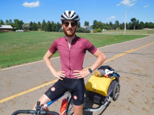
I was rescued again by a man named Roger wearing a baseball cap, and his wife Deb.   That part of the story, however, comes later.

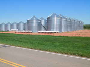
On Saturday (July 14, 2018) I woke up in Circle.  My plan was to ride from Circle to Wilbaux Montana, which was 88 miles.  Given how punishing Eastern Montana has been, I spent extra time looking at Google Maps and noticed that the last 38 miles were on gravel hilly roads.  I was not physically able to handle the pounding so I decided ahead of time to just bike to Glendive, Montana, a shorter 50 mile ride.

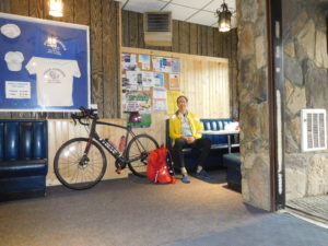
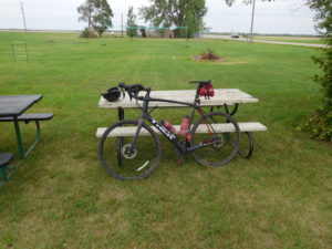
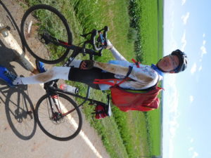
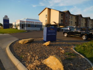
Riding to just Glendive was the right choice.  It was very hot and dry. I had a strong tailwind and made great time, but arrived in Glendive around 1:30 pm parched and tired.  I checked into a nice motel (Baymont by Wyndham) and sat down on the inviting looking bed to take off my shoes.  I don't remember taking off the shoes, but I apparently did get them off before falling asleep wearing all of the other biking gear.

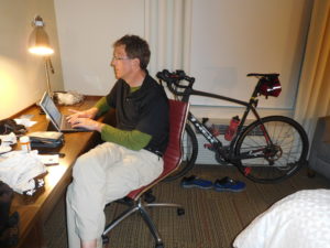
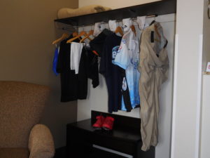
When I awoke it was time to do laundry.  The motel had a laundry room for guests two floors above my room.  I did what any person with almost no modesty left would do.   I took all of my clothes off, wrapped myself in a bath towel and went upstairs and put everything I had in the machine.

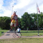
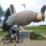
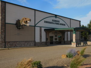
By the time the laundry was dry enough to wear I had missed seeing Glendive's one tourist attraction, the Glendive Dinosaur and Fossil Museum, which "proudly presents its exhibits in the context of Biblical history." I was interested in understanding how they explain dinosaurs, whose bones are abundant around Glendive, in the context of God creating everything in just six days. You can see more on their biblical explanation of dinosaurs at their website here.  I had a forgettable dinner and went to bed early because my goal for Sunday was a 100+ mile ride to Dickinson, North Dakota.

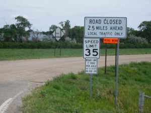
I woke up excited.  I was going to be done pedaling across Montana!  Montana, however, was not done with me yet.  The Swanson family had shown me that from Missoula until after Glendive I was on an official long distance bike route, called the "Lewis and Clark Trail."  Their official paper map, showed there was no need to take gravel roads after Glendive.  Instead, the map said bicyclists should get on Interstate 94 and pedal 9 miles east on the highway shoulder.

I was not keen to pedal on I-94 so I stood at the on-ramp for awhile.  Unfortunately, there were almost no cars getting on or off the highway so hitchhiking was futile.  I was not interested in doing an extra 30 miles of gravel so I bit the bullet and got on I-94.

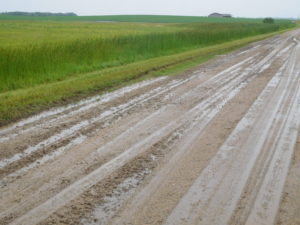
The first two miles of the highway were easy.  The shoulder was wide and almost no one was driving at sunrise on a Sunday.  The next seven miles were not easy.  Those seven miles were under construction and both the travel lanes and shoulder were done in loose gravel.  Trucks going by threw up a cloud of small rocks and dust. I was very happy to get off the highway and onto smaller roads that were in a better condition.

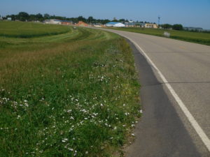
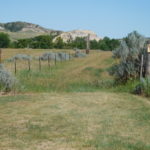
From the highway exit until the North Dakota border, Montana gave me every type of road; dirt, hard pack, gravel and smooth as silk asphalt in a steadily changing mix.  It was as if the state wanted to make sure I did not forget her.

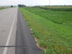
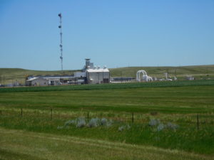
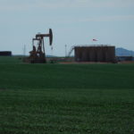
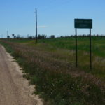
North Dakota started off with light traffic, a much lower speed limit (55 mph instead of 70) and roads in much better condition than Montana.  My guess is that the shale oil boom in North Dakota has given the state government enough money to take better care of their roads.

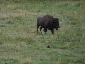
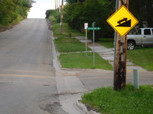
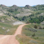
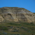
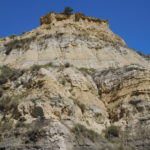
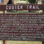
My goal was the town of Medora for lunch and the city of Dickinson for supper.  The miles were going by steadily, when Google Maps said turn right onto some switch backs.  I was hungry but expected the switch backs so I grumpily followed the directions and started climbing.  The scenery was breathtaking.  I was on part of the "Custer Trail," and following in the footsteps of General Custer, who fought and lost one of the last wars against the Native Americans.  Then I hit a very long downhill, complete with numerous cattle guards.

At the bottom of the downhill Google Maps decided to go crazy.  When Google Maps is lost the directions start getting strange.  I was going straight and suddenly the map said make a U turn.  I did and went a few feet before the program told me to a make a U turn and go back the way I was originally going.  When the program does this, it means only one thing: trouble!

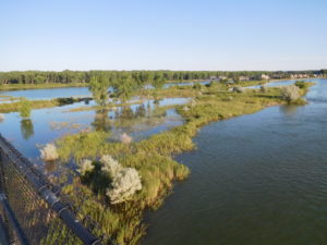
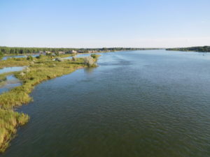
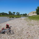
Luckily, there was a person walking by who I could ask for directions.  I told her I was trying to get to Medora.  She said that from where I was standing Medora was only 1 mile away, but the town was on the other side of the Little Missouri River.  There was no bridge.  My choices she explained were to either go back ten miles up the gravel road I had just come down or ford the river with my bike.

She pointed me down a sandy path and said at the end of the path is a iron gate, go through the gate, get wet and you will be in Medora.  Locals always make it sound so easy.  I never did find an iron gate.  I found a wooden one.  Then after taking off a lot of clothes and packing things in plastic bags it was time to ford the river.

Stumbling across slippery rocks carrying a bike on one shoulder and my pack on the other was not easy.  Luckily, the river was only about two feet deep in the place where I crossed.

However, the hardest part was once on the other side trying to figure out how to get to Medora.  The other side of the river was a state campground but almost no one was camping there.  The one person I did find was from Tennessee and had no idea where the campground exit was.  She came up with a novel solution.  She put Medora into her car's GPS and drove off, with me following.  I couldn't do this with my phone because my battery was just about dead.  She got me to the main road, which was about 1/2 mile away and pointed me in the right direction and said Medora is less than a mile.

That less than a mile was a killer.  It had a long 9% grade uphill followed by an 8% downhill.  I wanted food, not steep climbs.  I did make it to Medora and had lunch almost two hours later than I expected.  Fording the river was a slow process.

I finished lunch by 3:30 and still had over 40 miles to pedal to get to Dickinson.  I recharged the phone during lunch and Google Maps told me to go back to the campground (ugh) and then head east on Sully Creek Road, which was gravel.  I pedaled back up the giant hill but could not see any sign.  I turned on the map program and it got me onto a small driveway that ended in barbwire and a "no trespassing sign."  Sully Creek road existed beyond the barbwire, but it was clearly off limits no matter what the mapping app said.

I went back to town and stood next to the I-94 on ramp and hoped to hitch a ride down the highway for two exits, which was where "Sully Creek Road" ended and the paved road "Old Highway 10" began.  I stood there for a very long time, baking in the sun until Roger and his wife Deb stopped and picked me up.  They own a gift store in Medora and explained that very few locals were in town.  Almost everyone was a tourist visiting the Theodore Roosevelt National Park.  Tourists typically don't pick up hitchhikers, which explains my long wait for a ride.

They dropped me off in Belfield, North Dakota, which is where the paved bike route began.  I pedaled a few more hours and pulled into a Motel 6 in Dickinson a little after 7 PM.

Given I started pedaling at 7 AM it was a 12 hour day.  I certainly did not pedal for 12 hours.  I had lunch, took  a couple of snack breaks, stood on the side of the road trying to hitchhike and spent a lot of time fording the river.  Hopefully, tomorrow's ride to Bismark will take less time to cover the same mileage.