I was rescued again by a man named Roger wearing a baseball cap, and his wife Deb. That part of the story, however, comes later.
On Saturday (July 14, 2018) I woke up in Circle. My plan was to ride from Circle to Wilbaux Montana, which was 88 miles. Given how punishing Eastern Montana has been, I spent extra time looking at Google Maps and noticed that the last 38 miles were on gravel hilly roads. I was not physically able to handle the pounding so I decided ahead of time to just bike to Glendive, Montana, a shorter 50 mile ride.
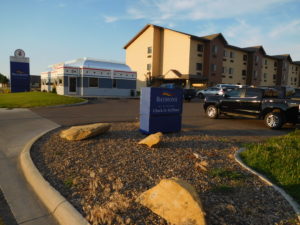
Riding to just Glendive was the right choice. It was very hot and dry. I had a strong tailwind and made great time, but arrived in Glendive around 1:30 pm parched and tired. I checked into a nice motel (Baymont by Wyndham) and sat down on the inviting looking bed to take off my shoes. I don’t remember taking off the shoes, but I apparently did get them off before falling asleep wearing all of the other biking gear.
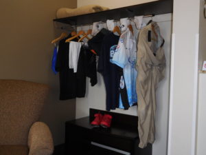
When I awoke it was time to do laundry. The motel had a laundry room for guests two floors above my room. I did what any person with almost no modesty left would do. I took all of my clothes off, wrapped myself in a bath towel and went upstairs and put everything I had in the machine.
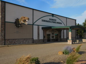
By the time the laundry was dry enough to wear I had missed seeing Glendive’s one tourist attraction, the Glendive Dinosaur and Fossil Museum, which “proudly presents its exhibits in the context of Biblical history.” I was interested in understanding how they explain dinosaurs, whose bones are abundant around Glendive, in the context of God creating everything in just six days. You can see more on their biblical explanation of dinosaurs at their website here. I had a forgettable dinner and went to bed early because my goal for Sunday was a 100+ mile ride to Dickinson, North Dakota.
I woke up excited. I was going to be done pedaling across Montana! Montana, however, was not done with me yet. The Swanson family had shown me that from Missoula until after Glendive I was on an official long distance bike route, called the “Lewis and Clark Trail.” Their official paper map, showed there was no need to take gravel roads after Glendive. Instead, the map said bicyclists should get on Interstate 94 and pedal 9 miles east on the highway shoulder.
I was not keen to pedal on I-94 so I stood at the on-ramp for awhile. Unfortunately, there were almost no cars getting on or off the highway so hitchhiking was futile. I was not interested in doing an extra 30 miles of gravel so I bit the bullet and got on I-94.
The first two miles of the highway were easy. The shoulder was wide and almost no one was driving at sunrise on a Sunday. The next seven miles were not easy. Those seven miles were under construction and both the travel lanes and shoulder were done in loose gravel. Trucks going by threw up a cloud of small rocks and dust. I was very happy to get off the highway and onto smaller roads that were in a better condition.
From the highway exit until the North Dakota border, Montana gave me every type of road; dirt, hard pack, gravel and smooth as silk asphalt in a steadily changing mix. It was as if the state wanted to make sure I did not forget her.
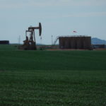
North Dakota started off with light traffic, a much lower speed limit (55 mph instead of 70) and roads in much better condition than Montana. My guess is that the shale oil boom in North Dakota has given the state government enough money to take better care of their roads.
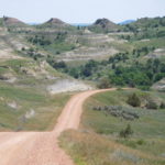
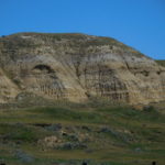
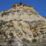
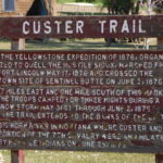
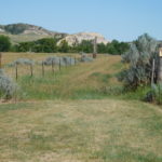
My goal was the town of Medora for lunch and the city of Dickinson for supper. The miles were going by steadily, when Google Maps said turn right onto some switch backs. I was hungry but expected the switch backs so I grumpily followed the directions and started climbing. The scenery was breathtaking. I was on part of the “Custer Trail,” and following in the footsteps of General Custer, who fought and lost one of the last wars against the Native Americans. Then I hit a very long downhill, complete with numerous cattle guards.
At the bottom of the downhill Google Maps decided to go crazy. When Google Maps is lost the directions start getting strange. I was going straight and suddenly the map said make a U turn. I did and went a few feet before the program told me to a make a U turn and go back the way I was originally going. When the program does this, it means only one thing: trouble!
Luckily, there was a person walking by who I could ask for directions. I told her I was trying to get to Medora. She said that from where I was standing Medora was only 1 mile away, but the town was on the other side of the Little Missouri River. There was no bridge. My choices she explained were to either go back ten miles up the gravel road I had just come down or ford the river with my bike.
She pointed me down a sandy path and said at the end of the path is a iron gate, go through the gate, get wet and you will be in Medora. Locals always make it sound so easy. I never did find an iron gate. I found a wooden one. Then after taking off a lot of clothes and packing things in plastic bags it was time to ford the river.
Stumbling across slippery rocks carrying a bike on one shoulder and my pack on the other was not easy. Luckily, the river was only about two feet deep in the place where I crossed.
However, the hardest part was once on the other side trying to figure out how to get to Medora. The other side of the river was a state campground but almost no one was camping there. The one person I did find was from Tennessee and had no idea where the campground exit was. She came up with a novel solution. She put Medora into her car’s GPS and drove off, with me following. I couldn’t do this with my phone because my battery was just about dead. She got me to the main road, which was about 1/2 mile away and pointed me in the right direction and said Medora is less than a mile.
That less than a mile was a killer. It had a long 9% grade uphill followed by an 8% downhill. I wanted food, not steep climbs. I did make it to Medora and had lunch almost two hours later than I expected. Fording the river was a slow process.
I finished lunch by 3:30 and still had over 40 miles to pedal to get to Dickinson. I recharged the phone during lunch and Google Maps told me to go back to the campground (ugh) and then head east on Sully Creek Road, which was gravel. I pedaled back up the giant hill but could not see any sign. I turned on the map program and it got me onto a small driveway that ended in barbwire and a “no trespassing sign.” Sully Creek road existed beyond the barbwire, but it was clearly off limits no matter what the mapping app said.
I went back to town and stood next to the I-94 on ramp and hoped to hitch a ride down the highway for two exits, which was where “Sully Creek Road” ended and the paved road “Old Highway 10” began. I stood there for a very long time, baking in the sun until Roger and his wife Deb stopped and picked me up. They own a gift store in Medora and explained that very few locals were in town. Almost everyone was a tourist visiting the Theodore Roosevelt National Park. Tourists typically don’t pick up hitchhikers, which explains my long wait for a ride.
They dropped me off in Belfield, North Dakota, which is where the paved bike route began. I pedaled a few more hours and pulled into a Motel 6 in Dickinson a little after 7 PM.
Given I started pedaling at 7 AM it was a 12 hour day. I certainly did not pedal for 12 hours. I had lunch, took a couple of snack breaks, stood on the side of the road trying to hitchhike and spent a lot of time fording the river. Hopefully, tomorrow’s ride to Bismark will take less time to cover the same mileage.

We are with you, Jay!!!
Love,
Molly and Marty
jay, thanks for the great travelogue — in fact, it is so fantastic, i am not encouraged at all to reprise it! i am still expecting that a former student of yours from bu or osu will recognize you on the rode, & offer to drive you the rest of the way, or not….. good luck! get sufficient rest, eat as well as you can, & don’t wear camouflage colors….
best, dan k (& suekahn)