Category Archives: Pictures

Day 5: Spokane to Kellogg, Idaho

If you read day 4’s post you might ask, “What is the point of cycling across the USA?”  Today answered this question emphatically.

While yesterday had some low moments, today had one long and continuous high moment.  I had this experience during my last 50 miles of the day, while pedaling the Trail of the Coeur d’ Alenes.

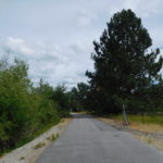
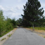
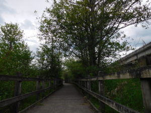
What is this trail?  Imagine a 10 foot wide flat sidewalk that winds its way for 72 miles through some of the most scenic areas in the Northwest.  While pedaling down this trail as added bonuses, you get bathrooms every dozen miles, benches or picnic tables every 2 or 3 miles, almost no road crossing, very few people and amazing wildlife and scenery.

I had no idea what the trail was like.  Nor did I expect to be on it for so long.  Unexpected experiences like this are the reason for traveling and in my case bicycling across the USA.

The trail starts almost at the Washington State border and ends just before the Montana border. It is a joint project of the Coeur d’ Alene Indian tribe and the government of Idaho.  The trail runs along an old railroad bed which is why it is almost flat.

Are there downsides of the trail?  It is tough to find something negative to say.  The trail caused my camera to run out of power, because the views were so photogenic.  That is really not a negative.

The single small downside is that the trail has water at the beginning and end, but not in the middle.  In the trail’s defense after riding it I looked at some websites that discuss the trail and they say “bring water” and a camera.

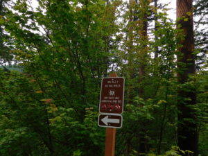
I got on the trail at mile marker 6 and had no idea what to expect.  I was using Google Maps.  It said, “turn left here.”  I turned left and saw a sign “no motorized vehicles.”  I started pedaling and then after a mile pulled over to see what the next set of instructions were going to be.  I scrolled through a couple of screens of going straight when suddenly the screen showed I was supposed to be cycling in the middle of a lake.  I felt a bit confused but Google Maps had done well so far that day so I decided to take a chance.

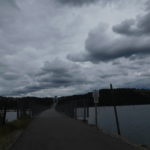
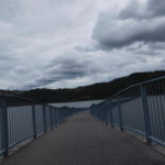
A few miles later a giant bridge appeared that was open only for walkers and bicyclists.  The bridge crossed a large lake right where Google indicated I should be pedaling.  By the end of the bridge I knew I was on something special, since even the bridge was built to make cycling up it easy, with short flat spots interspersed with up-hills, so you were not continuously climbing.

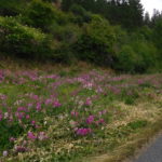
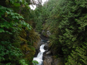
On the other side of the bridge the trail didn’t just hug the shore.  Instead there were times it bisected inlets and small ponds.  The vegetation kept changing along the side of the trail and the distant scenery kept changing from farms, to alpine meadows, to mountains.

The skies were busy with birds flying about trying to catch insects.  I joined the birds by occasionally swallowing a few bugs too.  The difference was that they were trying to catch bugs and I just opened my mouth at the wrong time.

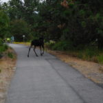
There were a few other special moments.  I was about 20 miles in on the trail when I saw what I thought was a horse on the trail in front of me.  Another bicyclist coming towards me saw me brake while staring ahead.  He turned to look back and whispered, “Moose.”  We stood there about 20 feet from a teenage moose who was sniffing trees on both sides of the trail before jumping in the water to swim off.

The trail has many interpretive signs.  My goal was to read the heading of every sign as I pedaled past.  I saw one that said, “bald eagle nesting ground.”  A few minutes later I could hear a pair of eagles screeching to each other, but I could not see the actual birds.

Another memorable  experience was about an hour later.  A moose started to crash out of the woods beside me.  Just as his head broke through the thicket I whizzed by.  We looked at each other from about 6 feet away.  The moose sniffed, turned and darted back into the forest.  While I don’t smell particularly fresh, I sill felt a bit insulted the moose darted off that quickly once it caught wind of me.

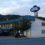
To top it all off, I booked a motel three blocks off a trail entrances in Kellogg Idaho.  The room is clean, comfortable and quite cheap ($45).  What more can you ask for in one day?

Day 4: Moses Lake to Spokane, WA

When doing long trips like hiking or biking the third or fourth day is typically a problem.  The initial adrenaline has worn off.  The novelty of being out of the office, school or work has worn off.  Most importantly, your body is tired.  This is the time when you want to say; “I quit.”

I was concerned about the “I quit” issue since today I needed to do over 110 miles to reach Spokane.  I didn’t really want to hit the century (100 mile) mark this early in the trip.  The problem was that after leaving Moses Lake, I didn’t see on the maps any motels or hotels until Spokane.  So, it was Spokane or bust.

I spent hours mapping out the optimal route using Strava.  Strava is a bicycle app that also shows you what other cyclists have done.  This gives it the ability to suggest the most “popular” bike routes.  I mapped out four choices.  My first choice was 111 miles.  The problem with this route is that it went through one town around mile marker 45 and then no other towns until Spokane.  Strava’s most popular choice was 160 miles, which was a no go this early in the trip.

I looked at another route that hit three towns.  It was ten miles longer for a total of 120 miles.  The clincher was that the last 35 miles into Spokane were labeled “most popular” by Strava.  I chatted with my wife and we agreed that an extra ten miles was probably worth it since it went through more towns.  I also liked it because the last 35 miles were on an east-west road and the weather report said that would give me a tailwind.

That choice of a route turned out to be a disaster, but more on that later.

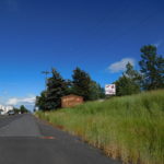
The first part of the ride from Moses Lake to a town called Ritzville was lonely.  The road started off with two lanes in each direction and a wide shoulder.  As I pedaled out of town the road started shrinking.  First, the road dropped down to one lane in each direction with a shoulder.  Then the shoulder started shrinking.  At least the large telephone poles with their nice mile markers were still there.  Then the telephone poles shrunk in size before disappearing.

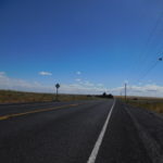
I was soon on a two lane road with nothing else.  No homes, no farms, no telephone poles, no cars, no trucks….nothing but wheat.  A vehicle passed in either direction about once every ten minutes.  I have not felt this isolated in my life.  It was like being in a zombie movie where almost everyone in the world has died.  For those of you worried about my safety, there was no fear for the first 45 miles.  The only thing that would have killed me was boredom.

After pedaling for three and a half, isolated hours in zombie land, I reached Ritzville.  Ah, I thought civilization, however, brief.  I was wrong.  Ritzville looked like it was once ritzy but that was a long time ago.  My guess is that Ritzville and many other towns around here thrived when farms were small, relatively close together and primarily used physical labor.  Today, with giant farms, heavy equipment and relatively few farmers there is less need for many rural towns.

I searched Ritzville for an open restaurant.  All I wanted was a sandwich, but I couldn’t find anyplace to eat.  On my way out of town, I passed a bowling alley that had a bar sign.  Under the bar sign it said, “we serve breakfast.”  If they serve breakfast in the bowling alley, maybe they serve lunch?
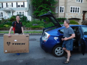
I carried the bike inside the bowling alley and the place was dark but there were four people inside.  It was not a good sign but what did I have to lose?  I asked if they were serving lunch?  One of the four people said, “sure, we can do that.”  Lunch (grilled cheese and a side salad) was excellent.  Plus, they had clean bathrooms. Then the bill came for just $5.80.  That was a real bargain given I am writing this from a restaurant in Spokane that just charged me $30 for a bowl of tomato soup, a bowl of mac-n-cheese and one glass of apple cider.

With a full belly it was back on the bike for 30 miles to Harrington.  The first part of the ride was great.  The road was smooth, sealed and I had a tail wind.  Then I switched onto “North Hills Road.”  The wind now tried to push me over as it gusted.  The road was not sealed and bounced me up and down.  Not surprisingly, given its name, I pedaled up and down a lot of large hills.  I arrived in Harrington, another semi-deserted town with a dying main street.  They did have a nice park with a bathroom and a working water fountain so all was good.

The final town before Spokane was Davenport.  This was where I would pick up the “popular” route.  I hit Davenport 85 miles after leaving Moses Lake.  It was a nice place and had a main street that was alive with shops, banks and a nice new park.  I was excited.  It was 4:15 pm and I had only 35 miles left.  I was thinking, this is great.  It is day 4, I don’t want to quit ,and the easiest part of the ride is about to happen.

At that point the entire day went very wrong.  The “popular” route from Davenport to Spokane was route 2, which was a graded highway.  Graded highways are where the construction crews blast out parts of hillsides and fill in valleys so that cars go straight.  It was also a busy highway. At this point I was trapped and had one choice; just to pedal onward to Spokane.  The first 13 miles were not bad.  The highway department had built a shoulder that was wider than a car.  I hugged the far right side and had plenty of distance between cars and myself.  There were relatively few trucks since long distance truckers use the interstate and the local truckers were all done for the day.

Then I hit Reardan, the last town before Spokane.  I stopped and had a milkshake to give me some energy for the last 20+ miles.  The highway changed leaving Reardan.  The shoulder was narrower, and it was no longer clean of garbage.  The ride after breaking the 100 mile mark was becoming less than fun.

At the edge of Spokane, at Fairchild Airforce base, the shoulder became filled with rocks, glass and other debris.  My rear tire punctured.  I was on a highway with cars whizzing by and the shoulder was not wide enough to fix the bike.  I had done almost 108 miles and made it to Spokane, but not downtown Spokane.  I thought to myself, “I quit!  This entire ride is dumb.”

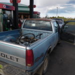
Then I pulled the bike and myself off the road, mentally rebooted and stuck out my thumb to hitchhike.  About 20 cars and trucks passed me before someone stopped.  The man who stopped was named Roger.  Sometimes saints come in baseball caps.

He was part of the local Spokane Indian tribe and worked for the tribe as a tree scaler.  The tribe owns trees that they cut down.  To prevent lumber mills from ripping the tribe off tree scalers estimate how many usable board feet are available from each tree before the saw mill begins to cut.  If the mills output and the tribe agree (within 2%) there is no problem.  If they don’t agree then someone has to figure out why.  Who knew there was so much economics in cutting down trees?

Roger said he was just going down the road to the gas station.  I offered to buy gas for his truck if he was willing to take me the 12 miles I needed to go to get to my hotel.  He drove me into downtown using many of the same roads I would have had to pedal.  Getting a ride all the way was a smart thing.  The last 12 miles into Spokane were not designed for cyclists since it was strip malls and fast food restaurants, plus a shoulder filled with more debris.

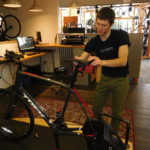
I got the bike and myself into my hotel room and flipped the bike over to start changing the tire.  The rear wheel was badly out of alignment and the rear tire had two deep gashes.  It was almost 8 pm and the internet showed every bike store around was closed except one.  REI was open until 9 pm.  I called and the repair man said he had time for an emergency repair.

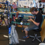
The store was only a few blocks from my hotel.  Randy the bike tech was amazing.  He spent a long time truing the wheel.  He replaced the tire and tube with heavier, but more puncture resistant stock.  He oiled and cleaned the chain and drive!  By 9 pm my bike was like new again, ready for another day of adventure.  After a shower and an expensive dinner (see above) my faith in humanity was restored.  I am looking forward to pedaling into Idaho tomorrow!

Day 3: Ellensburg to Moses Lake, WA

Before this trip started there were a number of days I had either nightmares or tossed and turned in my bed thinking for hours about part of this ride.  Today is the first of these days.

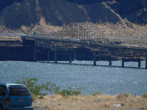
I have an easy morning, just 28 miles to Vantage Washington on a flat road that ends in a steep downhill.  Then comes the part over which I have lost sleep.  Getting across the Columbia River.  There is basically one bridge on this stretch of the river.  That bridge has Interstate 90 running over it.  The bridge is about one mile long, four lanes wide, no shoulder, no sidewalk and lots of trucks doing 70 miles per hour.

The Internet is filled with totally unhelpful suggestions for getting across.  For example; wait for a break in traffic (doesn’t usually happen), pedal as if your life depends on it (it does) or call the State Police and ask for an escort.  Another suggestion is that there is a dam nearby and if you call ahead by a month you can get security clearance to cross over the top of the dam.  This is impractical since I didn’t know the date and time I wanted to be escorted over the top of a dam.

My current idea is to pull into a gas station that is located just before the bridge and see if I can get a ride in someone’s pickup truck over the bridge.  Cross your fingers that this works.  If it does the pedal to Moses Lake, Washington where I am planning on spending the night should be fine.

What happened?

I left Ellensburg, Washington on a sleepy Sunday morning.  It was 28 miles to the bridge.  The first 18 miles were a slog.  I wasn’t going very fast and the scenery was mainly scrub and sagebrush.  I did have a nice tail wind, so it wasn’t miserable.  After pedaling for 18 miles I stopped at the top of a large hill beside a giant windmill farm to take off my windbreaker.  I was not looking forward to the next ten miles.  I was surprised at what happened next.

From the windmill farm to the Vantage Bridge was a 10-mile-long steep downhill.  The downhill was so long my fingers began to cramp holding them in anticipation of using the brakes.  The experience was a scream (both literally and figuratively).  I rolled into the gas station without pedaling once in the entire 10 miles.

I went inside the gas station to buy an ice cream and the clerk asked me if I was trying to get over the bridge.  She said there was a woman in town who drove cyclists over the bridge for a nominal fee.  She called, but the lady didn’t pick up.  Clearly, other riders had hitched rides across the bridge if the gas station clerk knew what I needed before saying anything.

Since the unofficial lift was not there, I looked around myself.  There was a boy and his mother selling cherries in the gas station parking lot.  They had a pickup truck and no customers, so I paid them to give me a lift over the bridge.  I worried for weeks about crossing the bridge, but it was relatively simple to get across safely.

The climb out of the Columbia River Basin once I made it to the other side was only a six or seven mile uphill.  Maybe it was the sugar from the ice-cream or relief that I made it across the river easily, but the climb was not too bad.  The last 50 miles of the day were okay.  I spent about half of it on the I-90 service road.  The scenery was mainly cars and trucks whizzing by, but I got to Moses Lake, which is where I want to be tonight.


Day 2: North Bend to Ellensburg Washington

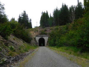
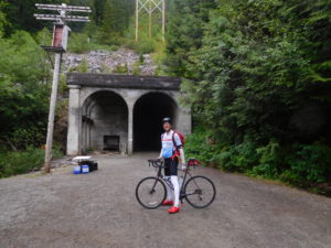
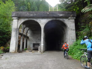
Day two's goal was to get through the Cascade Mountain range.  My plan was to use the John Wayne bike trail, which was once the train tracks that cut through the Cascades.  This bike trail has a two mile long tunnel through the mountains, which I thought would be "easier" than pedaling over.

To steal from Dickens' "A tale of two cities," the ride was the best of times and the worst of times.  The motel I stayed in was a half-hour pedal outside of North Bend, Washington.  My mapping software suggested a "short cut."  Instead of pedaling all the way back into town and getting on the rail-trail, I could go do another "short walk in the woods" to avoid back tracking.

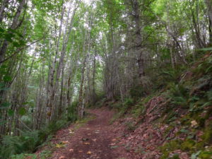
The short walk turned out to be a multi-mile wilderness experience where I carried my bike up the side of a mountain.  It took an hour and half going up a trail that I couldn't have done even on a mountain bike (biking was prohibited on the trail and it had a number of fallen trees covering the path plus stairs).

When I made it to the top I was in for a surprise.  They were running a marathon down the trail I was going up.  Fast runners would even qualify for the Boston Marathon!  The rail-trail went over a number of beautiful trestle bridges before getting to a 2 mile long tunnel.

The tunnel felt like a nightmare.  It was totally dark except for my headlight.  I kept pedaling and since the scenery didn't change it was like running in place.  Plus, I passed two guys in the tunnel and they were huffing and puffing behind me.  It all added up to a nightmare scenario.  People chasing me in a dark tunnel that never seemed to end.

After the tunnel the rail-trail alternated between amazing and awful.  Parts had miles of fresh, thick gravel which was like biking through quicksand that was trying to flip me over. I almost wiped out at least a dozen times.   Parts had great scenery and a hard packed surface where I could make good time, except for the constantly jarring  from the uneven surface.  You don't have to worry about cars and trucks on a rail trail, but the bike and I took a pounding.

The last part of the ride from Cle Elum to Ellensburg was amazing.  I took state highway 10 most of the way.  There was a strong tailwind the entire way.  The road was in good shape and the drivers all gave me a wide berth.  I hit 40 mph on one of the downhills coming out of the Cascades.

Day 1: Seattle to North Bend

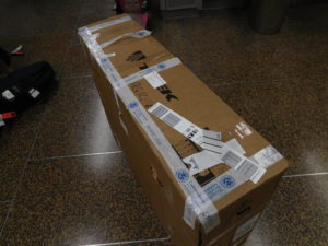
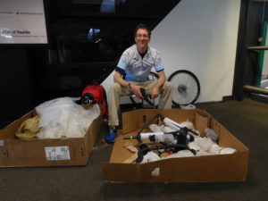
The first day was very long.  I got up at 5:30 am to catch a 7:15 am flight to Seattle.  It took an hour to put the bike together in the Seattle airport, partly because I only had one small multi-tool, which was designed primarily for use in emergencies.

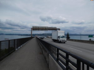
The first day of riding I thought was going to be relatively quick, just 40+ miles.  It took a very long time.  Part of the ride was on the I-90 bike trail.  While there is a fence pedaling along side speeding trucks was an experience.  Google Maps not only used the I-90 bike trail but for parts of the route had me go through the woods.  Maybe if I had a mountain bike the route would have made sense but on a road bike the woods were a huge slog.  Part of it was slow because I kept getting lost.  The entrance to the bike path at times was quite obscure.

I also took care of my first flat of the trip.  Luckily, it wasn't mine.  I passed by a stranded cyclists named Emily and helped fixed her bike.  She rewarded me with a Clif bar of energy shots, which came in handy over the next 24 hours.

I made it to the hotel in North Bend, Washington just as the sun was setting.  My speed was pretty low, but I got where I needed to be.