This morning I hit the wall. Maybe I was over-optimistic that I could do hundred-mile days through the Rockies. Maybe I am just getting older. Maybe many of you told me I was being unrealistic to not schedule any rest days.
Whatever the reason, I woke up around 5:30 AM and felt terrible. I went back to sleep. At 7 AM I woke up and still felt bad. I decided to try the Super 8 Motel’s free breakfast. It didn’t help. On my way back to the room I looked at the sign and thought it said check-out was noon. Maybe sleeping till noon would help? I went back to bed. At 11 am housekeeping knocked on the door and told me check-out was now. Noon was actually check-in.
The front desk said I could stay the extra hour. My original plan, months ago, was a 90-mile trip to Missoula, one of Montana’s big cities. There was no way starting at noon that I could do 90 miles even if I felt in great shape and I didn’t.
Google Maps showed there was another motel 16 miles down the road in Superior Montana and also one 47 miles down the road in Alberton. The maps also showed that some of the route would be on abandoned railroad right of ways. My body was saying it needed a rest day, so I figured I would try the 16 miles and if that felt good I would keep going to Alberton. Missoula would have to wait.
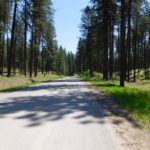
My wife called the motel in Alberton and they said there was plenty of rooms so there was no need to book ahead. The first 16 miles to Superior were relatively easy for the Rockies. There was one gravel section during a huge up and downhill, but the gravel was small and not very loose.
The scenery for the first 16 miles was amazing. I went through one meadow that was particularly memorable. A rancher had just pulled his truck and horse trailer into the meadow and opened the back down. Four majestic horses sniffed the air and then bolted for freedom. I felt I was watching a tourist commercial for “welcome to western Montana, were everything is free.”
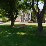
Lunch, around 1:30 was a sandwich on the lawn in front of the courthouse in Superior. After eating I checked in to see if I could go another 32 miles. Legs, brain and backside all said 32 more miles were possible, but not a lot more.
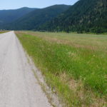
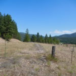
The next 16 miles were just as scenic as the first 16 miles. The river, mountains and trees were beautiful. I was not setting any speed records by pedaling a bit less than 10 miles per hour, but the bike was moving forward.
A few miles later I ran into some problems. Before setting out I had spent time with Google Maps ensuring I could make it the whole way from St. Regis to Alberton. I looked at roads and even did satellite mode when the roads turned to dirt or gravel, since the Google mapping cars only stay on paved roads. It looked like a good route on the computer.
Around mile 33 or 34 I was feeling good, thinking I had less than 15 miles to go. Then the road switched from asphalt to gravel. No worries, the gravel was packed. Then the road split. I was bit unsure which way to go since the mapping software said go straight but the sign clearly said, “no outlet.” I went right and ended up at the river’s edge at a boat put-in and take-out. I walked back up the hill, since pedaling on loose gravel with weak legs was not an option. Just at the split a raft guide in his van passed me by. I flagged him down and asked. He said there was no road and I had to peddle on I-90 the last 15 miles to Alberton.
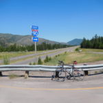
This did not sound good. I-90 in Montana has an 80-mph speed limit. I was not interested in being road kill. Since not all the advice you get, even from river guides, is right I went up the “no outlet” road that Google Maps said was the way to go.
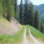
The gravel road soon stopped and became two ruts separated by grass. Then the ruts stopped at a gate and the road completely disappeared. There were two options. First, bushwhack without a compass or map through someone’s private property. This was not my first option since landowners in Montana don’t like trespassers. The second was to go back to the highway. Just before the highway I heard a truck coming up behind me. I stuck out my thumb and a giant pickup truck pulled over.
It was driven by Jared, who was taking a couple from California, for a fishing trip on the river. I told him my problem. He threw the bike in the truck and drove one exit down the highway, which was where he was going. I was willing to pedal the whole way, but if the road no longer exists there did not seen much choice but to ask for a ride.
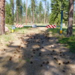
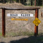
One exit down Google Maps showed I was still on the right road! I pedaled for a few more miles and ran into another problem. The road I was supposed to continue onward was closed with barbwire across it. For added measure the owner put an interesting sign that you can see in the pictures. For those who cannot see the pictures the sign suggested the surest way to a fast death was trespassing. The only option was getting on I-90.
I stood next to the barbwire hoping someone like Jared would show up but traffic was nonexistent. About 20 minutes later one car did drive down. It turned out to be the co-owner of the fast death sign. I told her my problem and she was clear that her family had bought the railroad right of way and did not want people on it. However, she did understand my predicament and volunteered to drive me one exit down the highway, which was the town of Alberton, so I did make it to the next motel
Early this morning I didn’t think I could pedal even one mile. I ended up having a relatively light day and covered about 40 miles of pedaling in about five hours. I am not sure what lesson to take from today. Maybe, just be flexible and things work out.

