Category Archives: Montana

Day 16 and 17: Circle, Montana to Dickinson, North Dakota

I was rescued again by a man named Roger wearing a baseball cap, and his wife Deb.   That part of the story, however, comes later.

On Saturday (July 14, 2018) I woke up in Circle.  My plan was to ride from Circle to Wilbaux Montana, which was 88 miles.  Given how punishing Eastern Montana has been, I spent extra time looking at Google Maps and noticed that the last 38 miles were on gravel hilly roads.  I was not physically able to handle the pounding so I decided ahead of time to just bike to Glendive, Montana, a shorter 50 mile ride.

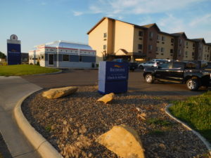
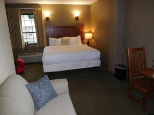
Riding to just Glendive was the right choice.  It was very hot and dry. I had a strong tailwind and made great time, but arrived in Glendive around 1:30 pm parched and tired.  I checked into a nice motel (Baymont by Wyndham) and sat down on the inviting looking bed to take off my shoes.  I don’t remember taking off the shoes, but I apparently did get them off before falling asleep wearing all of the other biking gear.

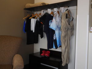
When I awoke it was time to do laundry.  The motel had a laundry room for guests two floors above my room.  I did what any person with almost no modesty left would do.   I took all of my clothes off, wrapped myself in a bath towel and went upstairs and put everything I had in the machine.

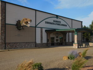
By the time the laundry was dry enough to wear I had missed seeing Glendive’s one tourist attraction, the Glendive Dinosaur and Fossil Museum, which “proudly presents its exhibits in the context of Biblical history.” I was interested in understanding how they explain dinosaurs, whose bones are abundant around Glendive, in the context of God creating everything in just six days. You can see more on their biblical explanation of dinosaurs at their website here.  I had a forgettable dinner and went to bed early because my goal for Sunday was a 100+ mile ride to Dickinson, North Dakota.

I woke up excited.  I was going to be done pedaling across Montana!  Montana, however, was not done with me yet.  The Swanson family had shown me that from Missoula until after Glendive I was on an official long distance bike route, called the “Lewis and Clark Trail.”  Their official paper map, showed there was no need to take gravel roads after Glendive.  Instead, the map said bicyclists should get on Interstate 94 and pedal 9 miles east on the highway shoulder.

I was not keen to pedal on I-94 so I stood at the on-ramp for awhile.  Unfortunately, there were almost no cars getting on or off the highway so hitchhiking was futile.  I was not interested in doing an extra 30 miles of gravel so I bit the bullet and got on I-94.

The first two miles of the highway were easy.  The shoulder was wide and almost no one was driving at sunrise on a Sunday.  The next seven miles were not easy.  Those seven miles were under construction and both the travel lanes and shoulder were done in loose gravel.  Trucks going by threw up a cloud of small rocks and dust. I was very happy to get off the highway and onto smaller roads that were in a better condition.

From the highway exit until the North Dakota border, Montana gave me every type of road; dirt, hard pack, gravel and smooth as silk asphalt in a steadily changing mix.  It was as if the state wanted to make sure I did not forget her.

North Dakota started off with light traffic, a much lower speed limit (55 mph instead of 70) and roads in much better condition than Montana.  My guess is that the shale oil boom in North Dakota has given the state government enough money to take better care of their roads.

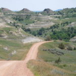
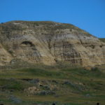
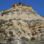
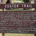
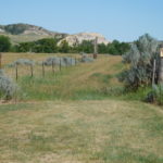
My goal was the town of Medora for lunch and the city of Dickinson for supper.  The miles were going by steadily, when Google Maps said turn right onto some switch backs.  I was hungry but expected the switch backs so I grumpily followed the directions and started climbing.  The scenery was breathtaking.  I was on part of the “Custer Trail,” and following in the footsteps of General Custer, who fought and lost one of the last wars against the Native Americans.  Then I hit a very long downhill, complete with numerous cattle guards.

At the bottom of the downhill Google Maps decided to go crazy.  When Google Maps is lost the directions start getting strange.  I was going straight and suddenly the map said make a U turn.  I did and went a few feet before the program told me to a make a U turn and go back the way I was originally going.  When the program does this, it means only one thing: trouble!

Luckily, there was a person walking by who I could ask for directions.  I told her I was trying to get to Medora.  She said that from where I was standing Medora was only 1 mile away, but the town was on the other side of the Little Missouri River.  There was no bridge.  My choices she explained were to either go back ten miles up the gravel road I had just come down or ford the river with my bike.

She pointed me down a sandy path and said at the end of the path is a iron gate, go through the gate, get wet and you will be in Medora.  Locals always make it sound so easy.  I never did find an iron gate.  I found a wooden one.  Then after taking off a lot of clothes and packing things in plastic bags it was time to ford the river.

Stumbling across slippery rocks carrying a bike on one shoulder and my pack on the other was not easy.  Luckily, the river was only about two feet deep in the place where I crossed.

However, the hardest part was once on the other side trying to figure out how to get to Medora.  The other side of the river was a state campground but almost no one was camping there.  The one person I did find was from Tennessee and had no idea where the campground exit was.  She came up with a novel solution.  She put Medora into her car’s GPS and drove off, with me following.  I couldn’t do this with my phone because my battery was just about dead.  She got me to the main road, which was about 1/2 mile away and pointed me in the right direction and said Medora is less than a mile.

That less than a mile was a killer.  It had a long 9% grade uphill followed by an 8% downhill.  I wanted food, not steep climbs.  I did make it to Medora and had lunch almost two hours later than I expected.  Fording the river was a slow process.

I finished lunch by 3:30 and still had over 40 miles to pedal to get to Dickinson.  I recharged the phone during lunch and Google Maps told me to go back to the campground (ugh) and then head east on Sully Creek Road, which was gravel.  I pedaled back up the giant hill but could not see any sign.  I turned on the map program and it got me onto a small driveway that ended in barbwire and a “no trespassing sign.”  Sully Creek road existed beyond the barbwire, but it was clearly off limits no matter what the mapping app said.

I went back to town and stood next to the I-94 on ramp and hoped to hitch a ride down the highway for two exits, which was where “Sully Creek Road” ended and the paved road “Old Highway 10” began.  I stood there for a very long time, baking in the sun until Roger and his wife Deb stopped and picked me up.  They own a gift store in Medora and explained that very few locals were in town.  Almost everyone was a tourist visiting the Theodore Roosevelt National Park.  Tourists typically don’t pick up hitchhikers, which explains my long wait for a ride.

They dropped me off in Belfield, North Dakota, which is where the paved bike route began.  I pedaled a few more hours and pulled into a Motel 6 in Dickinson a little after 7 PM.

Given I started pedaling at 7 AM it was a 12 hour day.  I certainly did not pedal for 12 hours.  I had lunch, took  a couple of snack breaks, stood on the side of the road trying to hitchhike and spent a lot of time fording the river.  Hopefully, tomorrow’s ride to Bismark will take less time to cover the same mileage.

Are Silicon Valley and Wall Street tycoons ruining Montana’s cattle business?

I was having dinner in a bar a few days  ago.  In Eastern Montana bars double as restaurants since most small towns cannot support both.   I always eat dinner sitting at the actual bar, not at a table, because the bar is a place where there is a chance to talk to other people.

I started chatting with a rancher who was there to have a few drinks.  He looked exactly like what central casting from a movie would have ordered.  He had a large white cowboy hat, a big bushy mustache, nice boots and a big laugh.

I bought him a beer since that is an easy way to keep a conversation going.  He told me about his life ranching and hunting.  He asked about me and my trip.  Hearing that I teach in a business school he was keen to explain the problems raising Angus beef, which is the specialty of that area.

His story was clear and simple.  Small ranches and farms were no longer profitable.  Only large ranches and farms could economically make it in today's world.

The problem was that outsiders, with lots of money, like Silicon Valley and Wall Street tycoons were interested in buying large ranches as trophy properties.  He said they were willing to pay ten times the actual value.  This was boosting land prices and preventing future generations, like his children, from being able to go into ranching.  In this part of the world they call it shifting property from agricultural to recreational use.

He didn't say this but if his complaint was true then the end result for beef eaters would be bad news.  Less property to raise cows would mean grass feed Angus beef prices in the future would go steadily upward.

I thought about his complaint for the next few days.  It made perfect sense from a theoretical perspective.  However, I had one small nagging issue.  I didn't see any evidence of well-to-do outsiders.  On a bike you are very attuned to cars and trucks that pass you.  In the past week, I have not seen a single Mercedes, BMW, or Tesla.   The only planes at the airports I pass are small prop planes, not personal jets.  The bars don't stock high end liquor for the occasional rich person.

I saw just one instance of the very rich.  Outside of Missoula, which is in Western Montana, not Eastern, I passed by a ranch that specialized in glamping, called Paws Up.  Glamping is glamour camping, which means you sleep in a luxury tent and have a high end experience.  Their website said rates were $800 a night per tent.  However, this ranch was catering to very rich outsides who only wanted to experience Montana's great outdoors for a few days, with all the creature comforts that are possible.

Today, I had enough time to bring up some data to look into the rancher's complaint.  The  US Department of Agriculture has been doing a survey since the late 1990s of cash rents.  The survey contacts about a quarter-of-a-million farmers and ranchers.  It asks them questions about the price it costs to rent land.  More details on the survey are found by clicking here.

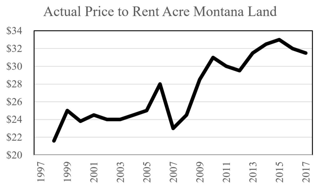
Sure enough the price to rent land in Montana has increased a lot, just like my rancher friend stated.  In 1998 you could rent an acre of land for one year in Montana for about $22.  In 2017 the price was about $32.  You can see the full series in the next picture.

Montana Land Prices Actual

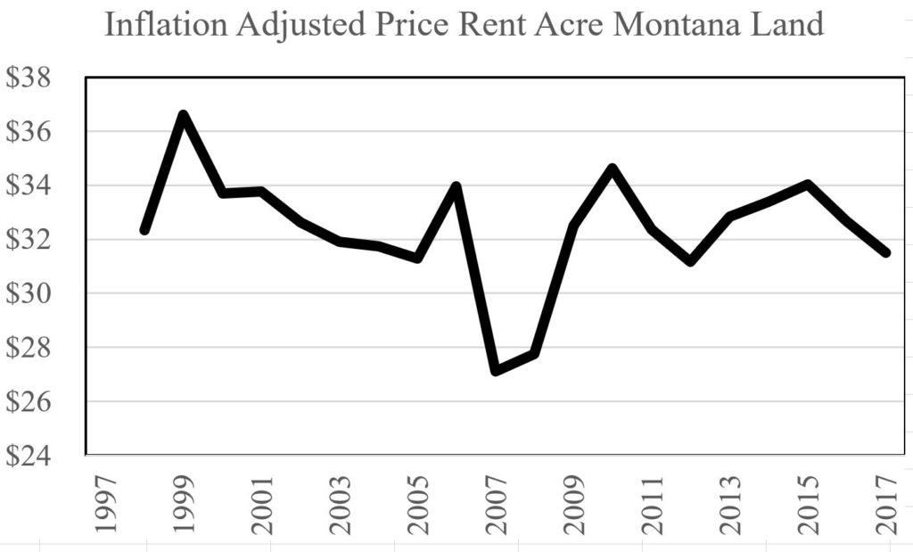
However, as I remind my students, unless you adjust for inflation long term comparisons are meaningless.  The next picture shows the inflation adjusted price, in 2017 terms.

Montana Land Prices Infaltion Adjusted

After adjusting for inflation the price to rent an acre of land for ranching or farming in Montana is about the same in 2017 as in 1998.

What does this mean?  Rich people might be converting agricultural land to recreational use.  However, not enough land is disappearing to push the price up over time.  We came blame Silicon Valley and Wall Street tycoons for many things.  One thing it doesn't look like they are guilty of is making it tougher for a new generation of ranchers and farmers to get into the business in Montana.

Day 15: Jordan to Circle, Montana

Today is Friday, July 13, 2018.  It is day many people consider unlucky because it is a Friday the 13th.

I have been on the road for over two weeks.  Being on the road for long periods of time by yourself is lonely.  For much of the day an old Billy Joel song called the ""Piano Man" played in my head.  In the song Billy Joel talks about playing a piano in a bar where patrons request their favorites.  The part stuck in my mind was all the people in the bar were "sharing a drink they call loneliness, but it's better than drinking alone."

I deal with the loneliness by talking on the phone to people back home after the cycling is done.  Other opportunities for direct human contact are relatively limited in Eastern Montana,  which has very few people.  Fridays are especially lonely because back home, this is the main night of the week when guests come over for dinner.

I was not looking forward to the Jordan to Circle Montana stretch.  It was relatively short, just 68 miles.  However, it had many punishing hills to climb.  I ended up climbing three-quarters of a mile today.

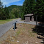
More importantly, today was expected to be especially lonely because there is almost no place to stop.  There is one highway rest area at the 36 mile marker.  There is one bar around the 55 mile marker.  Other than that there is nothing.

I really mean nothing.  There are almost no cross roads, almost no homes, and almost no animals.  In a car the emptiness goes by quickly when driving at highway speeds.  On a bike when slowly grinding up a two mile long incline the emptiness seems to stretch forever.

The loneliness was broken at the rest stop when I meet up with the Swanson family.  This couple and their two children were pedaling from Seattle to Minneapolis.  They had done many long distance cycling trips and had interesting stories.  I had lunch with them, a drink of Gatorade at the 55 mile marker bar with them and dinner with them in Circle, Montana.

It was Friday and I got to share the day with interesting people instead of being lonely.  Who says all Friday the 13th's are unlucky?

Day 14: Winnett to Jordan, Montana

Food and water are key to a successful day, especially in Eastern Montana because there are so few places to eat or drink.  Between Winnett, Montana, where I spent last night and Jordan, Montana where I am sleeping tonight, there are 78 miles of punishing hills.  The bike computer tells me I climbed 4,400 feet on today's ride.

Between these two towns is one rest area with bathrooms and one small store.  Almost everything else is grass lands or sage brush.

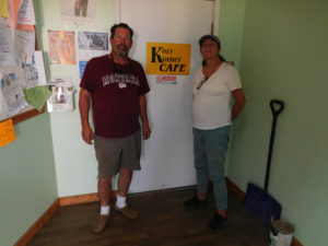
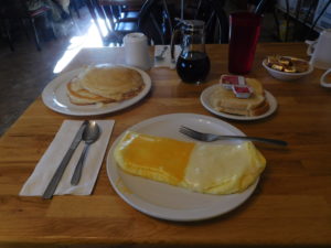
Because there are so few places to stop it is key to get the food and water right.  I had breakfast in Winnette at the Kozy Korner Cafe.  It was good food and helped me through the early miles.

I drank a lot of Gatorade getting to the rest stop, which was about 26 miles outside of Winnette.  At the rest stop I ate a couple of bananas, a couple of pieces of bread and a Cliff bar.

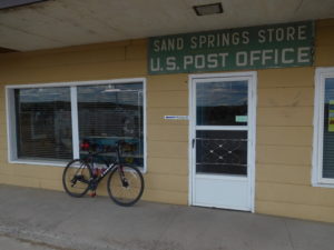
This got me another 20 miles down the road to Sand Springs, where they made milk shakes in the store.  I consumed about half a gallon of Gatorade between Sand Springs and Jordan.

The result was clear.  Not enough food consumed to fuel a punishing 78 miles ride through numerous large hills.  My body just wanted to stop pedaling.

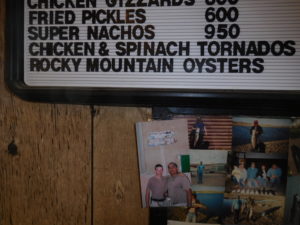
In Jordan I tried to make up for the lost calories by consuming a lot of food.  For part of my dinner I even tried "Rocky Mountain Oysters."  They are fried cattle testicles and not for the faint of heart.  I thought they were tasty.  Given how hungry I was, however, eating my socks might have also seemed tasty, so I will hold off judgement and try them again when I am not famished.

Tomorrow's ride to Circle should be just as challenging since there is just one highway rest stop at the 35 mile point.  There are no other services, shade, or places to stop  between Jordan and Circle Montana.  I expect another punishing day.

Day 13: Lewistown to Winnett, Montana

The reader of a travel blog and the blog’s writer have very different desires.  The reader is interested in posts that are exciting and have interesting adventures.  The writer, especially this one, would like a day or two of boredom.  I thought today would be a simple, boring day where I could write a short post that said something like “nothing really happened.”  Unfortunately, for me, but not for you, today was not boring.

I spent the night in the Calvert Hotel in Lewistown, Montana.  The bed was large and comfy.  The bathroom was stocked with soaps made with goat milk.  The internet was fast and I was finally able to upload pictures.  The hotel was quiet.  It was heaven.

Check-out time was noon and they provided a cooked breakfast buffet that was worth eating.  I woke up early, had breakfast and went back to bed to sleep.  It was wonderful.  I packed up just before noon and ate a lovely lunch in the hotel lobby that I procured at the local grocery store.

The ride for today was expected to be just 54 miles to Winnett, Montana.  Google maps said there were two ways to go.  One was to continue on Route 200.  The second was just two miles longer and went via Route 238 through the town of Grass Range.  I was skeptical of the second route since Google Street View was not available.  This meant part of the second route was on an unpaved road.
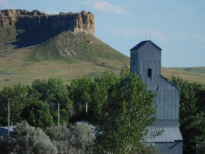
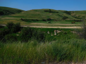
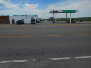
I then used the satellite image to check out the road.  Modern technology gives us such amazing tools.  The road had a painted yellow line on it!  The Street View map was done a decade earlier.  The satellite image was only a few months old.  That sealed the deal.  I would take the second route, which looked like it went through more scenic land.

I started pedaling and made terrible time because the scenery was so amazing I kept stopping to take pictures.  The weather was perfect.  The road surface was new and hard.  I was following a large stream and life was glorious for the first hour of pedaling.  Suddenly the beautiful road stopped and became hard packed gravel and then the road split.  At the split a road sign stated that route 238 was veering off in a southward direction.  This was not right.  Grass Range was due east.

No, I did not have any cell phone reception to check a map.  No, I forgot to download and create an offline map, like I had done on other days.  What to do?  I did something old fashioned.  I asked a man sitting in his front yard for directions.

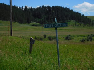
It took a while for us to connect since I kept telling him that I was trying to go to “Grass Land” and he had never heard of the place.  Once we figured out I was using the wrong name of the town he told me that I missed the turn-off a couple of miles back.  He said that I could get to "Grass Range" by continuing up the same gravel road and turning left at the next fork onto Tyler Creek Road.  I then asked his advice.  Should I go back to the turn-off or take Tyler Creek Road?  He smiled and said something like “you are pedaling and looking for an adventure, so go up Tyler Creek Road.”

On the positive side Tyler Creek Road has some amazing scenery.  On the negative side the road was in terrible shape.  Parts were washed out a year ago and the temporary patches were just that, temporary.  I bounced, smashed and slid for an hour and half over rough terrain.

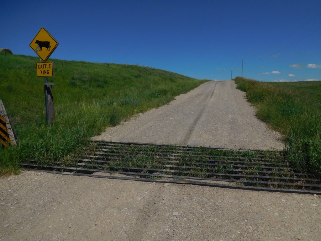
A cattle grid or cattle guard

To make matters more exciting the road contained cattle guards or cattle grids.  A picture of a cattle grid is above.  The idea is simple a rancher fences off all their land but cannot fence off the roads.  To prevent cattle from wandering off they drop a steel grid in the ground.  When a cow tries to walk off the property using the road they get stuck in the grid and learn not to go through the opening in the fence.

While the grids are great for ranchers, they are horrible for bicyclists since they are very slippery and the bar spacing captures your wheels.  The simplest way to handle a grid is to get off the bike and do a slip-slide walk over them.  Grids are not placed for the convenience of cyclists either.  There were places where I would come bouncing down a hill going too fast and realize there was a grid coming up very soon.  There was also one grid on Tyler Creek Road which was near the top of a large hill.  I almost pedaled to the hilltop when the grid appeared.

After bouncing for a long time, I came to the end of the road.  Behind me was a pickup truck with a local rancher.  He laughed at my going the back way to Grass Range and thought it was funny that I took Tyler Creek Road instead of the standard gravel road.  He marveled that I was able to do Tyler Creek on “them skinny little tires.”  He was also helpful and told me how to get on the regular road to Grass Range, which was called Forest Grove Road.

Forest Grove Road was also gravel, but most of it was hard-packed and none of it was washed out.  The Tyler Creek detour added an extra 10 miles to the day's pedaling.

I made it to Grass Range finally.  I never did find the gas station that attracted me to the town.  It didn’t matter.  The weather was cool so I still had enough water and Gatorade to make it the 20+ miles to the motel I booked in Winnett.  Getting back on Route 200 was a pleasure after bouncing the back way.  On Route 200 a motorcyclist slowed down to my speed and asked if I needed a refill on water.  This meant I didn't need to go to Grass Range at all, since I could have gotten a water refill on the road!

That peaceful uneventful day I wished for didn’t happen, but there are still many more miles to pedal.  Maybe the peaceful day will be tomorrow?

Day 12: Great Falls, to Lewistown Montana

Sometimes life and the weather change suddenly.  First, the life change story and then the weather.

I have worked at Ohio State University as a researcher for the past 23 years.  My sudden life change is that I am retiring from OSU at the end of August.  I have enjoyed working at OSU very much.  I was featured in the Spring 2018 Alumni magazine.  They convinced me to write for TheConversation.com, where my total readership broke 2 million people a few months ago.  They have promoted my research with over a dozen press releases.  Unfortunately, my job was supported by government grants, which have been cut.  After the trip is over it will be time to think about my next career, since playing golf daily holds little appeal.

The weather, especially in Montana, also changes quickly.  Last night at dinner the forecast was for hot and dry conditions during this morning.  Then with a 20 to 40 percent chance the forecast predicted that sometime from 3 PM till 5 PM a new cooler weather front would arrive.  Where the two fronts collide, the forecast was predicting large hail, heavy rain and lightning.

This forecast concerned me for two reasons.  First, pedaling a bike on the plains means that in a lightening storm I am the tall object on a metal bicycle.  While it is normally gratifying to attract attention, lightning is not something to entice.

Second, on the last cross-country bicycling trip, I was hit by hail and heavy rain in Kansas.  We made it to the edge of a city just as a storm hit.  One minute I could see.  The next moment everything beyond two feet away disappeared in the deluge.  I don’t mind getting wet.  But getting wet while being hit by sharp ice is quite painful.  In Kansas we were able to get onto the porch of a kind person’s home, so we had some protection.  I was unsure in Eastern Montana a similar kind of porch would be available again.

Since the forecast stated the chance of the storm was only 20 to 40 percent, I decided to try pedaling and not spend another night in Great Falls.  As a precaution I would start pedaling very early in an attempt to finish before the storm.  I also checked out all the places I could stop and seek shelter.

I was on the road at just after sunrise and did 25 miles before 9 AM.  I stopped for a bathroom break at a rest stop.  The bathroom had a loudspeaker system that was playing Montana’s weather.  The forecast had not changed.  By 11:30 I had done half the day’s mileage but was famished.  I stopped in the small town of Geyser for a hamburger, which was quite good!

After Geyser my speed dropped.  Part of it was a strong headwind.  Part of it was pedaling on a full stomach.  Part of it was that by noon I had already been on the bike for about five hours without a long break, except for wolfing down a hamburger and pulling over to swap water bottles.

I made it to Stanford, MT around 2 pm.  One hour to go before the storm was supped to hit and I still had 45 miles left to pedal through rural areas.  In Stanford the wind started to change direction and the sky began to darken.  I stopped at the last gas station in town.  They said it was 28 miles to the next gas station/shelter.  I wasn’t sure what to do with the storm coming closer.  I decided to hitch another ride.  If the storm showed up before I got a ride, I could at least stand under the roof that protected the gas station’s pumps.  If the storm hit while I was in a pickup truck, I was protected.

A very nice man named Dale, stopped and offered to give me a ride to the next gas station.  Dale ran his own repair shop and did a lot of work on combines and tractors.  He was going to fix the air conditioning unit on a combine just beyond the next gas station.  We had a nice chat and I learned all about the economics of repairing farm equipment and contract harvesting.  Dale’s ride was great because the storm was coming from the west and he drove me due east, which increased the distance between me and the storm.

He let me off at Eddie’s Corner, which was 17 miles from my destination of Lewistown, Montana.  I looked at the sky.  I looked at Eddie’s Corner, which offered less protection than I hoped.  The storm seemed to have slowed a bit.  The wind was now a gusting 20 mph tailwind.  My conclusion was there was enough time to pedal to Lewistown safely.

Did you ever make up your mind and then have that sickening feeling that the choice was wrong?  About 4 miles down the road from Eddie’s, the whole left side of the sky looked dark and angry.  Then I heard thunder.  It was far off, but it was clear this storm was going to happen.  I started pedaling faster.  To make the story short, I sprinted for 1 hour.  Normally, with a loaded pack I pedal about 12 mph.  The program that monitors my speed and distance showed I did the sprint to Lewistown at about 18 mph, with the help of a tailwind.

I made it to the “Welcome to Lewistown” sign just as the first rain drops fell.  I made it to a nice hotel, called the Calvert, as the sky overhead became dark and angry.  I don’t think hail hit Lewistown, so the forecast was off on that part.  But the forecast was right that the storm would pass quickly.  By the time I checked-in, took a shower and was ready to leave the hotel for dinner, the sky was clear again.

An afternoon of outrunning a storm was exciting, but also exhausting.  My original plan for tomorrow was to do 130 miles.  That plan is totally unrealistic.  Caleb, who checked me into the hotel suggested a shorter ride of 55 miles instead.  Caleb is a clearly a smart man.  I will sleep in tomorrow morning and take it relatively easy.

Day 11: Lincoln, Montana to Great Falls

Biking long distances is clearly more of a mental challenge than a physical challenge.  Last night, I stayed in the Three Bears Motel.  The bed was comfortable.  The room smelled fine.  The neighbors were not particularly noisy.  With all these advantages I didn't sleep a wink.  This morning I wanted to rename the motel the "Princess and the Pea," after the princess who could not sleep because a pea was placed under her mattress to test her.

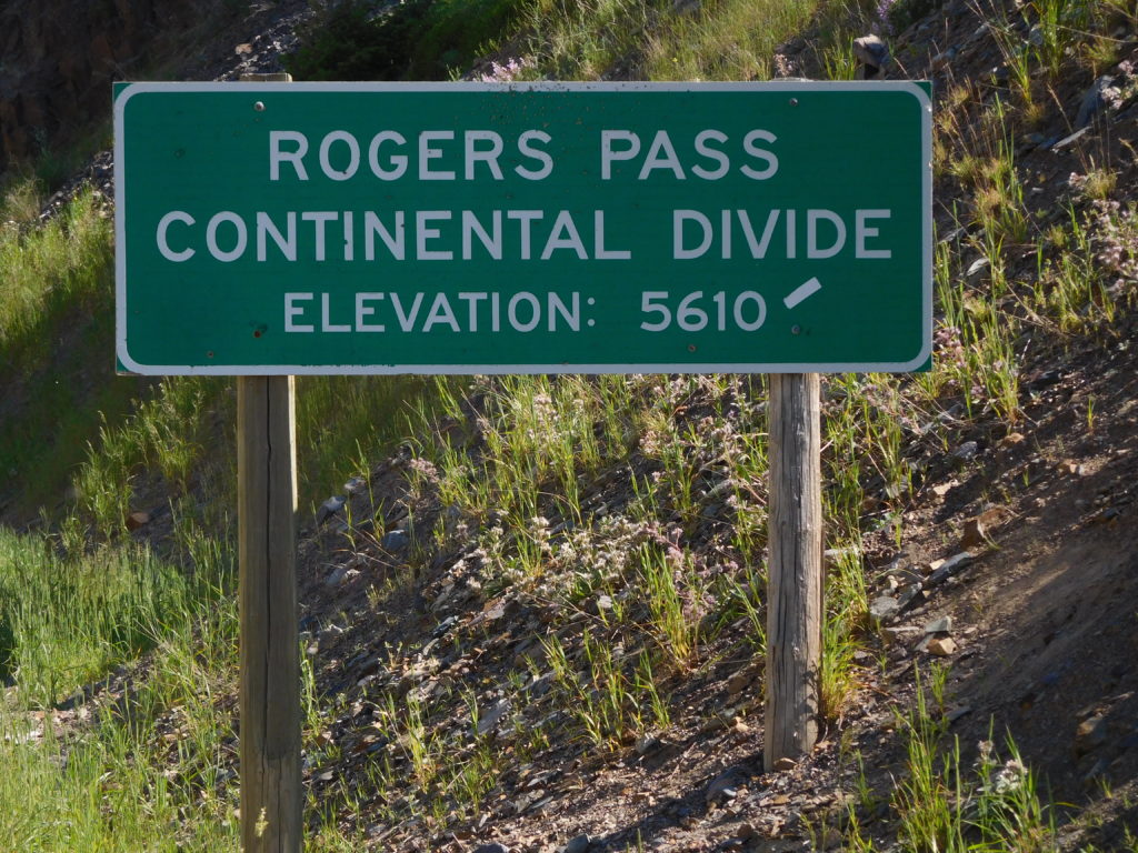
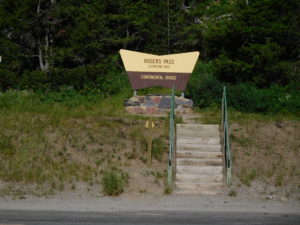
What was the problem?  I lay in bed stressing about today's ride.  Today I needed to bike up Roger's Pass on Montana's Route 200.  Roger's Pass, as the picture shows, is where I cross the continental divide.  All water dropped on the ground to the west of the divide sooner or later ends up in the Pacific Ocean.  All water to the east of the divide ends up in the Atlantic.

Rogers Pass

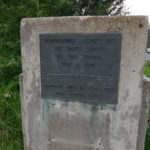
For those of you interested in history, Roger's Pass is famous for having the lowest recorded temperature in the contiguous 48 states.  In 1954 at a mining camp on the pass the temperature hit minus 70 degrees.  You can read about it here.

The last time I biked across the country I did eleven different continental divide crossings.  I was young and a wee bit stupid.  Instead of crossing the Rockies once, I went up the backbone of the Rockies.  This time would be different.  Just one crossing, not multiple.

Most continental divide crossings are a physical challenge so I wanted to know what to expect.  Google Map and Earth tell you a lot, but local experience today still beats looking at computer images.  I asked four different people where I was staying in Lincoln what the pass was like.  Three out of four said they had never been up the pass and the fourth had done it a long time ago.

This was shocking to me because Roger's Pass is a bit over 18 miles from Lincoln and the town of Lincoln has only one main road, that goes directly to the pass.  If these people had not done the pass, there must be a reason.  My brain went into hyperactive mode all night thinking of all the reasons why locals wouldn't go there.

The reason, which I found out later, is that there is an alternative pass five miles closer than Roger's that is very steep and has lots of switchbacks.  If you can manage to get over the alternative pass then you end up on the Interstate highway (route I-15).  Going over Roger's Pass takes you away from the Interstate, which was something I was keen to do, but most people who live in Lincoln are not.

Roger's Pass ended up being something pretty straightforward to bike up.  When the pass started I had 4 gears left and thought "this is going to be a piece of cake."  Halfway up the pass I was in my easiest gear (smallest ring in the front, biggest ring in the back) and sweating hard.  I did make it up to the top without stopping or walking, but it was no piece of cake.

I took the obligatory pictures and spilled a little filtered Gatorade and water on both the west and east side of the continental divide sign.  Then it was time for the six mile downhill.  If you ever do something like this, make sure you have wrap-around glasses.

The wind and air pressure coming down was intense and my eyes were tearing up.  Having your eyes filled with tears when nothing separates you from going over the edge of a mountain except for a low guard rail is a hair raising experience.  I used my brakes a lot, which kept the speed down enough so that I could see.  Wrap-around glasses keep some of the wind and pressure off the eyes and let you go down the mountain faster.

The end result was that I made it up, over and then down Roger's Pass.  There was a bit to worry about, but nothing worth spending 8+ hours in bed imagining all kinds of terrible things.  The mental pain was much more than the physical pain of getting over the pass.

Day 9: Rest day in Missoula

I am just beat, so very little happened today.  I spent a lot of time in bed trying to recover.  The Rockies and the Cascades were far tougher than I thought.

I had sushi in Missoula.  It was a nice change of pace from hamburgers.  I also spent a long time cleaning and reoiling the bike.

Day 8: Alberton to Missoula, Montana

Today was a relatively short day of pedaling, slightly more than 40 miles.  One problem that I have biking in Montana is that there are relatively few towns and motels.  The choice today was 40 miles to Missoula or 130 miles to Lincoln, Montana.

The last time I biked across the country I had the same problem in Montana; finding places to stop at reasonable distances.  Once on the last trip we just couldn’t make it to the next town because the distance was too far.  We saw a clearing just off the road.  It was besides some train tracks, but the tracks did not look very used.  We set up our tents, had some food and went to sleep.  In the middle of the night the ground started to shake.  It felt like an earthquake was happening.  Then a huge roaring noise filled the air as a giant train screamed by on the tracks.  I was too petrified to even open my tent flap.

The motel in Alberton was a bit like this story.  All the rooms looked at the Clark Fork River.  Just on the other bank of the river were train tracks.  These tracks were used more than the tracks I camped beside years earlier, but the result was the same.  I didn’t get a lot of sleep even though the surroundings were quite beautiful, and the motel’s restaurant served a great steak dinner.

My wife talked to me on the phone and tried to convince me of the need for a day off.  I wasn’t sure in the morning when I set off.  The ride towards Missoula was not much different than previous days of riding through Western Montana.  Today, luckily there were no missing or closed roads!  However, there were places were the road surface switched to loose gravel and hard packed dirt.   I was also chased by a dog, but it was early enough in the day that I could pedal faster than that dog could run.

I then hit a section of road construction.  The crew was spraying the dirt with water, so I got to pedal through sticky mud.  The bike and I were a total mess.  After making it through the mud the bike was not working well.  I was in a small town and found a man mowing his lawn.  I asked if he had a hose.  I was able to get the heaviest parts of the mud off the wheels, chain and brakes.  The bike worked much better after its bath, but I was still covered with dirt.

On the way into Missoula I picked up a bike path just ahead of a slightly overweight teenage girl wearing sandals.  I beat her on the downhill since I had the better bike.  On the flat she blew me away.  At that point I realized I needed a rest day, soon.

I made it by 2 PM to the local REI store.  I wanted a spare tire.  I had brought spare tubes and patches but the experience outside of Spokane convinced me that I needed a spare tire too.  They were out of my size (700 X 32 cm) but they did have lubricant so that I could reoil the bike after the mud bath.  The cashier chatted with me about my ride and felt that the next 200 miles would not be a problem.  He said the first 100 miles were a slow but steady uphill.  The next 100 miles were rolling hills that he didn’t think would give me a problem.  That was good news.

There was another bike store near my motel.  They had the same tire which REI was out of stock.  It was $10 more but I wasn’t going to take a chance of slicing a tire in Eastern Montana and not having a spare.  The salesman told me the same information about the next 200 miles.  I asked him if I should stop in Missoula or take a rest day in Great Falls, which is the town 200 miles from here.  He was unequivocal, “don’t go to Great Falls, stay here.”

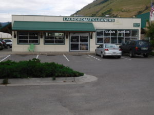
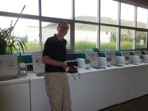
It looks like I am spending two nights in Missoula.  I took a rest day here decades ago on my last bike trip.  None of the town looks familiar but I am doing familiar things.  Last time in Missoula I cleaned my clothes in a laundromat.  Tonight, I went to a laundromat to get the mud out of my bike clothes.  Last time we had a small party in the laundromat.  I bought wine, cheese and crackers.  This time was more subdued.  I talked on my cell phone and read email.  The result in both cases was the same; clean clothes.

Day 7: St. Regis, Montana to Alberton, Montana

This morning I hit the wall.  Maybe I was over-optimistic that I could do hundred-mile days through the Rockies.  Maybe I am just getting older.  Maybe many of you told me I was being unrealistic to not schedule any rest days.

Whatever the reason, I woke up around 5:30 AM and felt terrible.  I went back to sleep.  At 7 AM I woke up and still felt bad.  I decided to try the Super 8 Motel’s free breakfast.  It didn’t help.  On my way back to the room I looked at the sign and thought it said check-out was noon.  Maybe sleeping till noon would help?  I went back to bed.  At 11 am housekeeping knocked on the door and told me check-out was now.  Noon was actually check-in.

The front desk said I could stay the extra hour.  My original plan, months ago, was a 90-mile trip to Missoula, one of Montana’s big cities.  There was no way starting at noon that I could do 90 miles even if I felt in great shape and I didn’t.

Google Maps showed there was another motel 16 miles down the road in Superior Montana and also one 47 miles down the road in Alberton.  The maps also showed that some of the route would be on abandoned railroad right of ways.  My body was saying it needed a rest day, so I figured I would try the 16 miles and if that felt good I would keep going to Alberton.  Missoula would have to wait.

My wife called the motel in Alberton and they said there was plenty of rooms so there was no need to book ahead.  The first 16 miles to Superior were relatively easy for the Rockies.  There was one gravel section during a huge up and downhill, but the gravel was small and not very loose.

The scenery for the first 16 miles was amazing.  I went through one meadow that was particularly memorable.  A rancher had just pulled his truck and horse trailer into the meadow and opened the back down.  Four majestic horses sniffed the air and then bolted for freedom.  I felt I was watching a tourist commercial for “welcome to western Montana, were everything is free.”

Lunch, around 1:30 was a sandwich on the lawn in front of the courthouse in Superior.  After eating I checked in to see if I could go another 32 miles.  Legs, brain and backside all said 32 more miles were possible, but not a lot more.

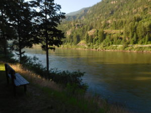
The next 16 miles were just as scenic as the first 16 miles.  The river, mountains and trees were beautiful.  I was not setting any speed records by pedaling a bit less than 10 miles per hour, but the bike was moving forward.

A few miles later I ran into some problems.  Before setting out I had spent time with Google Maps ensuring I could make it the whole way from St. Regis to Alberton.  I looked at roads and even did satellite mode when the roads turned to dirt or gravel, since the Google mapping cars only stay on paved roads.  It looked like a good route on the computer.

Around mile 33 or 34 I was feeling good, thinking I had less than 15 miles to go.  Then the road switched from asphalt to gravel.  No worries, the gravel was packed.  Then the road split.  I was bit unsure which way to go since the mapping software said go straight but the sign clearly said, “no outlet.”  I went right and ended up at the river’s edge at a boat put-in and take-out.  I walked back up the hill, since pedaling on loose gravel with weak legs was not an option.  Just at the split a raft guide in his van passed me by.  I flagged him down and asked.  He said there was no road and I had to peddle on I-90 the last 15 miles to Alberton.

This did not sound good.  I-90 in Montana has an 80-mph speed limit.  I was not interested in being road kill.  Since not all the advice you get, even from river guides, is right I went up the “no outlet” road that Google Maps said was the way to go.

The gravel road soon stopped and became two ruts separated by grass.  Then the ruts stopped at a gate and the road completely disappeared.  There were two options.  First, bushwhack without a compass or map through someone’s private property.  This was not my first option since landowners in Montana don’t like trespassers.  The second was to go back to the highway.  Just before the highway I heard a truck coming up behind me.  I stuck out my thumb and a giant pickup truck pulled over.

It was driven by Jared, who was taking a couple from California, for a fishing trip on the river.  I told him my problem. He threw the bike in the truck and drove one exit down the highway, which was where he was going.  I was willing to pedal the whole way, but if the road no longer exists there did not seen much choice but to ask for a ride.

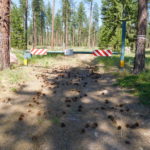
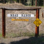
One exit down Google Maps showed I was still on the right road!  I pedaled for a few more miles and ran into another problem.  The road I was supposed to continue onward was closed with barbwire across it.  For added measure the owner put an interesting sign that you can see in the pictures.  For those who cannot see the pictures the sign suggested the surest way to a fast death was trespassing.  The only option was getting on I-90.

I stood next to the barbwire hoping someone like Jared would show up but traffic was nonexistent.  About 20 minutes later one car did drive down.  It turned out to be the co-owner of the fast death sign.  I told her my problem and she was clear that her family had bought the railroad right of way and did not want people on it.  However, she did understand my predicament and volunteered to drive me one exit down the highway, which was the town of Alberton, so I did make it to the next motel

Early this morning I didn’t think I could pedal even one mile.  I ended up having a relatively light day and covered about 40 miles of pedaling in about five hours.  I am not sure what lesson to take from today.  Maybe, just be flexible and things work out.

Day 6: Kellogg Idaho to St. Regis Montana

Today I hoped would be an easy day. It is the 4th of July. Traffic should be light and the maps said today would be under 70 miles. After doing two centuries, which are 100 mile days, that sounded like a nice change of pace. The goal was to get from Kellogg, Idaho to St. Regis, Montana.

It didn’t turn out easy. Instead, it took so much effort to get to St. Regis that I have fallen asleep numerous times typing this entry.

The first hour or so of pedaling was lovely. I was again on the Trail of the Coeur d'Alenes, which is a paved bike path. I even ran into the man who cleaned the path. He was driving an oversized golf cart. Attached as a trailer to the back of the cart was a large leaf blower on wheels. It was noisy, but certainly effective.

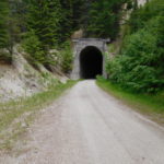
Unfortunately the trail ended, but the mapping program said to get on the Northern Pacific Trail, which was also an abandoned rail line. How different could the new trail be? For the first few miles, not different at all. Then the trail started to climb and not at a gentle 1 or 2% grade. Then the road switched from being paved to being hard packed dirt. Finally, it switched to rock and gravel. At a particularly steep part, I braked, got off the bike and switched from bike shoes with cleats to sneakers and started walking the bike up the hill.

I then spent the rest of the day alternating between riding and walking the bike. The map showed a large zig zag, which typically means a very steep part. As I was getting closer to the zig zag my legs started turning to jelly. I was a little concerned, but roughly every ten minutes an ATV (all-terrain vehicle) passed by me so I knew there would be help if I had to flag something down.

I soon discovered why my legs turned to jelly. I rounded a corner and saw that I was near the top of a large mountain and ¾ of a mile up in the air. It turned out I had pedaled and walked to “Lookout Pass” on the Idaho-Montana border. The legs turning to jelly was my feeling altitude queasiness.

Interstate I-90 was far below where I stood at the top of the pass. The signs stated the part of I-90 far below me is the highest elevation the highway ever reaches on its run from Boston to Seattle.

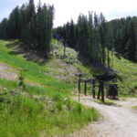
At the pass there even was a ski lodge and lifts (not running) which gave me an idea how high I had climbed. I figured having done the hard part, the easy part was next, the downhill. If the trail was paved or even hard packed it would have been a great ride. However, most of it was loose gravel. In some place the gravel was so loose I had trouble walking with the bike. The rough trail conditions made the ride down as punishing as getting up to Lookout Pass. One nice thing was after 15 minutes of riding downhill, my legs started recovering, which suggests altitude was a big part.

While the ride down was hard, I saw quite a few white-tailed deer. One even raced in front of my bike down the trail for a long way. Another stood in the middle of the trail and we had a staring contest. I lost.

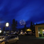
While it wasn’t the easy day I was expecting, I made it to St. Regis without any serious problems to myself or the bike. There are a lot of fireworks going off right now since it is the 4th and the town has a big stand selling them. I don't think the explosions will hamper my sleep in any way, shape or form.